


KANSAS CITY, Mo. — Good Tuesday, bloggers,
Happy Veterans Day. Thank you, veterans.
We are going to bring some nice afternoon weather for the veterans as the opposite of a storm system approaches and peaks over us on Saturday. Then, a storm system may follow.
Let's go through this.
The upper-level flow by Saturday will feature a big ridge over the middle of the U.S., which will be approaching the rest of this week. This means dry weather and a big warmup.
There is a small storm system in southern California, and this may bring us some rain.

By next Monday, that storm system will be moving into our region as it weakens. This could bring some rain.

TODAY:
At 5 a.m., it was in the 20s across Wisconsin and Illinois with some light snow. Temperatures were in the 20s and 30s across Iowa and Missouri; 30s/40s across Nebraska and Kansas; and 60° in Denver!
South winds are gusting over 30 mph behind a big surface high-pressure system that is now to our southeast. The wind blows clockwise around high pressure, so the south winds are surging in much warmer air as the upper-level ridge approaches.
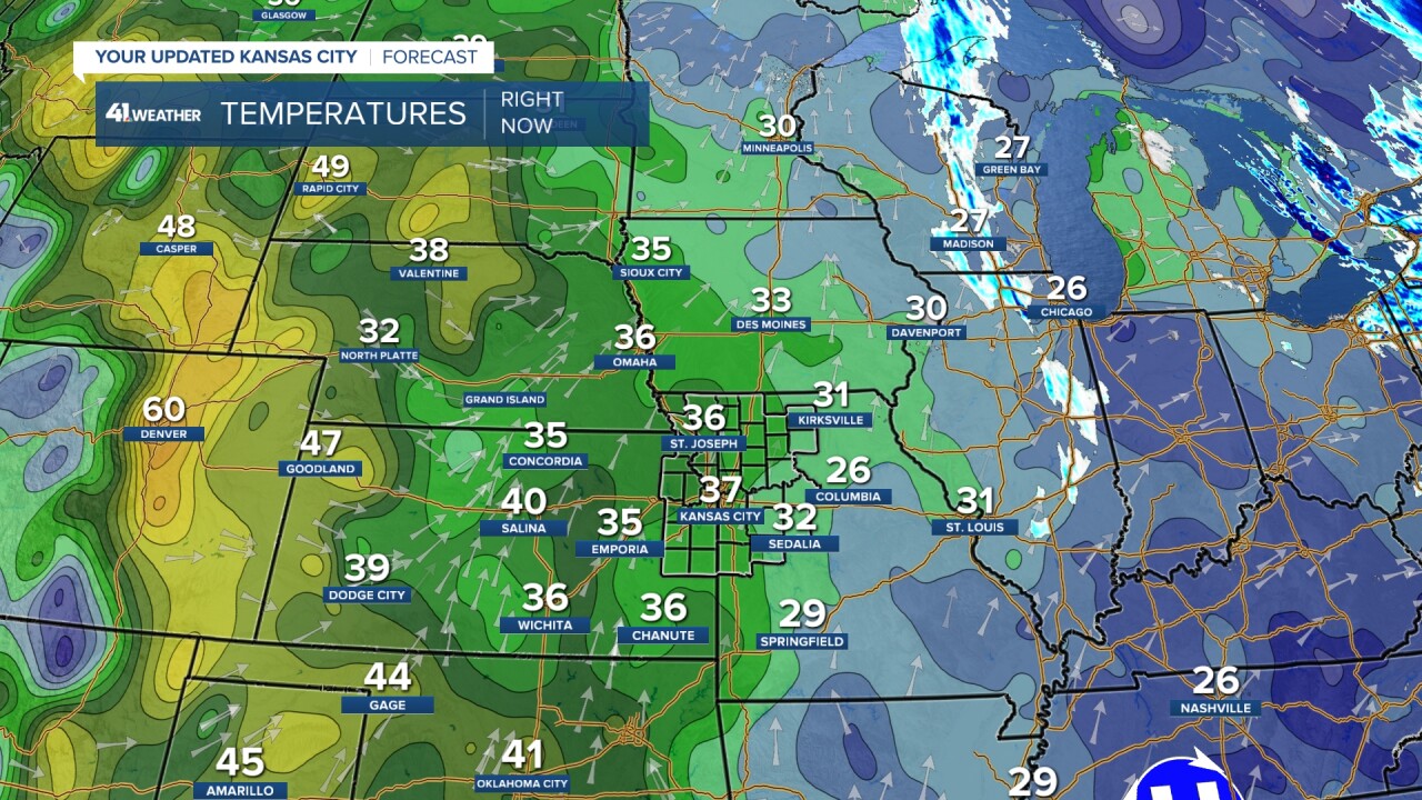
We will see the morning clouds and wind decrease, making for a nice afternoon with highs near 60°.

WEDNESDAY-THURSDAY:
It will be mostly sunny Wednesday and mostly cloudy Thursday. Both days will see highs in the 60s with a light north breeze on Wednesday and a south breeze of 10-20 mph on Thursday.


FRIDAY:
Highs will be in the 70s under a partly cloudy sky and a south breeze at 10-20 mph. A fantastic Friday!

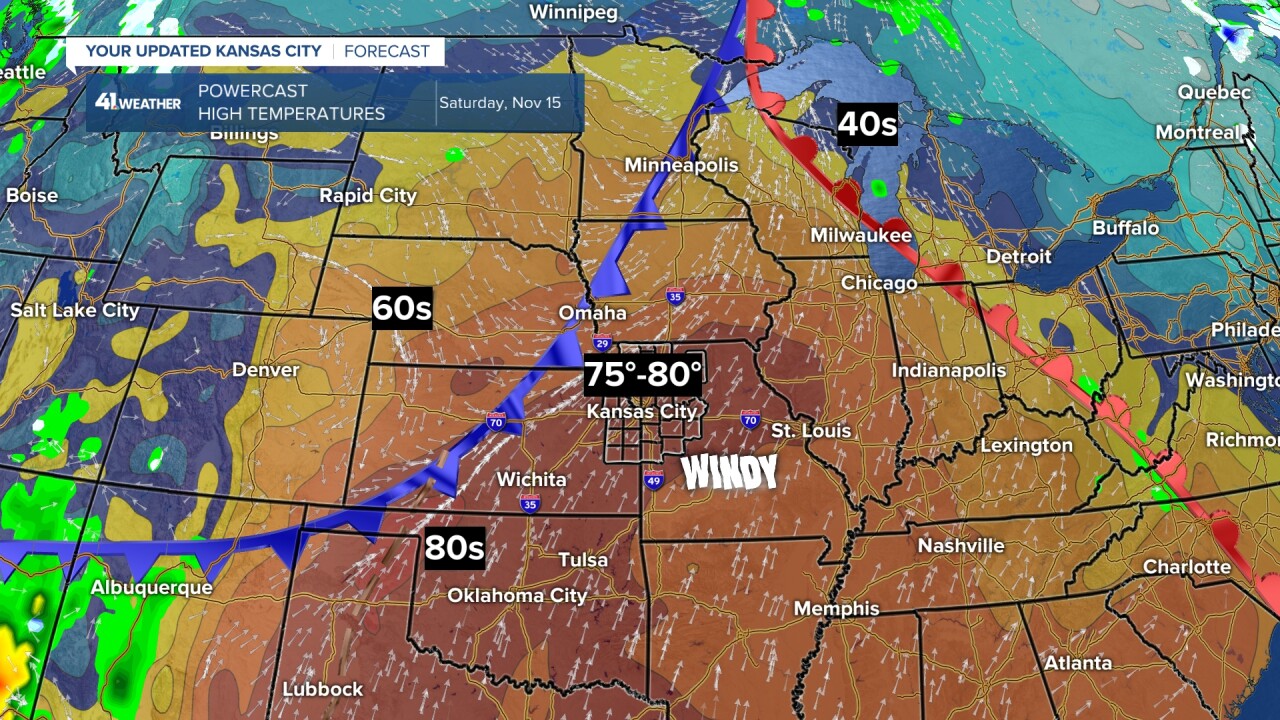
SATURDAY:
A super Saturday! This is the day we have a chance to reach 80°.
It depends on the timing of that cold front. If the front is faster, we will still see highs in the low to mid-70s. If the front waits until 3-4 p.m., then we could break the record high of 79° that was set in 1950.
It looks windy ahead of the front with south-southwest gusts over 30 mph.
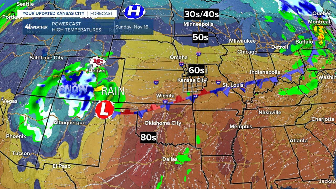
SUNDAY:
The front will have come through with little to no rain. Right now, Sunday is looking like a decent day with highs in the 60s.
The Chiefs have a rather important game in Denver, where it was 60° at 5 a.m.
Boulder, Colorado, has yet to see measurable snow, and the latest date ever to see measurable snow is Nov. 17.
Well, on Sunday, Nov. 16, the Chiefs are in Denver, and the storm system heading our way is in Colorado. This means there may be some rain/snow for the Chiefs game and in Boulder.
SUNDAY NIGHT-MONDAY:
The storm system will track into our region and weaken, which means we may see rain, but amounts look to be on the low side, under .50".
We are 8" below average rainfall since the end of July, so this is not much, but better than nothing. Let's hope we get more than nothing.

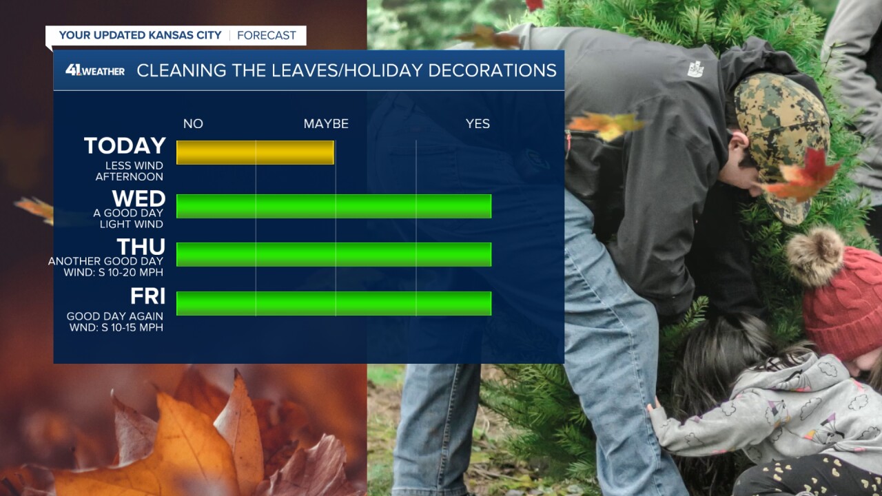
Based on the forecast above, we have a stretch of days that will be good to put up holiday decorations and/or take care of the leaves.
The leaves have been blowing around all over the place with all of the wind, and the fact that the leaves are dry.
Have a great week.
Stay healthy.
—
