


Good Wednesday bloggers,
Today will be a nice day with some pretty altocumulus, altostratus and stratocumulus clouds. There are also some high, thin cirrus clouds. We are on the eastern edge of the active weather pattern that is about to arrive.

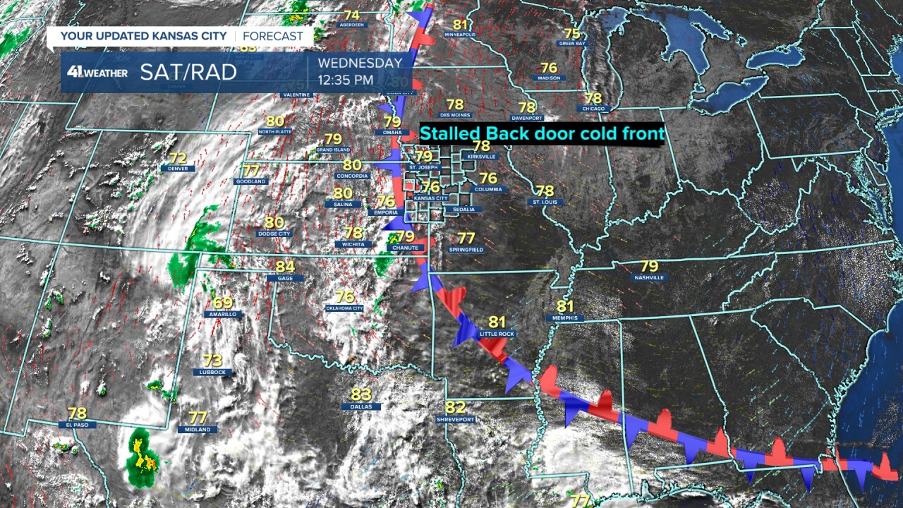
The rain and thunderstorm areas have been out west the last 2 days as drier air has barely moved in from the east. The back door cold front that has delivered the comfortable and dry conditions has stalled and is about to surge east putting us back in the high humidity with rain and thunderstorm chances.
We will be dealing with rain and thunderstorm chances nearly every day for a week. Below are the rain chances as of now. As you know, these chances will likely change and shift around.

Details on the upcoming rain and thunderstorm chances and possible severe threats are in the almost 8 minute video below.
Have a great rest of your week and weekend.
Stay healthy
