


Good Monday, bloggers,
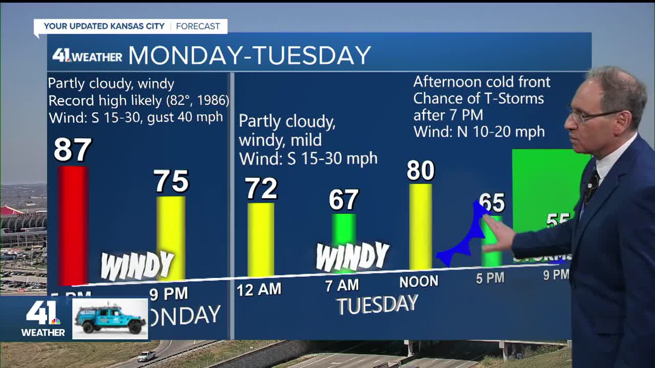
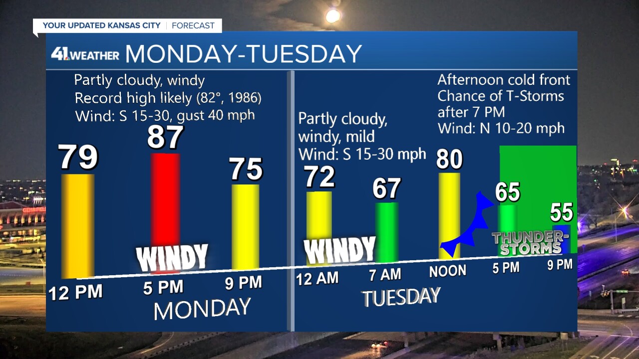
We are in for another record high for March as today's high will climb to the upper 80s. The record for today is 82°, set in 1986. Then, the first 4-5 days of April are going to be rather active.
We are tracking a system in the Pacific Northwest that will track across the northern U.S. today and Tuesday. It will send a cold front into our area Tuesday.
This front will waver back and forth through Saturday as two systems track from the Pacific Ocean to the Plains and Midwest. The system for Wednesday–Thursday is coming from north of Hawaii, while the storm system for Friday–Saturday is coming from the Bering Strait to the Gulf of Alaska.

Let's go through this.
TODAY:
We will see highs climb to the mid/upper 80s, which will break the record of 82° set in 1986 under a partly to mostly sunny sky.
The wind will be from the south, gusting to 30-40 mph.

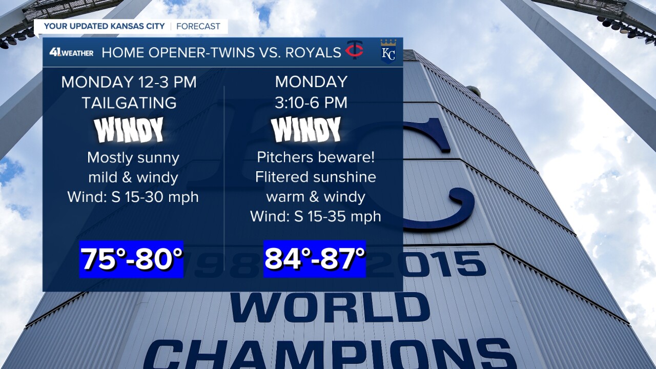
This means the wind will be blowing out to left-center at The K for the home opener.
The wind, warm air and moderate humidity will make the ball carry. Add in the fences being 10 feet closer to home plate, and the potential is there for a high-scoring game.
But it's baseball, so it could be a 1-0 game. It will be interesting to see what happens.
TUESDAY:
The front will be moving into the area.
It will not get here until early afternoon, so we will likely climb to around 80 before falling back to the 60s.

There won't be any thunderstorms along or ahead of the front, as a "cap" (warm air aloft) will be in place.
There may be thunderstorms tonight in Iowa with the front. There is a chance they slip into northern Missouri later tonight before falling apart.
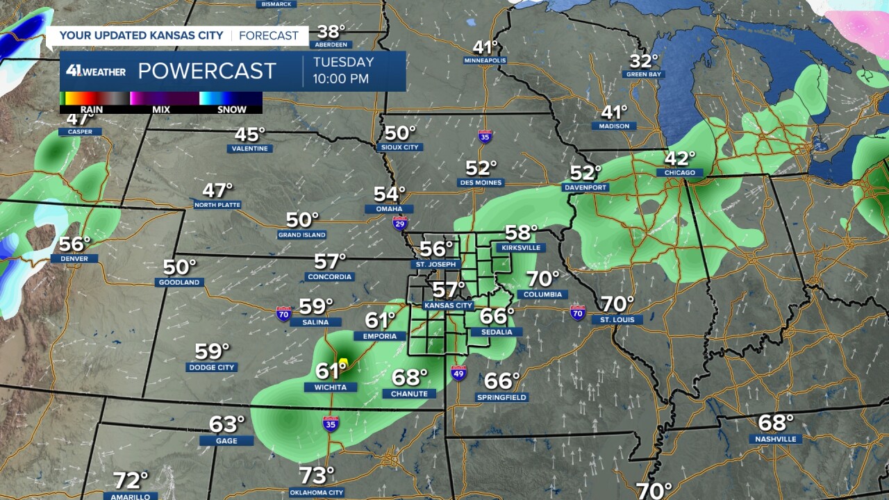
TUESDAY NIGHT:
Some showers and thunderstorms may form behind the front.
Right now, these look more scattered as the "cap" slowly breaks. Also, since they are behind the front, the severe threat is low.
A few thunderstorms could produce small hail if they really got going.
You can see the front is from southeast Kansas to eastern Missouri. Lows will be in the 50s.
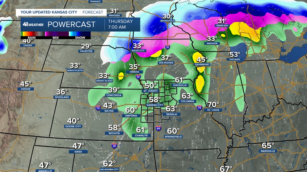
WEDNESDAY:
Rain and thunderstorms will increase as the first storm system arrives. The front will be just south or near KC. Heavy rain is likely.
What about severe weather? Right now, the threat is low in our area as the clouds and rain will keep it too cool to get severe weather going, and the shear is not great.
The Storm Prediction Center has just a Level 1 of 5 risk from eastern Kansas to Texas, but we always have to watch T-storm setups in April, May and June, as a few changes, such as more sunshine, can increase the severe threat.
Highs will be in the 60s to 70s, depending on where the front is located.


WEDNESDAY NIGHT:
Periods of rain and thunderstorms will continue. It is hard to find the front as it is embedded somewhere in the rain and thunderstorms.
Snow will be mostly north of I-80.

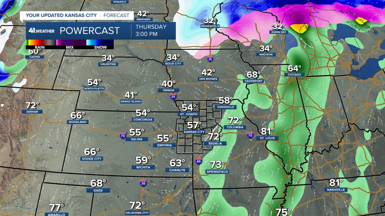
THURSDAY:
The rain will end by noon as the first storm exits.
Highs will be in the 50s, and we may see some sun before it sets.
FRIDAY MORNING:
It will be partly cloudy, calm and cool with lows in the 40s.

FRIDAY AFTERNOON/NIGHT:
The second system, now entering the Gulf of Alaska, will arrive.
Warm and moist air will surge north, taking highs to around 70°. A line of rain and thunderstorms will form in central Kansas to Oklahoma, then head east.
We will need to watch this for severe weather. The Storm Prediction Center has no risk at this time; they may be underestimating that.
The severe threat is going to depend on how much warm air makes it north and the shear. Right now, the flow aloft is somewhat parallel to the front, which is low shear.
The better shear and warmer air is across Oklahoma and Texas, as of now.

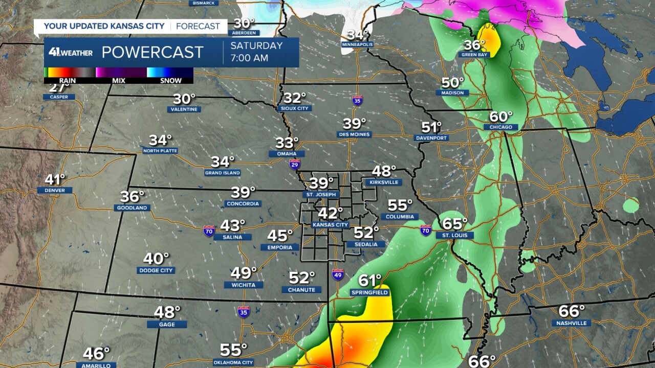
SATURDAY:
The rain and T-storms will exit during the morning, followed by some afternoon sun. It will be cool with lows in the 40s and highs in the 50s.
The good news is that there is no third storm system. So Easter Sunday looks dry with highs around 60°.
Now, the morning will be cold with lows around 32°.

RAINFALL FORECAST TUESDAY-SATURDAY:
There is going to be a zone of 2"-4" rain with pockets of 4"-7"! April averages 4.05" of rain as the wettest time of year, May and June, approaches.
The zone has trended much farther north and west during the last 24 hours. This is not set yet. It can still shift 50-100 miles northwest or southeast.

The current zone of rain does cross some locations that are in need of rain, such as northern Missouri, southeast Kansas and eastern Oklahoma.
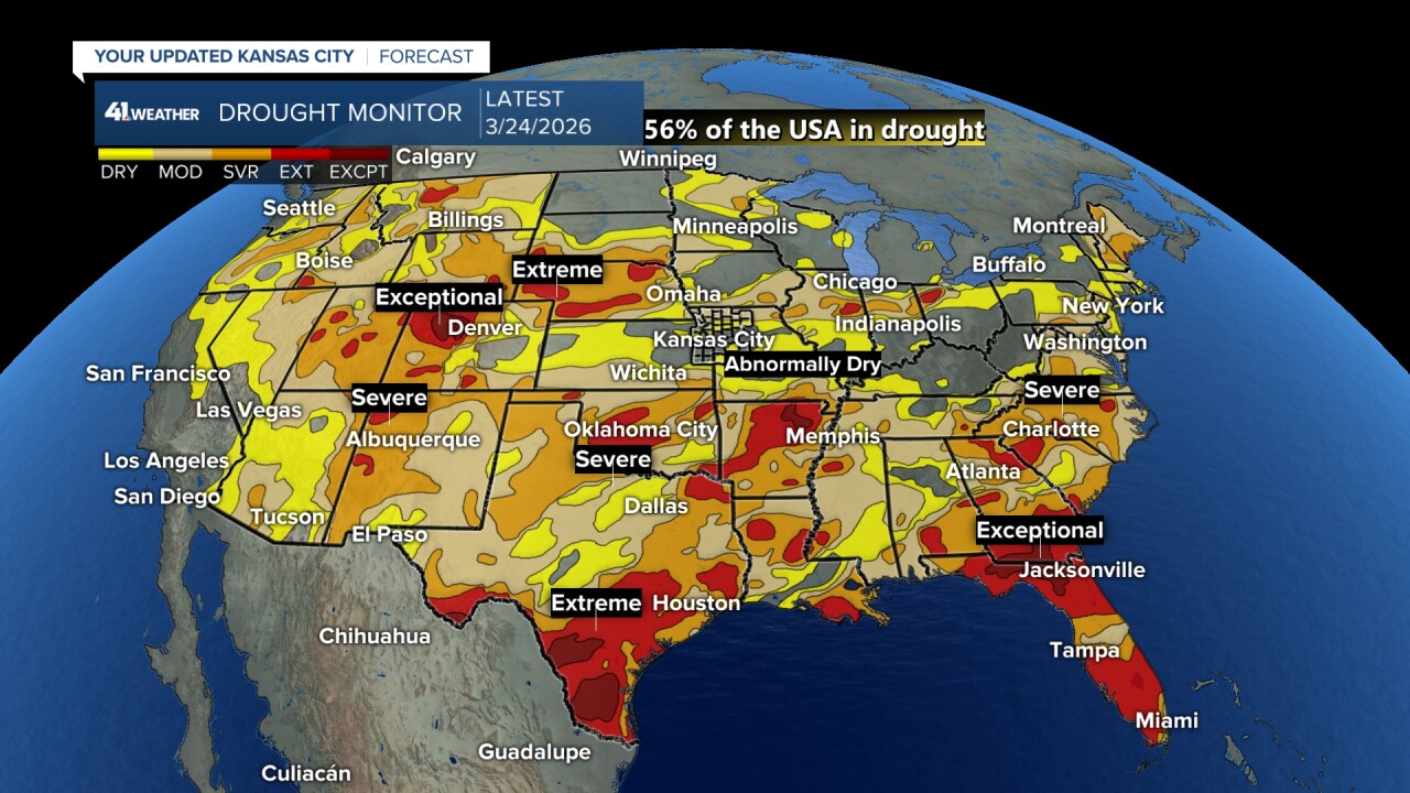
You can see eastern Kansas and western Missouri are not in drought.

Rainfall during the last 30 days has been 150%-215% of average from around I-35 and east. Northern Missouri has seen just 40%-55% of the average.
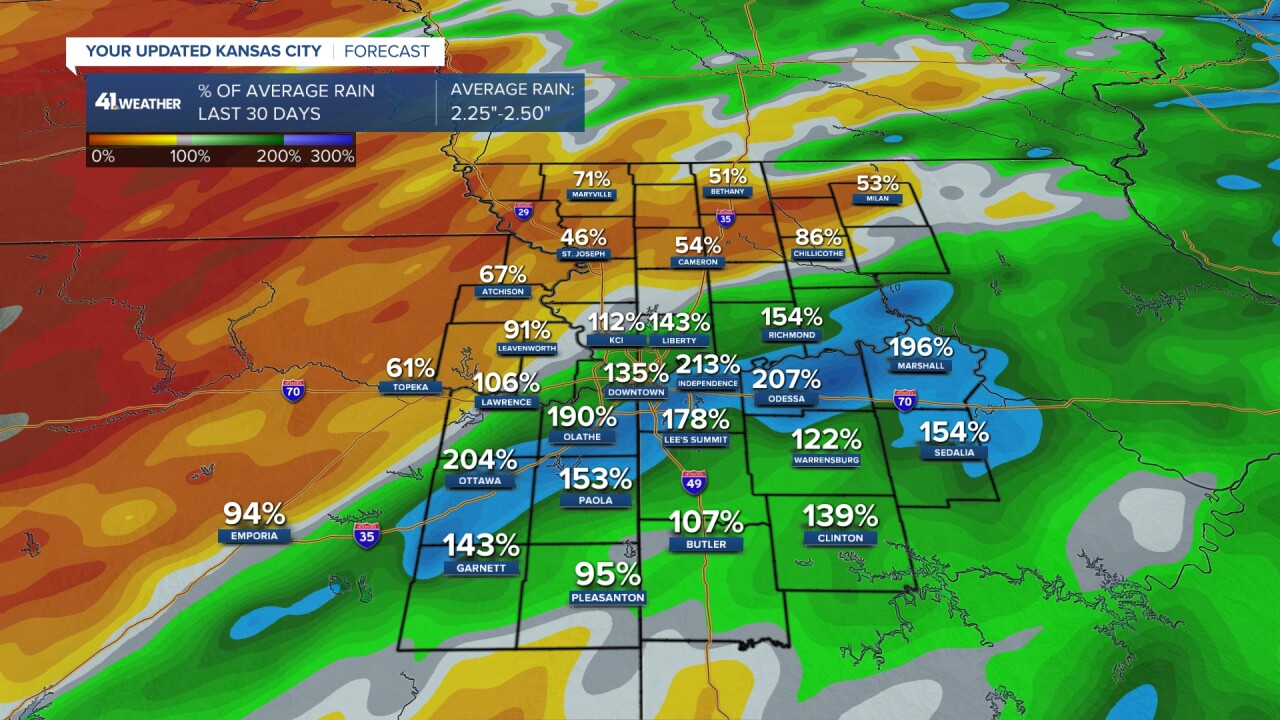
A closer look at the rainfall forecast shows the middle of the heavy rain zone is mostly in locations that have seen decent rain.
Most of the rain fell during the first two weeks of March, so it has dried out in all locations.

When we broaden the Drought Monitor to the USA, you can see 56% of the country is in drought, so at least some locations will get help this week.
Have a great week.
Stay healthy.
—
