

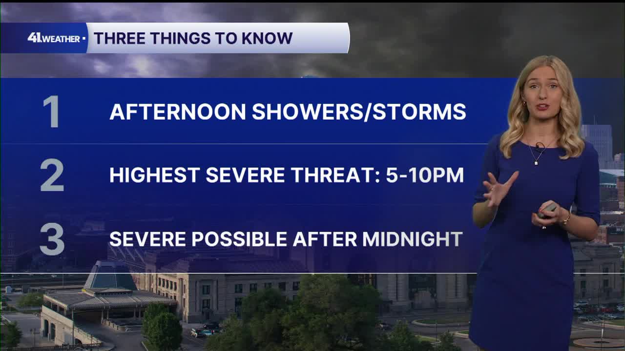


KANSAS CITY, Mo. — You're going to want to pay attention to the weather on Monday. There's a risk of severe weather in the KC area during the afternoon and evening, potentially extending past midnight.
The window with the highest chance of severe weather is 5-10 p.m. Monday.
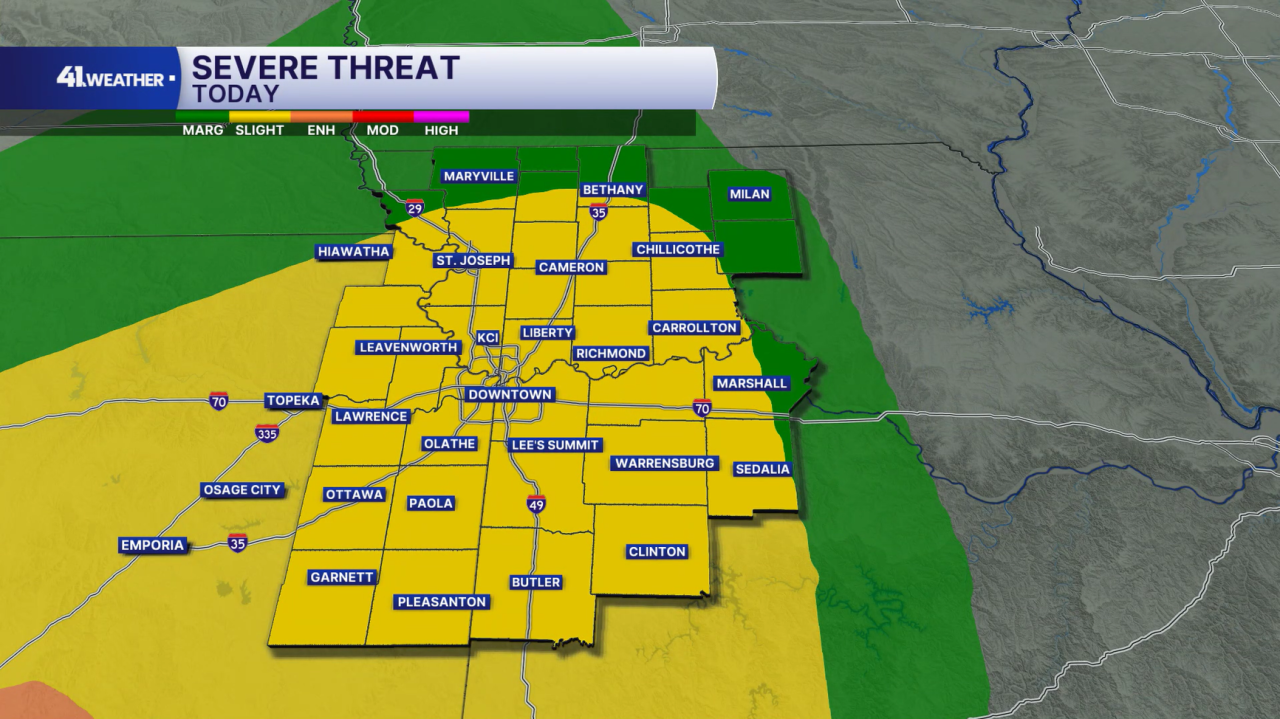
The Storm Prediction Center has increased the severe threat to a 2/5 (slight) risk for the area.
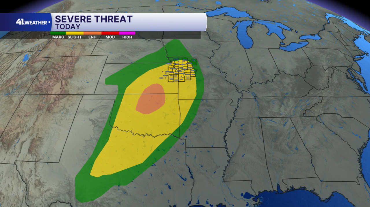
This is part of a large storm system driven by a cold front. The severe threat extends from northern Iowa to southern Texas.
The highest risk of severe weather is to our southwest; however, we'll be monitoring the chance of multiple threats throughout Monday.
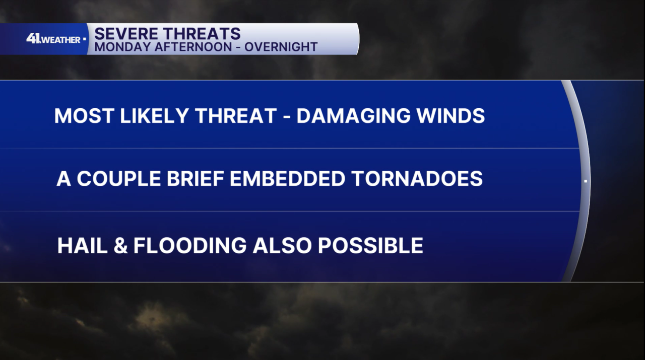
The most likely threat Monday will be damaging winds, gusting up to about 75 mph. The chance of a couple brief, weak tornadoes is also possible, likely embedded in the line of storms that will move in.
Flooding will also be a concern, especially during the later evening hours. I think we'll see the heaviest rainfall arrive just before midnight.
The chance of hail is lower on the list of threats but still possible.
The chance of rain/storms will gradually increase throughout the day.
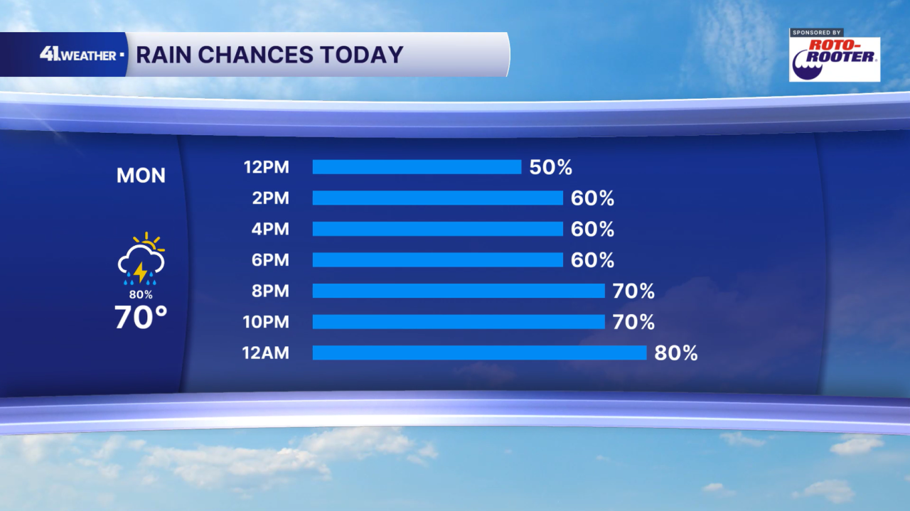
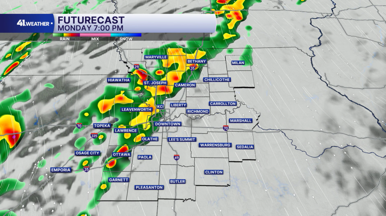
Walking through our futurecast, I think there's a very good chance we will have storms in the area by this evening.
This is a forecast look around 7 p.m. Please use caution and check the radar before your evening commute today.
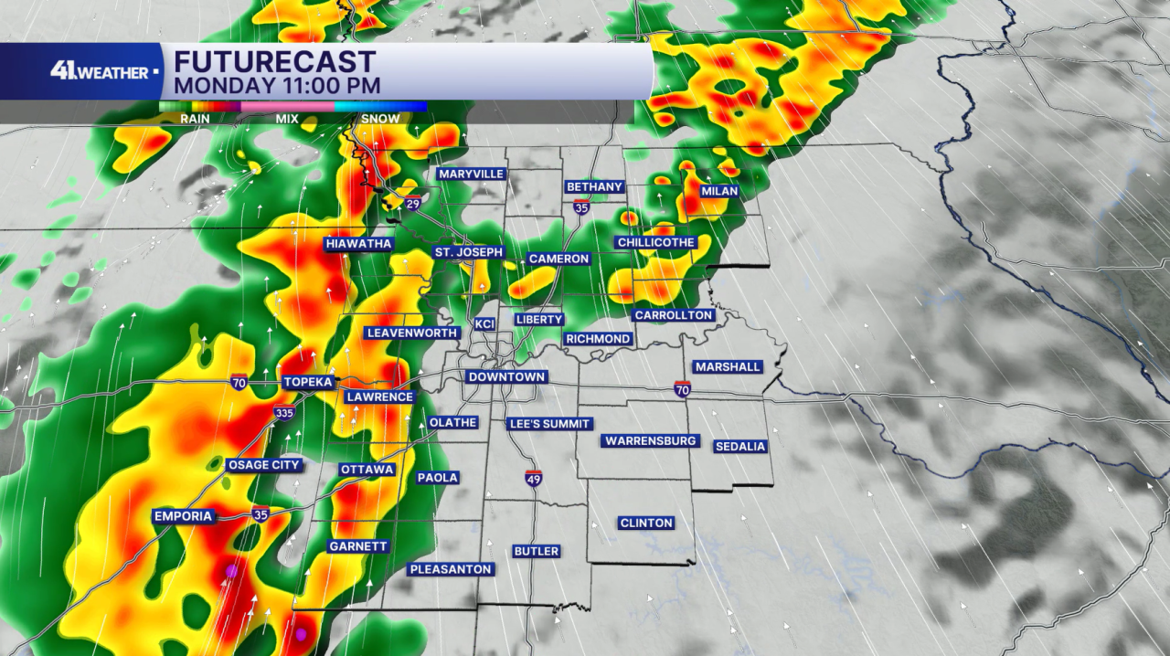
By 11 p.m., I expect to still see thunderstorms in our vicinity. This is around the time we could get some pretty heavy rainfall.
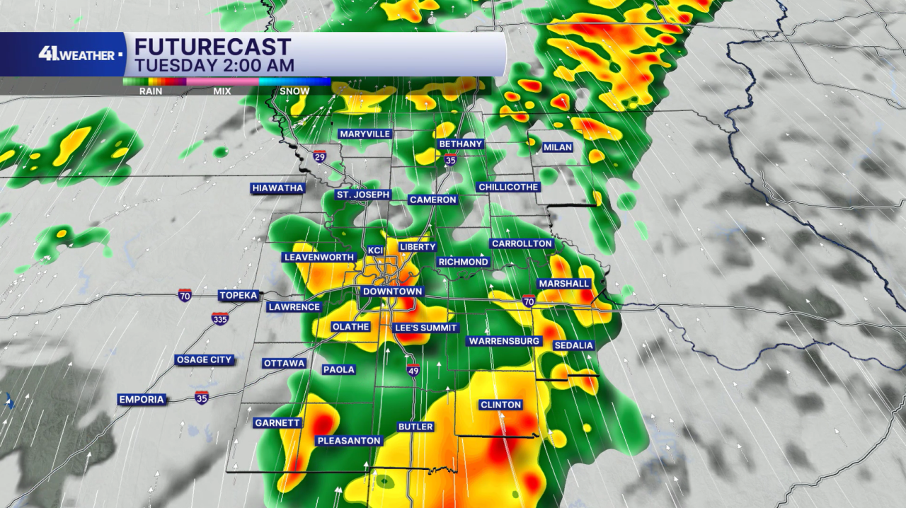
The threat of severe weather may persist as late as (or as early as, rather) 2 a.m.
As we get later in the morning on Tuesday, the severe risk will greatly decrease. I am not concerned about severe weather during the daytime hours on Tuesday.
Overall, rainfall totals from the next few days may add up to 2" in some places.

Tuesday will be overcast and cooler. We have the chance of a few lingering showers and thunderstorms, but I don't expect to see anything strong or severe. Rain chances will drop off throughout the day, likely leaving us dry after sunset.
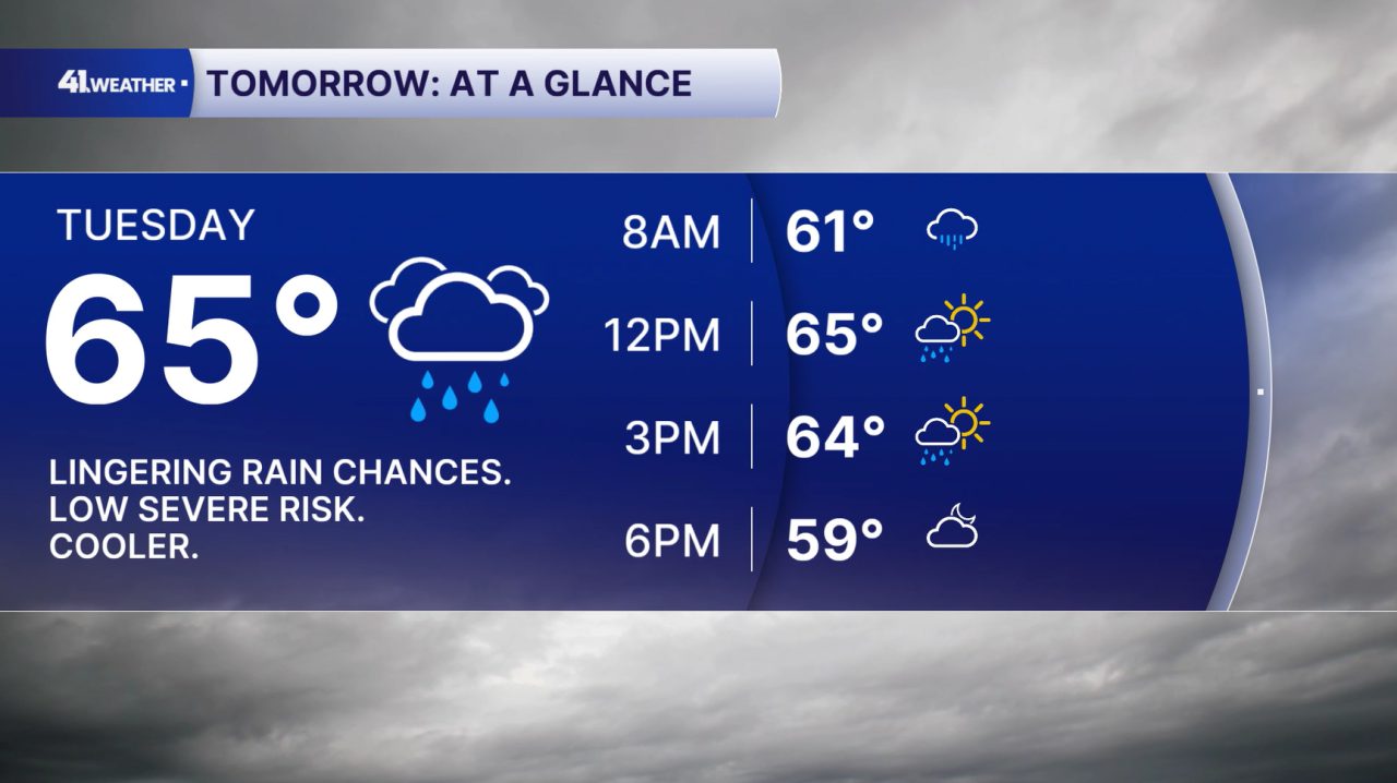
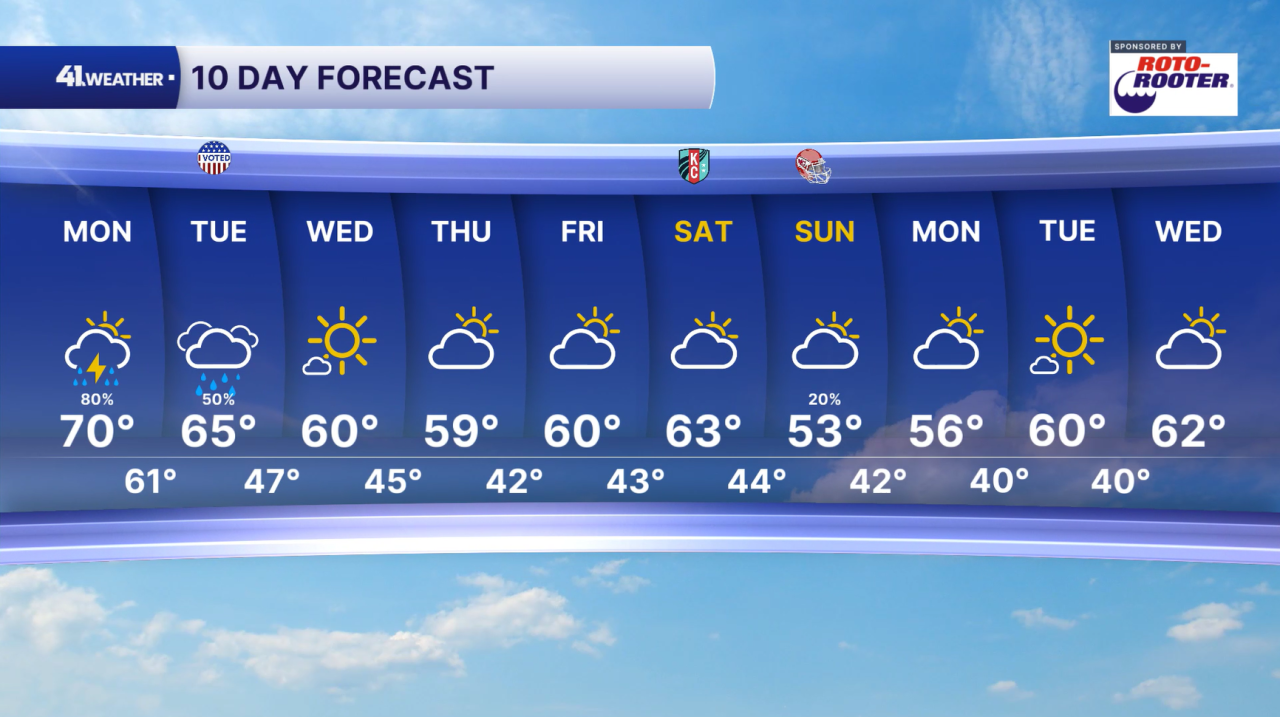
Thanks to the cold front moving in with the storms, you can expect much cooler weather for the rest of the week. Mostly dry conditions will take over as well.
Sunshine returns on Wednesday. Temperatures will remain near 60° in the afternoons for the second half of the week, with morning lows in the 40s.
This weekend should be mostly dry with a return to the low to mid-50s Sunday and Monday.
Have a question about the forecast? I'd love to hear it! Reach out, and I'll answer your questions in this weather blog.

Have a great week, and stay safe!
—
