


Good Tuesday, bloggers,
The weather today through Wednesday will see a series of changes as we track an exiting system and an approaching cold front. Let's go through this.
The previous seven days have seen interesting weather. There has been a ton of rain from South Dakota to Arkansas, as countless rounds of thunderstorms have been tracking through those states.
2"-4" rainfall has been widespread, with 4"-9" areas embedded in the large area. If you look closely, you can see it has all been just west of the KC area.
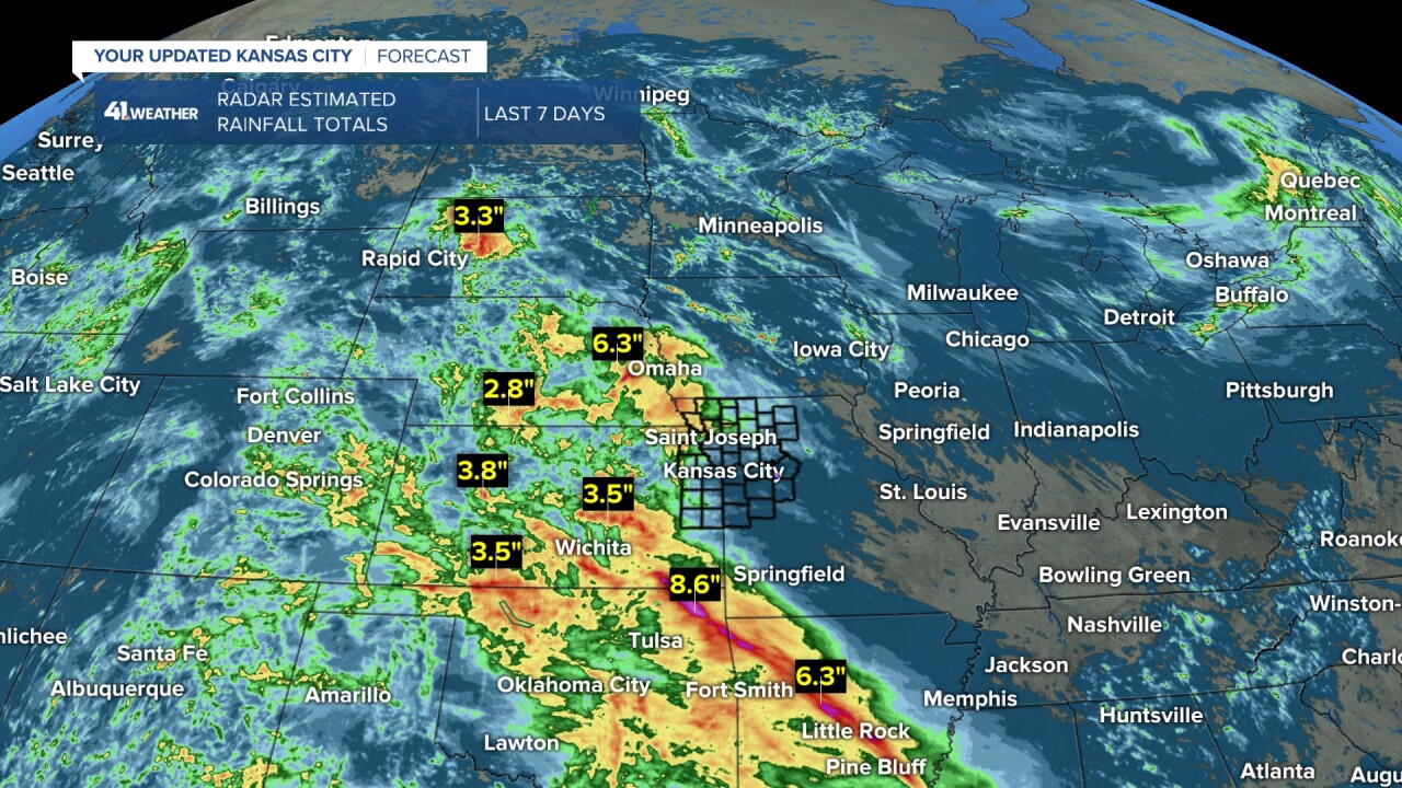
Northwest Missouri to far eastern Kansas got in on the rain party with amounts 1"-3" with embedded 3"-5" areas.
The KC area and points east and southeast were not invited to the rain party as rainfall was a trace-0.25". Northern Missouri at least saw 0.25"-1".

OK, now what is next?
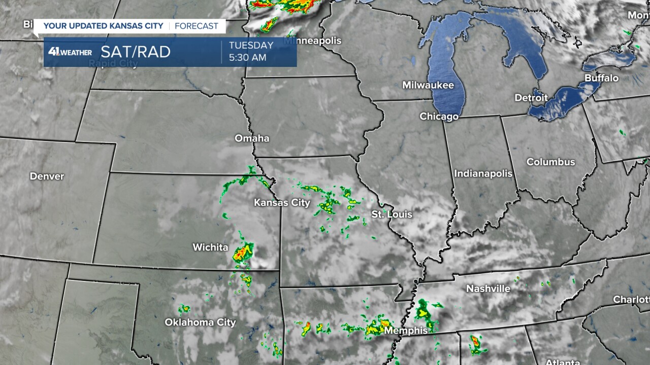
The system responsible for all of the clouds and some rain over the Labor Day weekend has mostly fallen apart as it tracks southeast across eastern Kansas and western Missouri. As it exits, we will see increasing sunshine this afternoon.
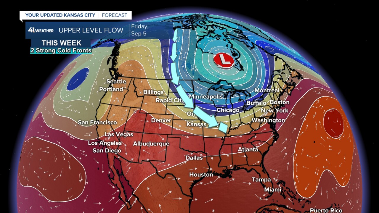
This is the upper-level flow for today. The system is being pushed southeast by an increasing flow from the northwest, a flow originating in northern Canada.

The upper-level flow for Friday will be swiftly coming in from northwest Canada to the Midwest. This will bring two strong cold fronts, timed for Wednesday and Friday.
We will focus on the first front, as thunderstorms are likely with the first front. The second front may bring some rain showers, but the low-level moisture for thunderstorms will be taken by the first front.
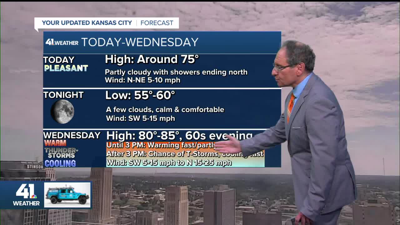
TODAY:
After the morning clouds and a few rain showers exit, it will become a nice and partly cloudy afternoon. Highs will be in the 70s.

TONIGHT:
There will be a few clouds with calm and comfortable weather. Lows will be around 55.
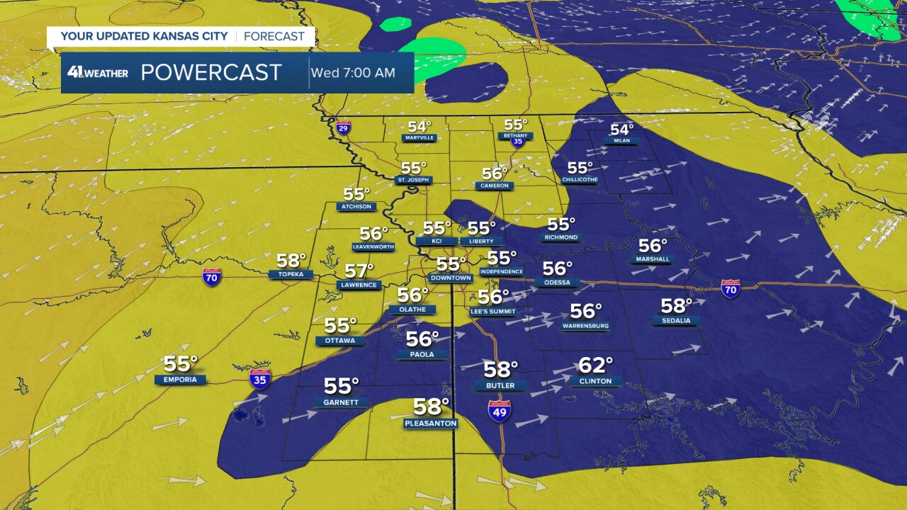
WEDNESDAY UNTIL 3-4 PM:
We will get a taste of summer as highs climb to the low and mid-80s under a partly cloudy sky.
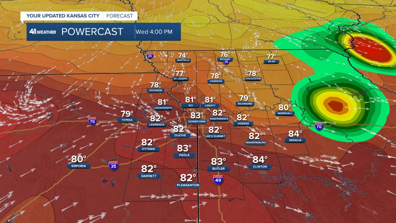
You can see at 4 p.m., the wind shift in the wind arrows near KC. That is the cold front.
A few thunderstorms are possible in northern Missouri by 4 p.m. The wind will be southwest at 5-15 mph.
WEDNESDAY 4-10 PM:
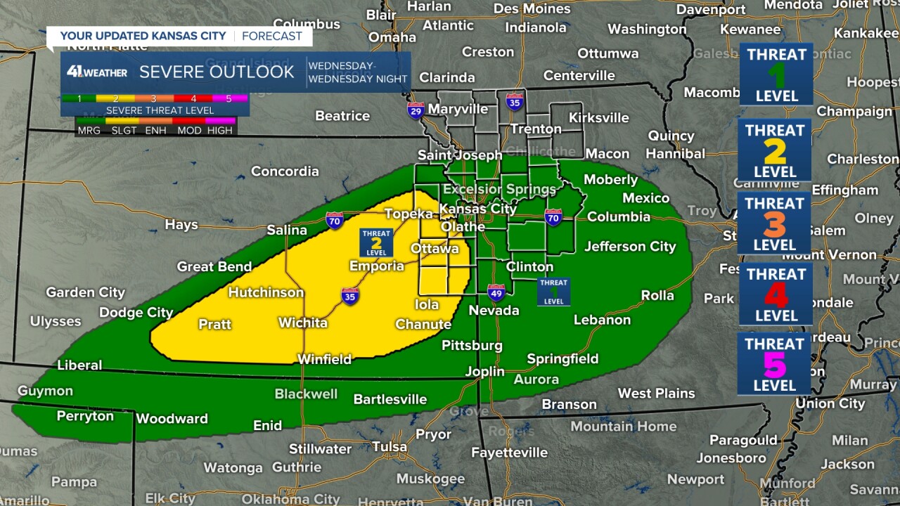
This is when the front moves through and thunderstorms form on the front. It will likely not be a solid line, so just because this data has KC in some big thunderstorms, it does not mean this is where it will be.
Where there are thunderstorms, some may be severe with damaging wind and hail — the main threats. Regardless of thunderstorms, the wind will pick up from the north and increase to 15-25 mph.
Some locations may see 1" of rain, others not a drop. Hopefully, the rain will fall in areas that have been missed, and there is no severe weather.

We are at a Level 1/2 out of 5 risk of severe weather. The higher severe threat is across south-central Kansas.
It is these locations where there is a minimal tornado threat. The tornado threat is never zero, but the threat here is close to that. Overall, this is not a tornado setup.
THURSDAY MORNING:
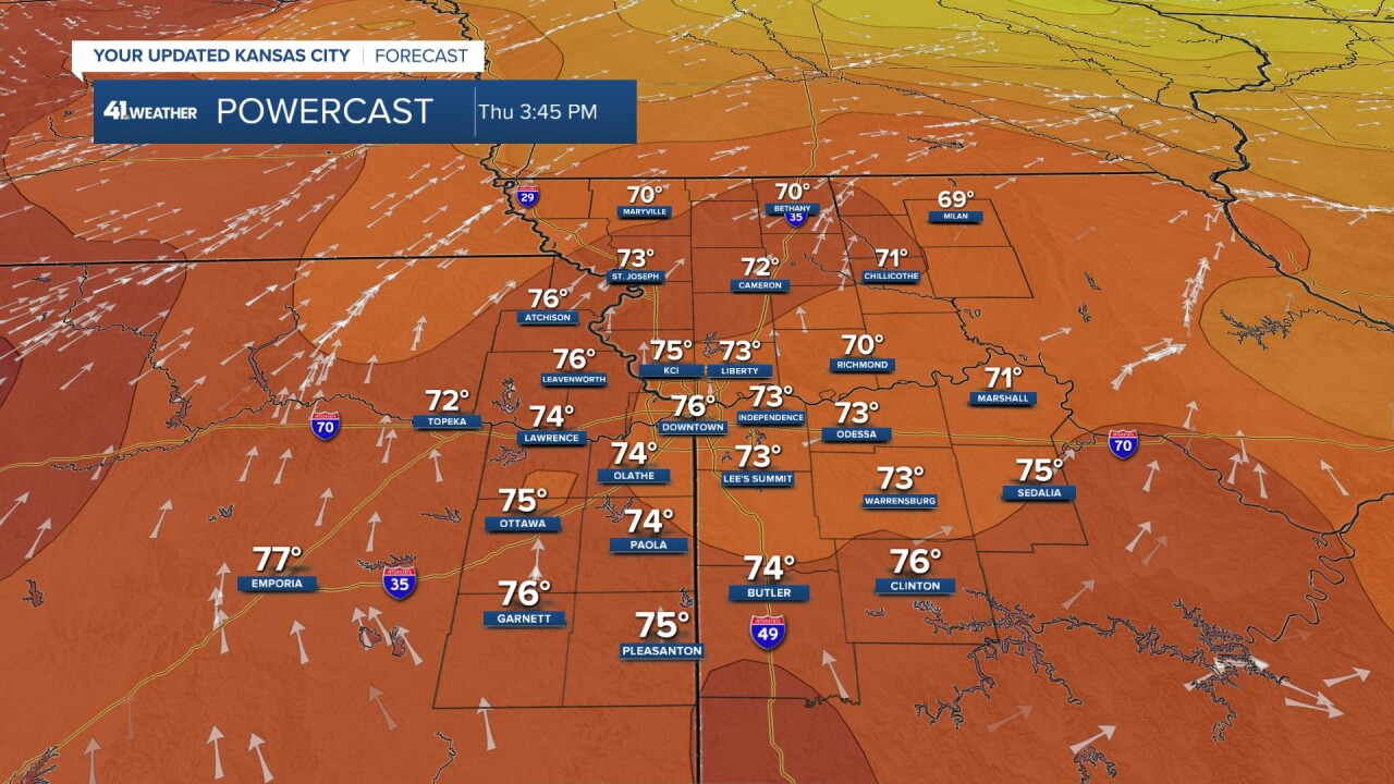
We will be back to the fall feel as lows drop into the 40s north of I-70 and low/mid-50s to the south. If there are fewer clouds as the wind decreases, then lows will be 5 degrees colder than shown below.

THURSDAY AFTERNOON:
It will become a nice afternoon with highs in the 70s and abundant sunshine. The wind will turn around to the southwest ahead of the second front.
The second front arrives Friday with clouds, more north wind and a few rain showers. Highs may struggle to reach 70°.
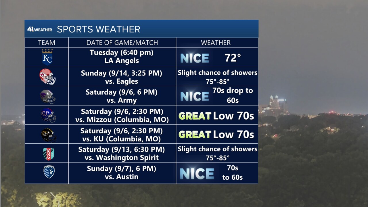
Right now, the weekend looks nice with highs in the 70s and lows in the 40s and 50s. This is good news for all of the sports events.
Here is a list of teams and the weather forecast for upcoming key games in our area.
We have the Royals tonight, the Chiefs next Sunday in KC, the border war in Columbia, Missouri, the Wildcats playing the Army this weekend in Manhattan, Sporting playing this Sunday, and the Current's next home game is a week from this Saturday. Whoosh, that is a lot of sports.
How about the Chiefs' first game this Friday in São Paulo, Brazil, that can be seen on KSHB 41?
It looks good with temperatures dropping from the 70s to the 60s. A few rain showers are possible at the end or after the game. BTW, São Paulo is two hours ahead of KC.

Have a great week.
Stay healthy.
—
