


KANSAS CITY, Mo. — Good Tuesday, bloggers,
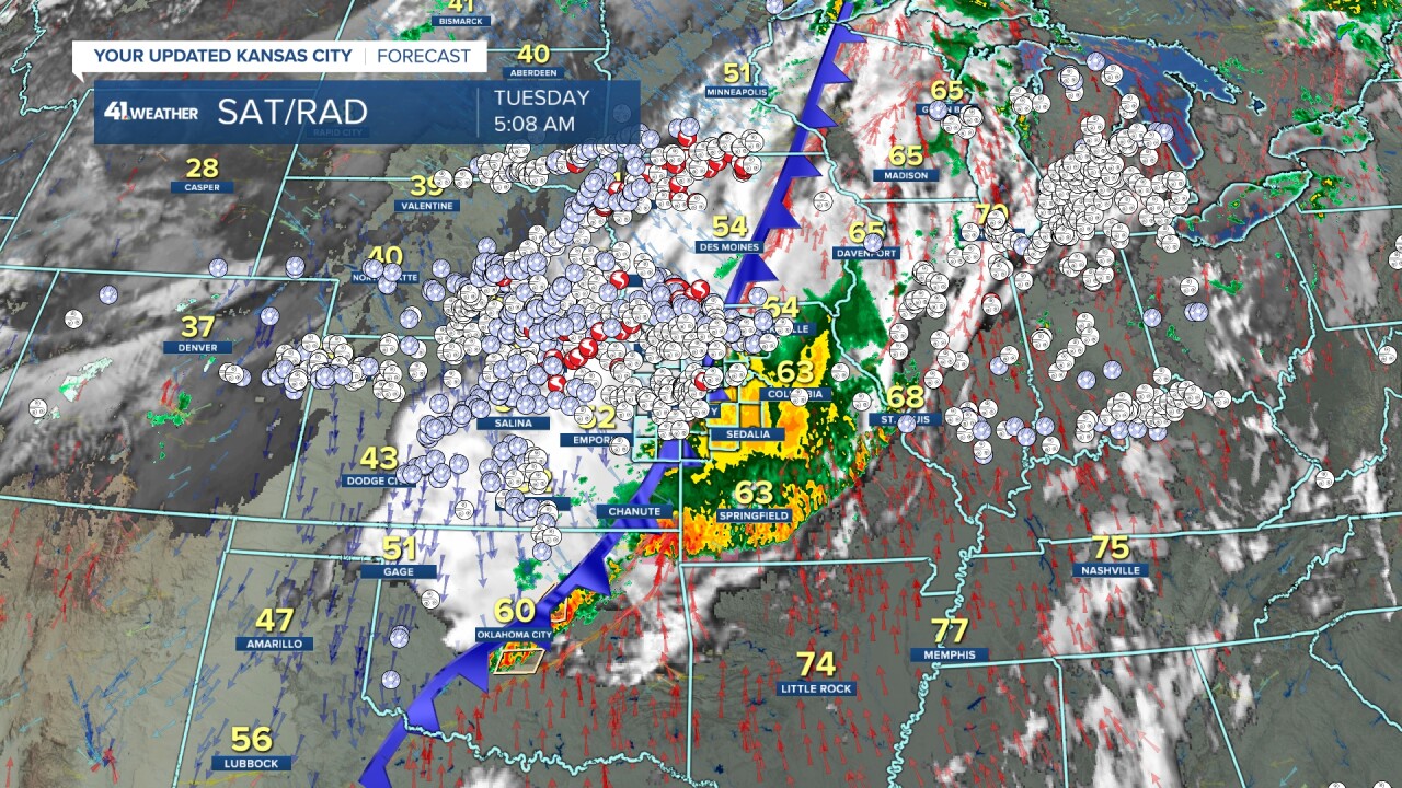
The latest round of heavy rain and severe weather exits today. But we have another storm system to track.
Before we look ahead, let's look at the last few days after several rounds of thunderstorms crossed the area.
Last night, a line of severe thunderstorms came in from the west and northwest. There were many reports of 50-70 mph winds in the city.
There was a tornado on the line three miles south of Wood Heights, Missouri, in southwest Ray County. There also may have been a brief tornado around Belton/Raymore/Peculiar. The National Weather Service will check these locations out today.
This line did weaken as it approached. You can see the severe reports ended east of KC.
The severe reports across eastern Missouri and Illinois occurred Monday morning. Manhattan, Kansas, had numerous power outages and flooding.
There was a reported 91 mph wind gust in Jarbalo, Kansas, which is west of Lansing.

Here are the tornado reports for the last three days. It looks like, unfortunately, Tornado Alley is alive and well.
Also, notice that it is 28° in Casper, Wyoming, with 30s/40s across much of Nebraska and Kansas. Cooler air is moving in and will stay.
This will play a role in the next storm. But I digress, more on the next storm below.

When you add in the wind and hail reports, you can't even see northern Kansas, southeast Nebraska, western Iowa or southern Minnesota.
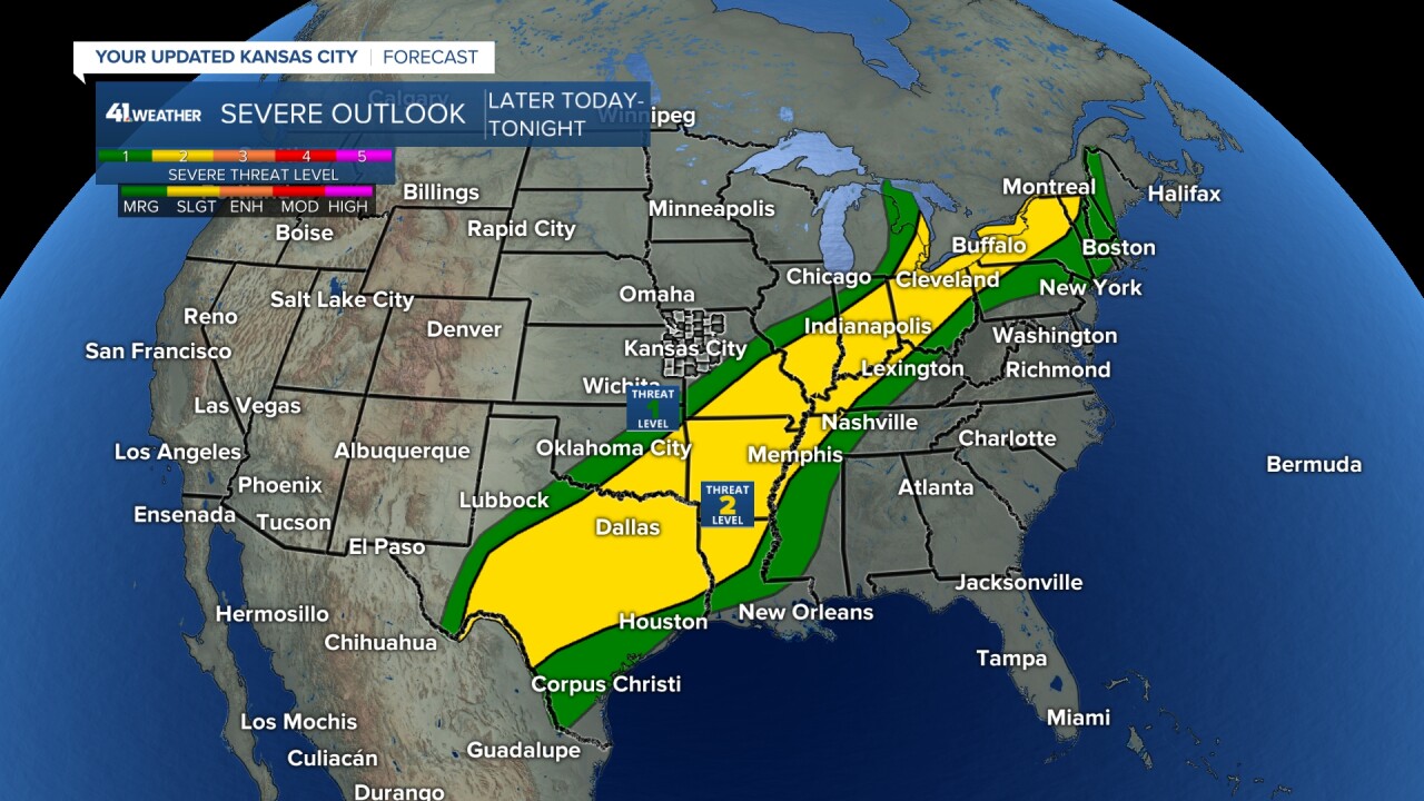
The severe threat today is Level 1/2 of 5, but it covers a huge area from southwest Texas (north Mexico) to New England into southeast Canada! It is southeast of our viewing area.
Rainfall amounts since Friday across the Kansas City metro were widespread at 1"-2". Some locations received 2"-3", especially from Spring Hill to Lone Jack.
These are radar-estimated totals, so your rain gauge may read differently.

When we look across the area, rainfall since Friday has been quite plentiful after a mostly dry first two weeks of May. Eight to 10 inches of rain occurred from Trenton, Missouri, to Beatrice, Nebraska. Trenton had some major flood issues on Saturday.

The flood watch ends today, but the creek, stream and river flood warnings will continue. The Missouri River is expected to rise above flood stage from here to St. Louis during the next few days.

Now, what is next? We do have another storm system to track at the end of the week. Let's go through this.
TODAY:
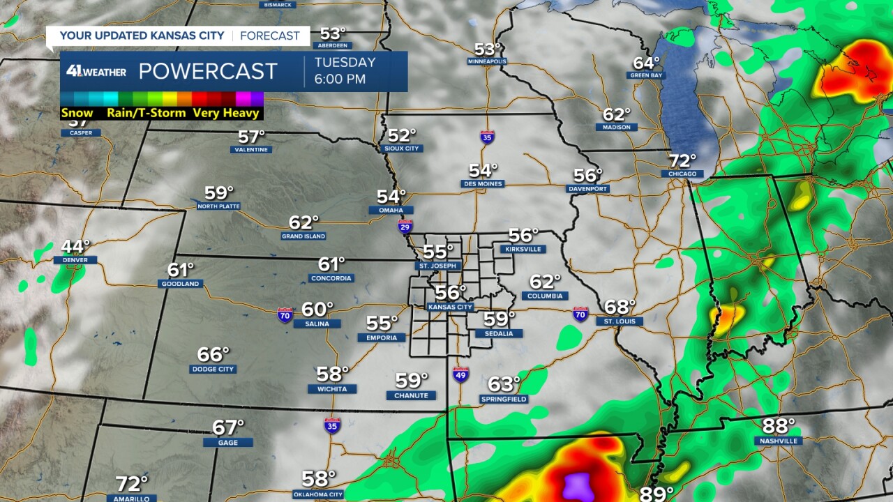
The rain and drizzle will end this morning, followed by a cloudy and cool day. Temperatures will stay in the 50s. The high for the day was 64°, which occurred between midnight and 3 a.m. The wind will be northwest at 10-15 mph. The average high for today is 76°, so we will be 20° below average.
TONIGHT:
It will become partly cloudy and cool with lows in the 40s and a light north-northeast wind.

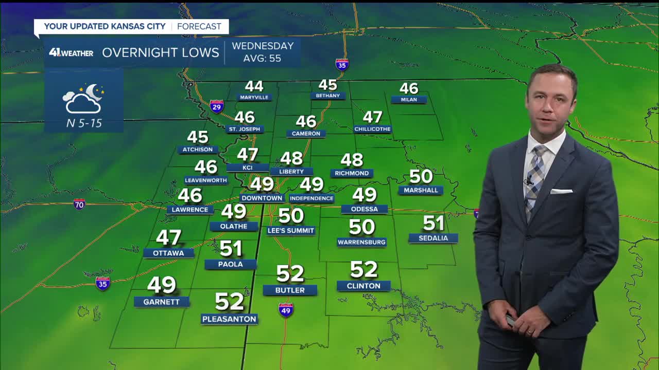
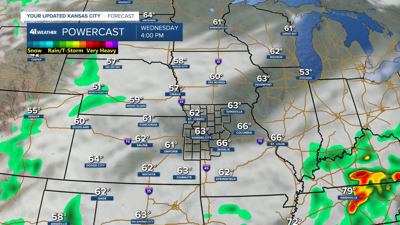
WEDNESDAY:
It will be a nice day with highs in the 60s along with an east-northeast breeze at 5-15 mph. If the yard is not too swampy, it may be the day to mow as more rain arrives Thursday and Friday.
THURSDAY:
We will see periods of showers with lows in the 50s and highs in the 60s. We do not expect any severe weather as the system is weaker and temperatures are too cool.


THURSDAY NIGHT-FRIDAY MORNING:
This is when we have the best chance to see widespread rain. Heavy rain and flash flooding are possible, but severe weather is not expected. It is too cool, and the system is not as vigorous. Lows will be in the 50s with highs in the 60s to near 70.

As of today, it looks like the storm exits Friday afternoon, which means the Memorial Day weekend is looking mostly dry in Kansas City and the area lakes. A few showers and thunderstorms may linger on Saturday. It is, on average, the wettest weekend of the year, so it is hard to keep all three days dry.
There is another system for next Tuesday-Thursday, so we will have to watch and see if it comes in one day early, affecting Memorial Day.
Have a great rest of your week.
Stay healthy.
—
