

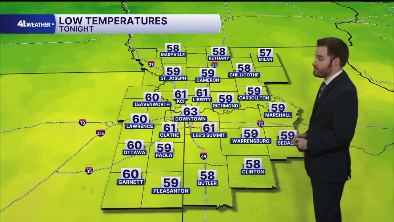


KANSAS CITY, Mo. — A fall warm-up is here! Seasonable highs in the 70s are behind us for now, as Kansas City is warming up into the 80s for the next week or so.
Although temperatures will be incredibly warm for this time of year, it's not all bad news. Conditions will be nearly perfect outside of the above-average highs. You can expect sunshine to continue, relatively low humidity and calm winds Tuesday.
The difference, of course, will be felt during the hottest hours of the day, with highs reaching the low to mid-80s Tuesday afternoon.
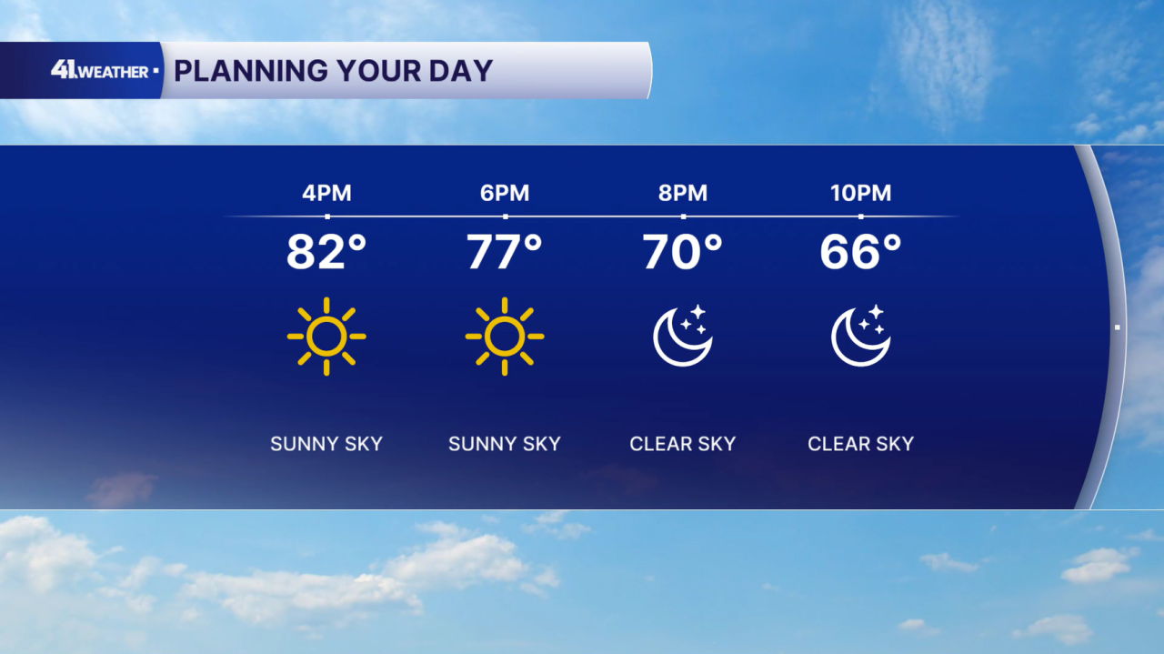
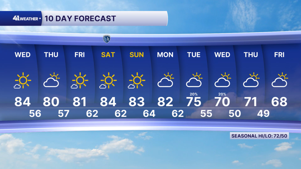
Wednesday will bring more of the same conditions, starting off the morning quite a bit warmer in the upper 50s and low 60s. After that, you can plan on temperatures in the mid-70s by noon and mid-80s in the afternoon and evening.
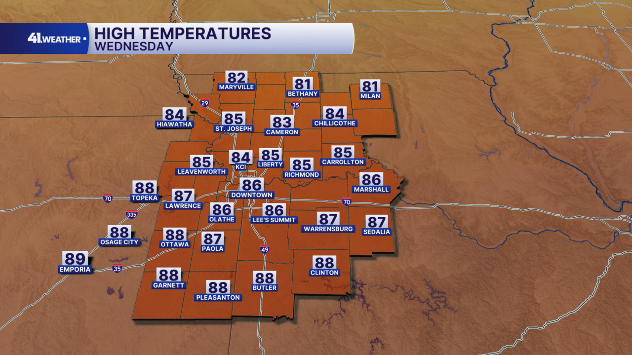
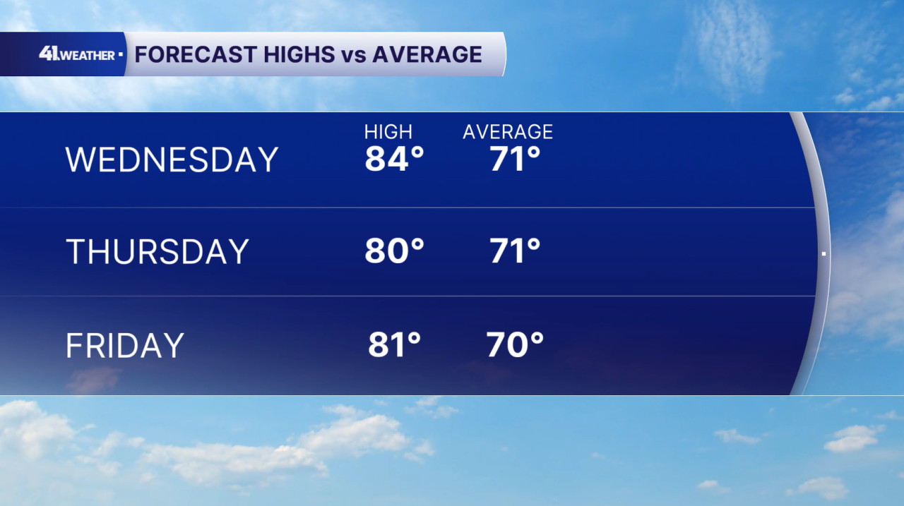
Mostly sunny skies persist through Wednesday before a few clouds move in Thursday. Low 70s are average highs for early October, so the KC area is likely going to be 10–15 degrees above that this week.
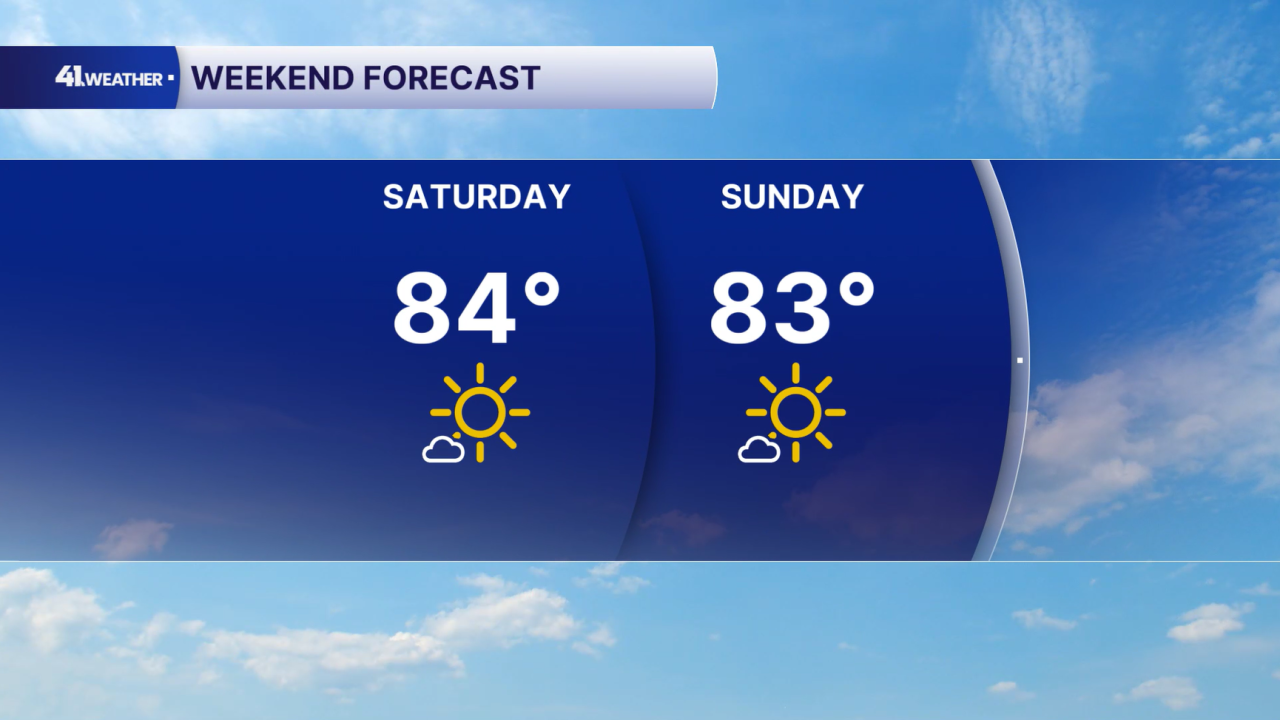
Then, the weekend should be mostly sunny with highs in the low to mid-80s. Conditions will remain pretty mild, outside of the warm temperatures.
Early next week, temperatures will likely still be in the 80s! Our next cold front is set to arrive around midweek next week. This will bring rain chances and temperatures back in the 70s and 60s.
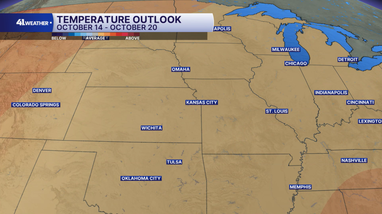
For the week of Oct. 14–20, temperatures are expected to be near or above average. Typical highs for the middle of October in Kansas City range from the mid to upper 60s.
Main takeaway here: We may be warmer than the 60s, but I don't expect our high temperatures in the 80s for this stretch of days.
Have a question about the forecast? I'd love to hear it! Reach out to me, and I'll answer your questions on this weather blog.

Stay cool, and enjoy the sunshine!
—
