

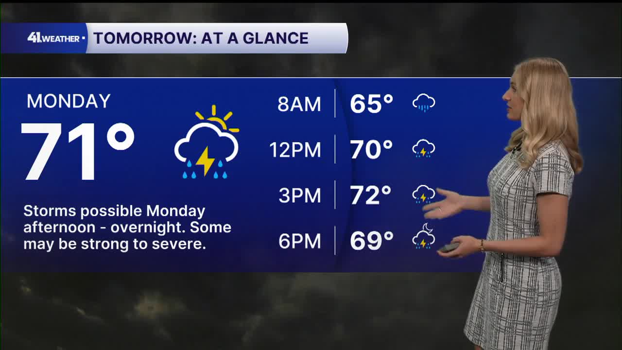


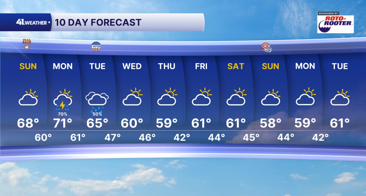
KANSAS CITY, Mo. — We're starting off the month of November with cloudy skies and (hopefully) an extra hour of sleep. Big changes arrive with a cold front Monday that may spark strong to severe storms.
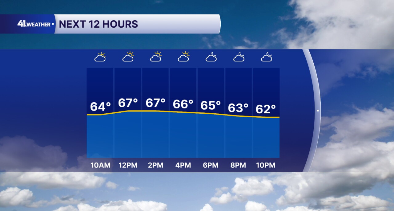
Cloudy skies dominate the day on Sunday, locking our temperatures in the 60s. It should feel very similar to Saturday's weather, just without the rain.
Mostly cloudy skies continue into the overnight hours, with a slow but steady cool-down into the upper 50s and low 60s.
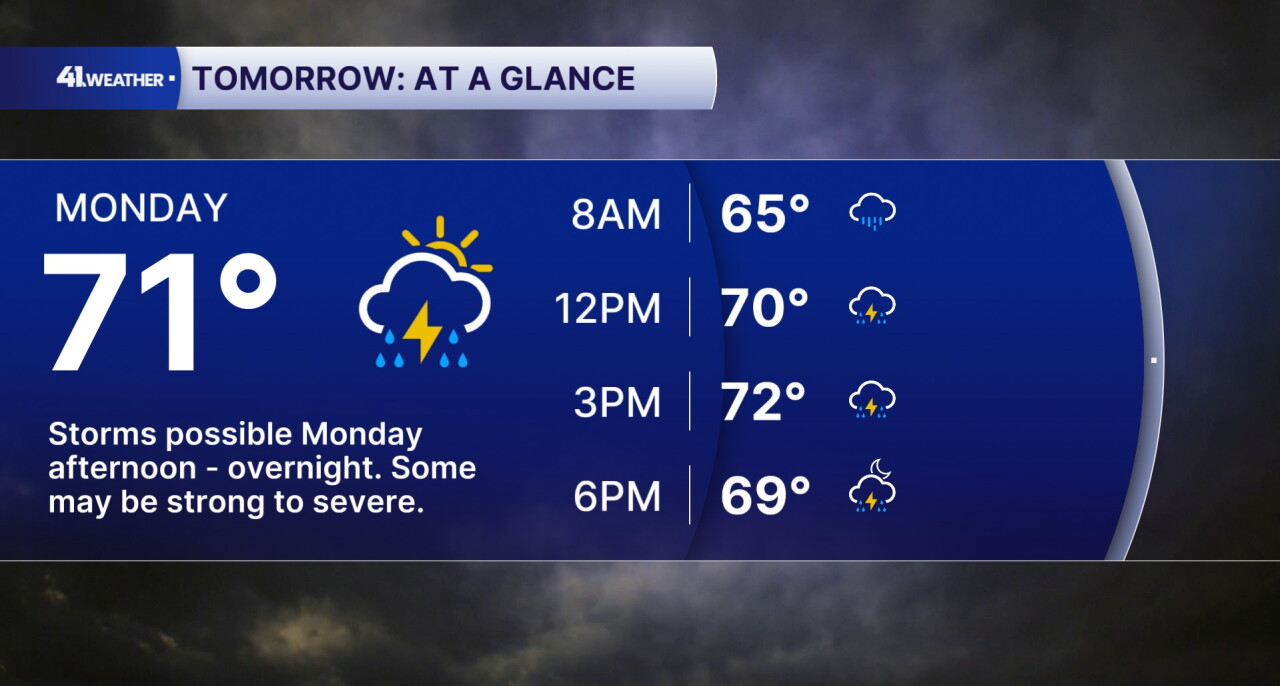
Monday is the day to pay attention to this week. It's when the next cold front arrives, bringing the potential for strong to severe thunderstorms.
We'll have a chance of thunderstorms starting in the afternoon hours. Temperatures will top out in the low 70s with mostly cloudy skies.
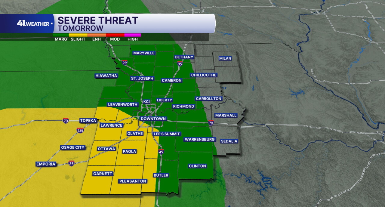
The Storm Prediction Center has issued a green 1/5 (marginal) risk and a yellow 2/5 (slight) risk of severe weather for Monday.
The number one threat will be damaging winds, though we cannot rule out the chance of a tornado or two. Large hail and flash flooding are also possible with any of the storms that develop.
Let's talk about timing.
We could see multiple rounds of thunderstorms on Monday. The first round of showers and storms may move in around midday and early afternoon.
After that, stronger storms with a higher severe weather threat may move in later in the evening and overnight hours. We cannot rule out the chance of severe weather at any point during the afternoon through the overnight hours, though.
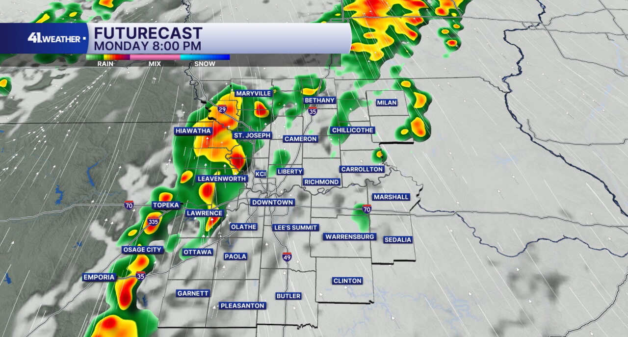
Rain chances will likely linger into Tuesday morning, with dry conditions returning Tuesday evening. I expect to stay pretty dry for the rest of the week after that.
Thanks to the cold front, the weather will be feeling very fall-like next week. You can expect to wake up to temperatures in the 40s, with highs in the upper 50s and low 60s throughout the week.
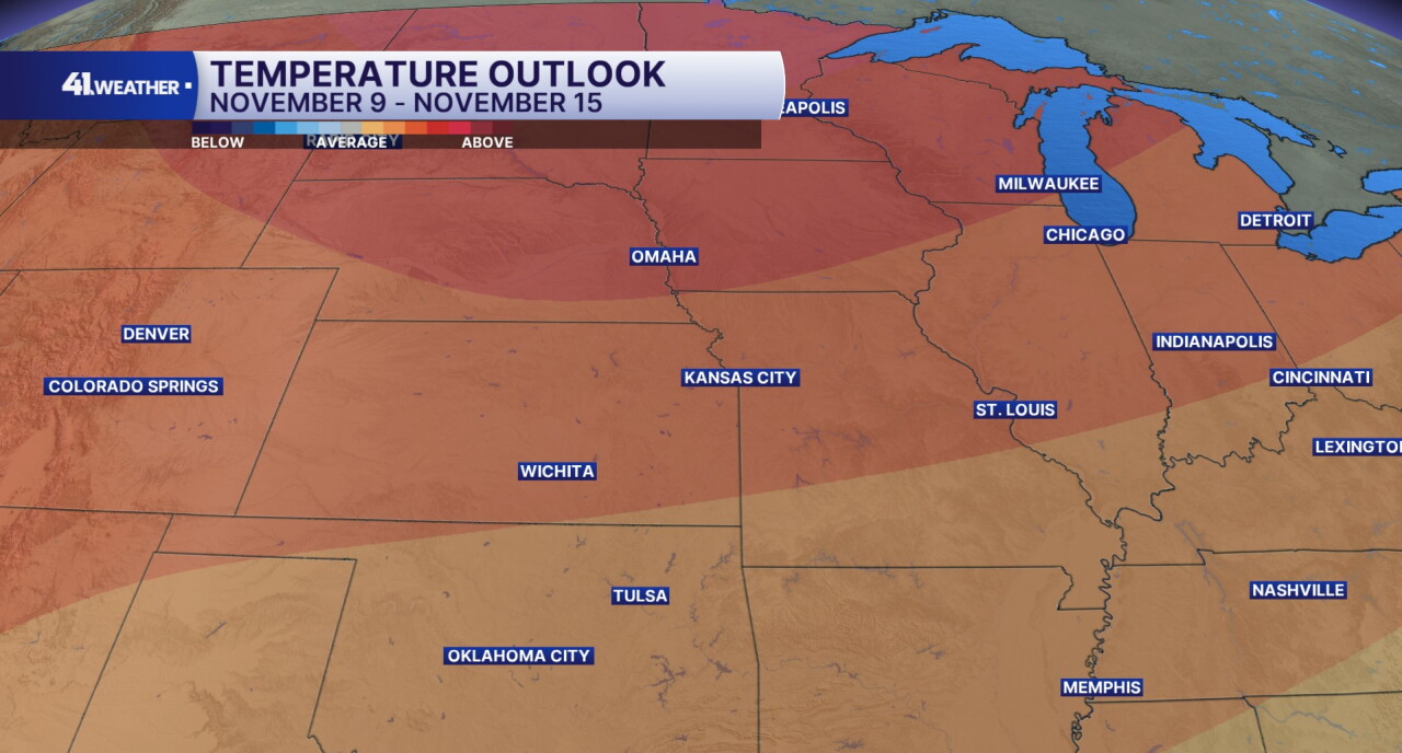
Temperatures are expected to be above-average for the week of Nov. 9-15, although that doesn't mean we are going to be hot by any means.
Highs in the mid-50s and lows in the mid-30s are considered average for that week, so anything above that would be considered warmer than normal.
Have a question about the forecast? I'd love to hear it! Reach out, and I'll answer your questions in this weather blog.
Please stay weather-aware on Monday. Enjoy the rest of your weekend!
—
