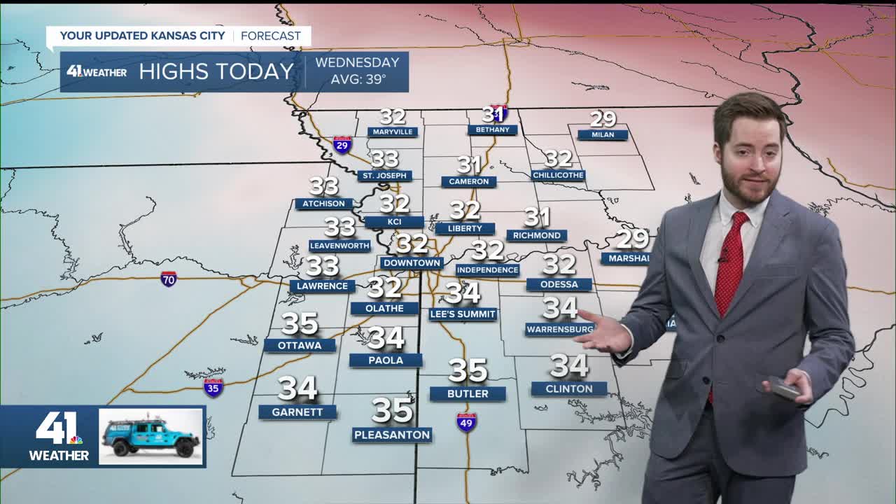


KANSAS CITY, Mo. — Good Wednesday bloggers,
We are tracking two cold fronts that will bring the Arctic air back to our area. We may see some very light snow and flurries, but a big snowstorm is looking more likely for the East Coast. Also, we are seeing a warm-up next week.
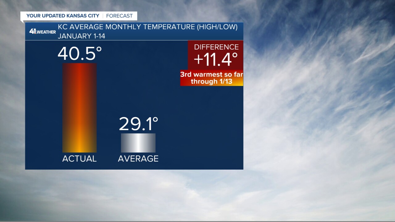
Before we get to all of that, let's take a look at the temperatures this January.
The average temperature, which includes highs and lows, was 40.5° on Jan. 14, which is 11.4° degrees above average. On the 13th, we were on pace to be the 3rd warmest January on record.
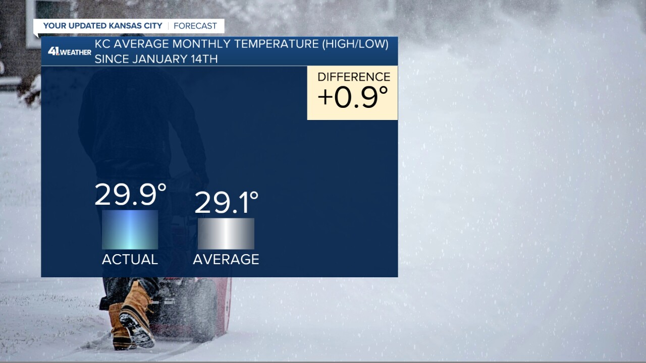
Well, since the 14th, it became a tad cold. Since the 14th, the average temperature has dropped from 40.5° to 29.9°, which is 0.9° above average. We will be below average today and way below average January 29-31. So, after being on pace to be the 3rd warmest January on record on 14th, we will finish the month with below-average temperatures.
Now to the Arctic air and potential big East Coast storm and any snow here.
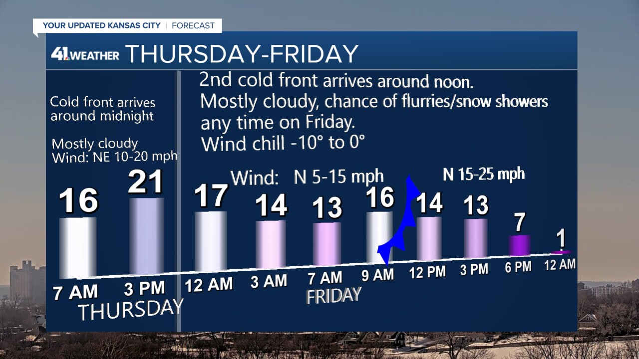
TONIGHT-THURSDAY:
The first cold front will come through around midnight tonight. So, lows by morning will be around 15° with wind chill values around 0° under a mostly cloudy sky with a few flurries possible. Highs will be around 20° as the 2nd cold front crosses Interstate 80 during the afternoon.
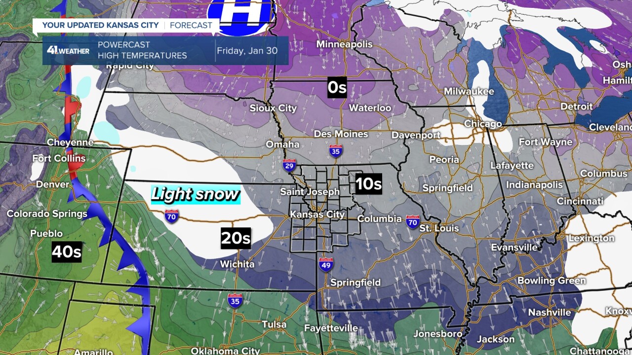
FRIDAY:
The 2nd front will surge through Friday morning, dropping lows to around 10° with highs struggling to 15° and wind chill values Friday between -15° and 0°. The actual high may be set at midnight before the 2nd front arrives.
The best chance to see accumulating snow will be across western sections of Nebraska and Kansas, where a dusting to 1" may fall. We will most likely see flurries and perhaps snow showers that won't accumulate to any more than a dusting in some locations. We will need to watch these more organized light snow areas as there is a slim chance one does affect our area.
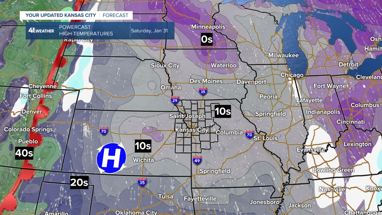
SATURDAY:
This will be the coldest day of the week, even though we will see abundant sunshine. A strong Arctic high-pressure area will be tracking south across Kansas. Lows around here will be around -5°, with highs around 15°. Fortunately, the wind won't be too strong, but wind chill values may get close to -20°.
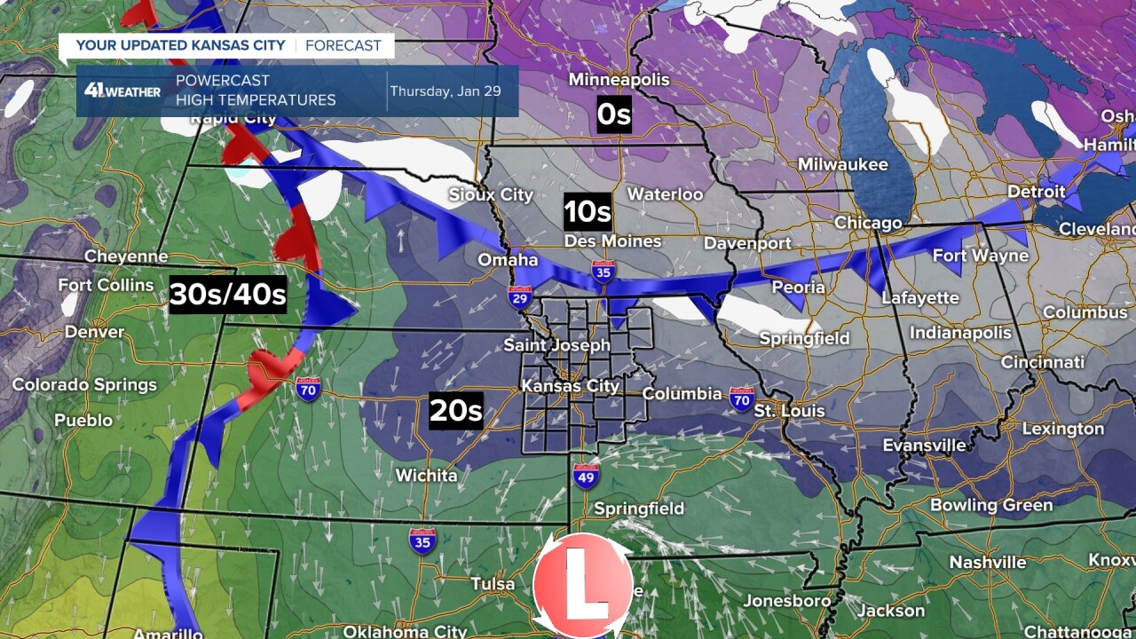
Notice the warm front across the western Plains:
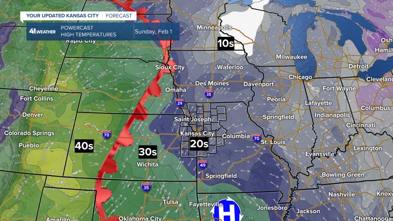
SUNDAY:
The warm front is heading this way. We will see highs in the 20s after lows in the single digits. We may see some light snow with the warm front. The model below does not have any precipitation. But, something to watch.
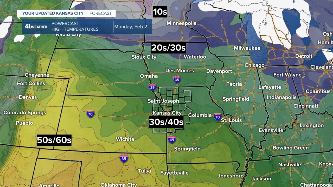
MONDAY:
Finally! Highs will reach the upper 30s to lower 40s. So, we are not talking 50s/60s like the first two weeks of January. But, 40° is 60 degrees warmer-feeling than last weekend and this Friday and Saturday. The wind chill on Monday may be around 30°, so actually it will feel 50° warmer.
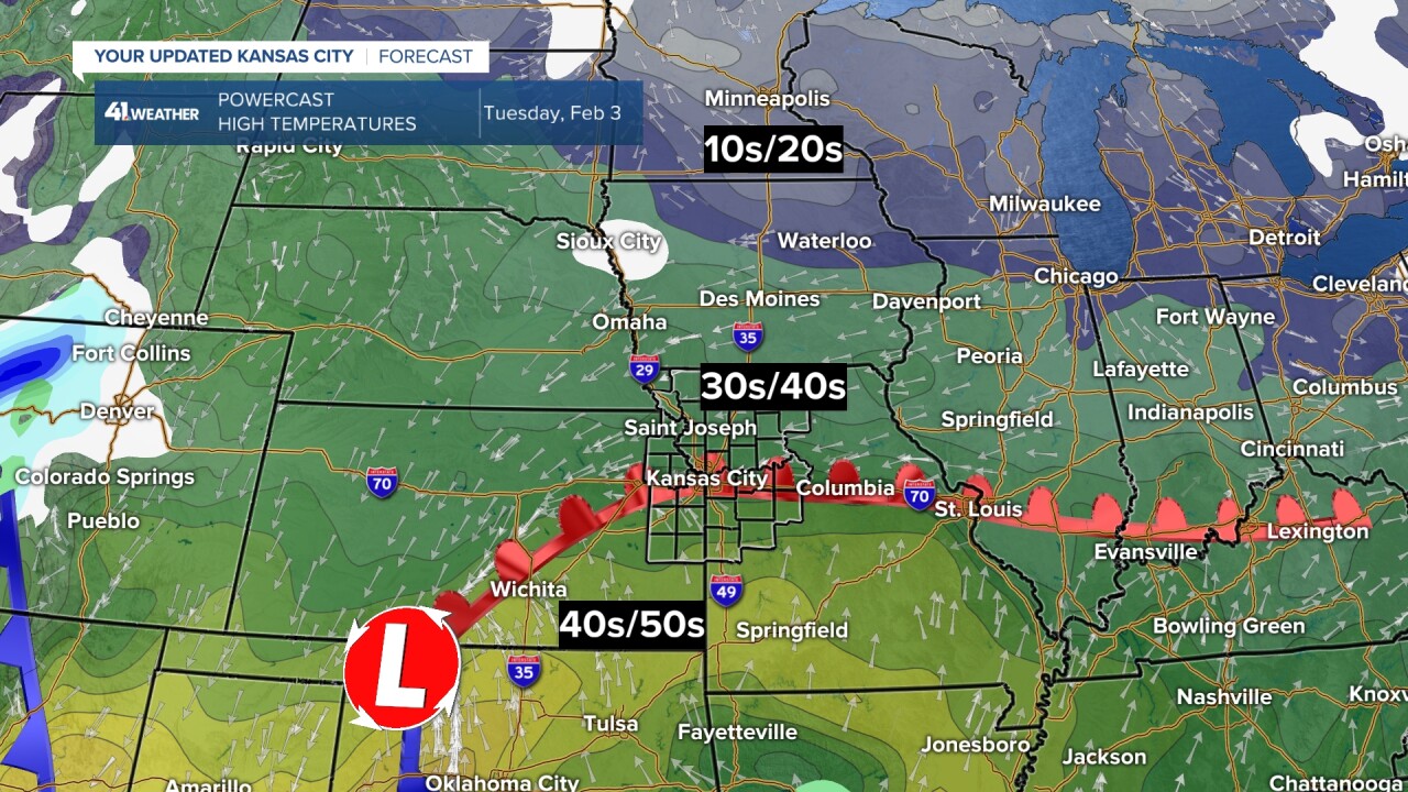
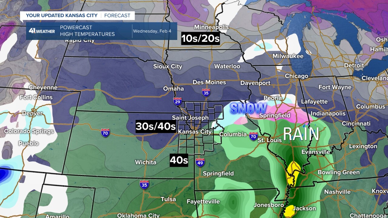
TUESDAY-WEDNESDAY:
There is some uncertainty here as we track a storm system that could bring rain and/or snow.
The American model keeps most precipitation to our east. The Euro model has the precipitation over us. It will be 3-4 days before we see which is right. It does not have Arctic air, so if we see snow it will be a wetter snow.
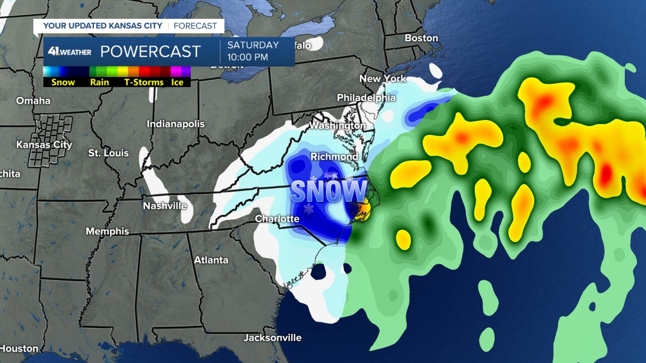
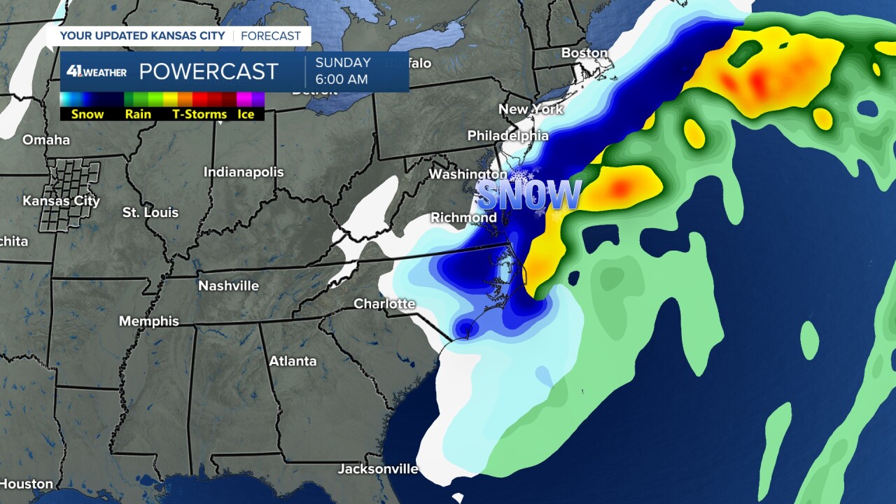
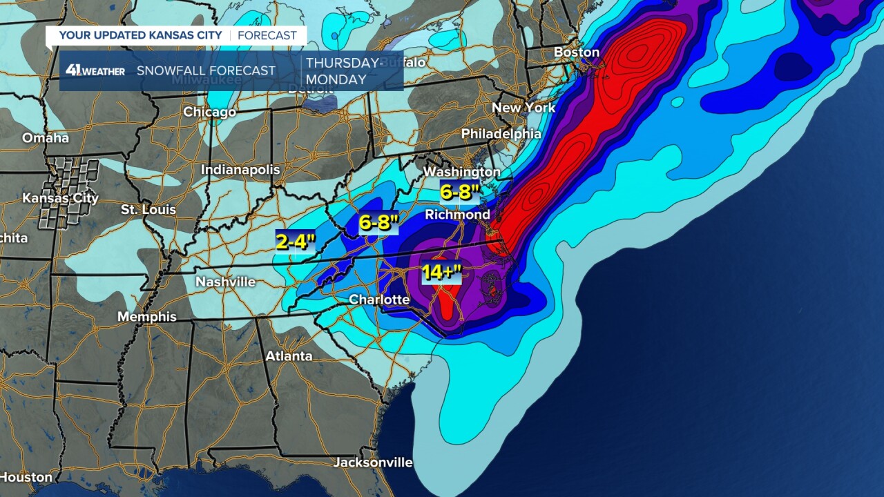
POTENTIAL BIG EAST COAST STORM FRIDAY-MONDAY:
It is looking more likely that the Carolinas and Virginia will get hit with a major snowstorm. There is still a big question to whether the heavy snow will affect NYC and Boston. If it does affect those cities, there will be more travel headaches across the USA due to the ripple effect of flights coming from the East Coast.
As is Washington D.C. and Baltimore may see some big effects from the storm.
Have a great rest of your week and weekend.
Stay warm, stay healthy
