


KANSAS CITY, Mo. — Good Wednesday bloggers,
We had quite a view of the Aurora Tuesday night. It was one of the best displays ever for two reasons. 1. You could see the colors with the naked eye. It looked mostly like a white haze with the naked eye the last times it was visible. The colors showed up with the phone camera. 2. It was vibrant enough to see in the city.
The chance to see it tonight is for sure there, but some high clouds could be an issue. It starts to become visible around 8 to 10 p.m. The iPhone takes good pics.

I was able to get the Aurora by walking out to my driveway last night.


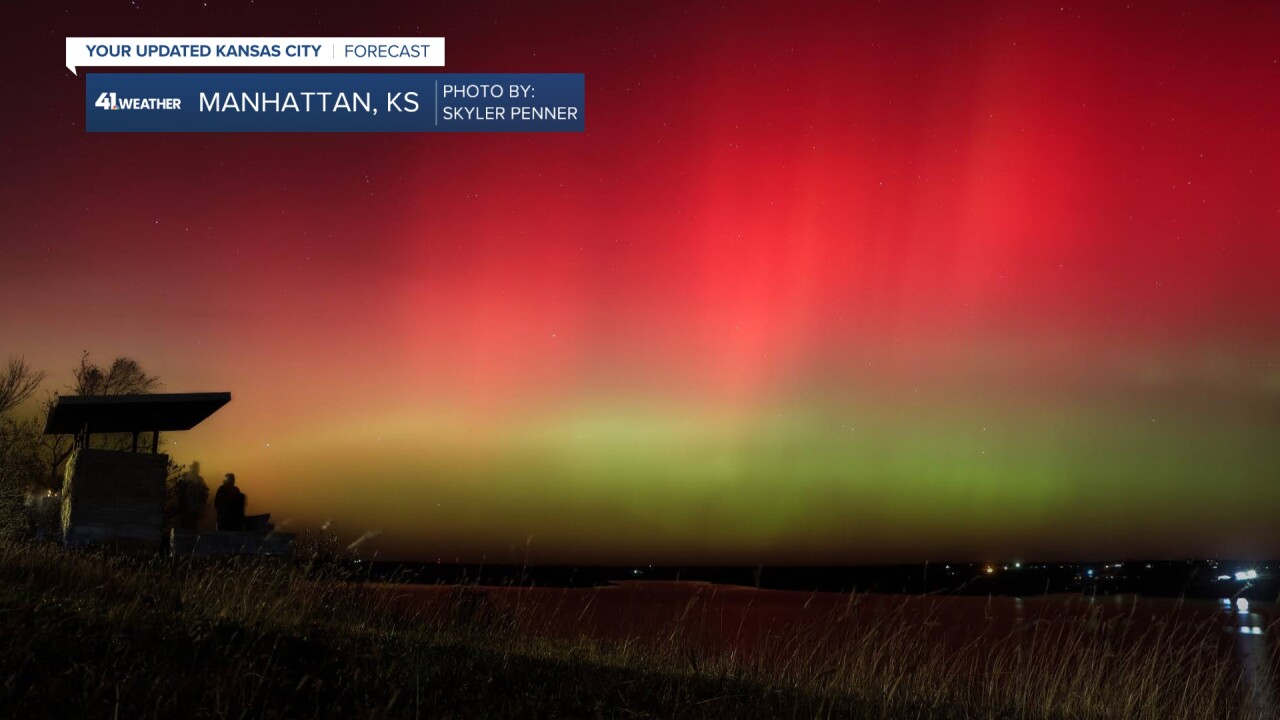
My son got some great pics out in the middle of Kansas at K-State in Manhattan, Kansas, at Observation Point.

The Aurora was even visible this morning, which is very rare for our area to see at this time of day.
This is a picture from Leesa Clement in Skidmore, Missouri, at 4:20 a.m. Wednesday.

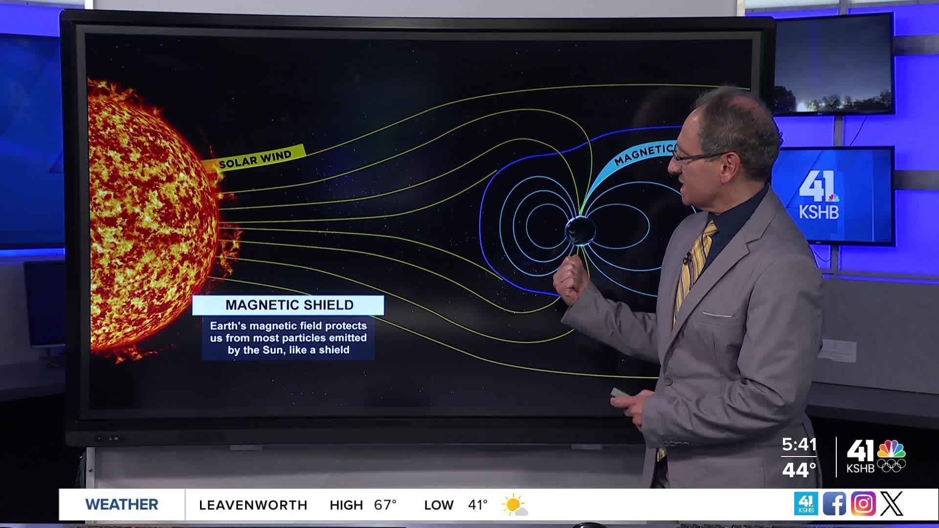
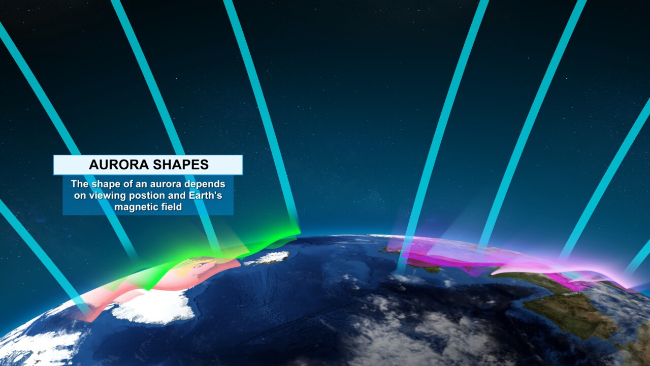
What causes the Aurora?
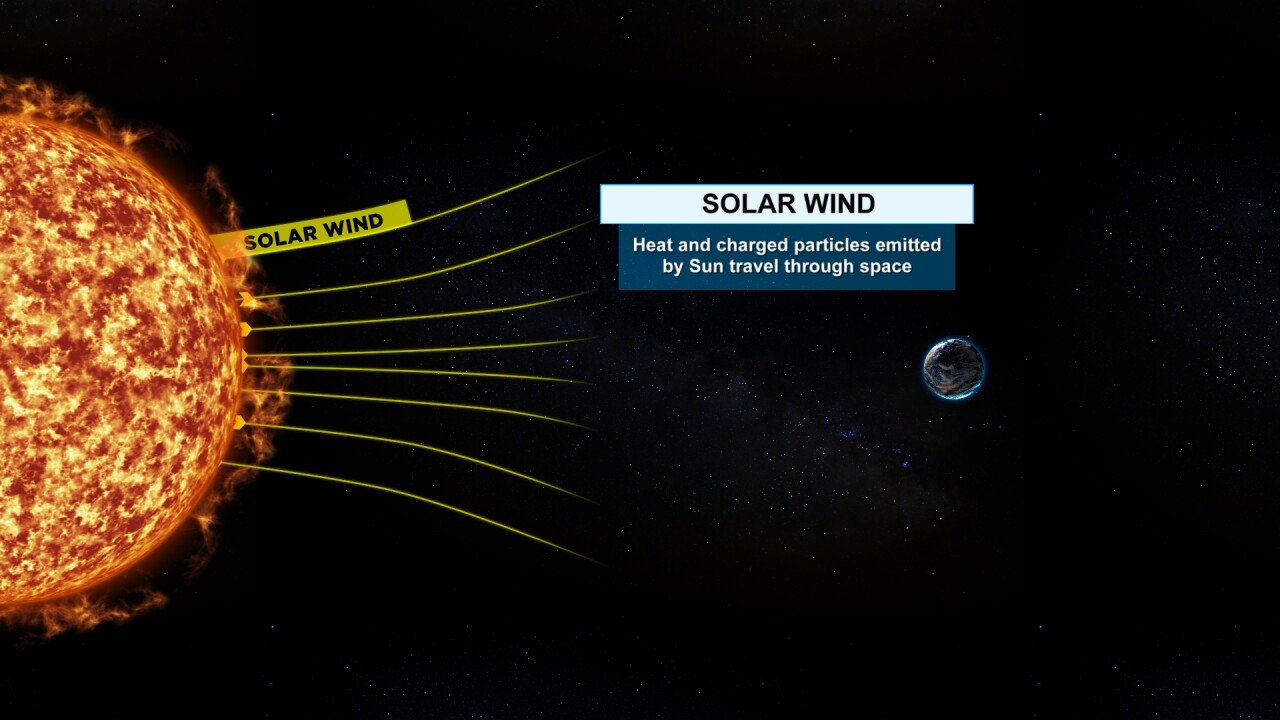
Heat and charged particles from the sun travel to Earth and interact with the Earth's magnetic field. When the sun emits a much larger amount of particles, during a solar storm, it enhances the Aurora and the stronger the storm, the more vibrant and farther south you can see the Aurora.


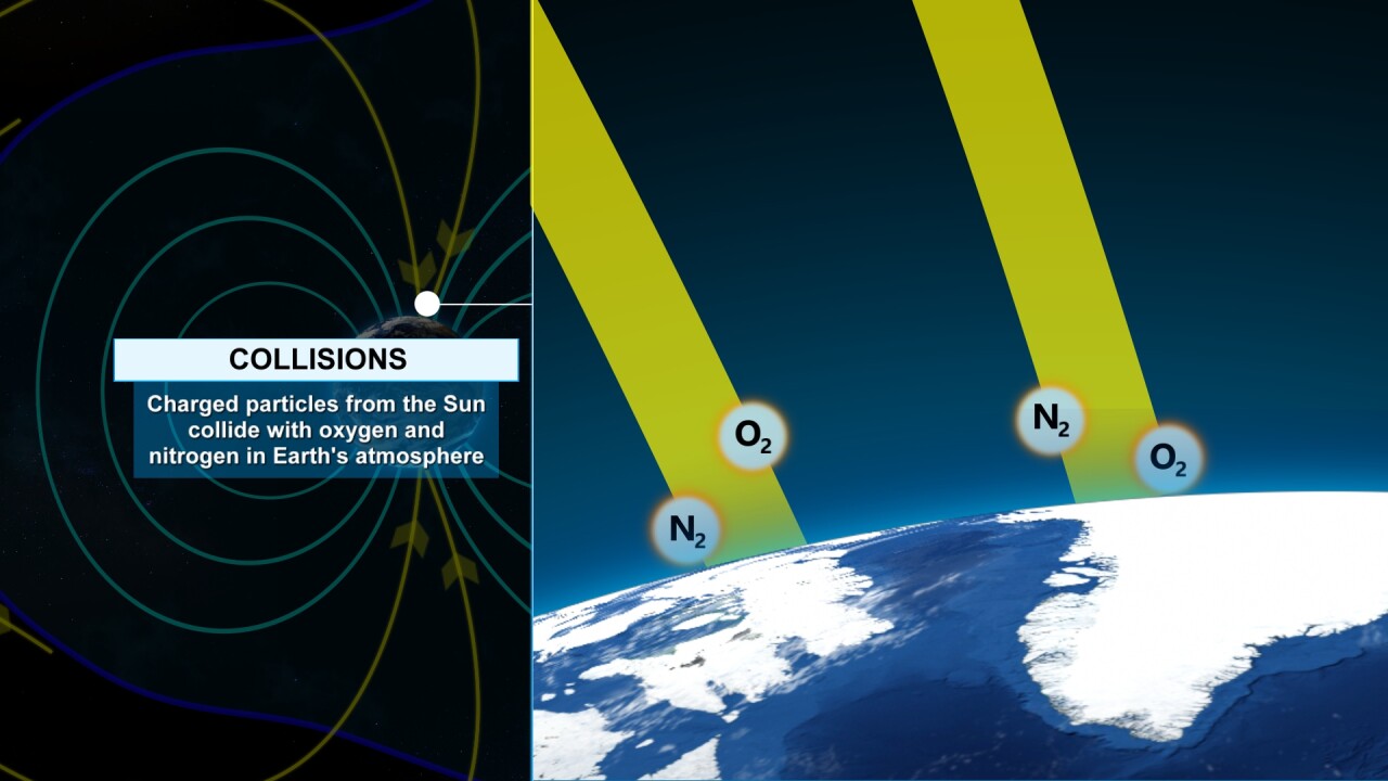
When the charged particles collide with the oxygen and nitrogen in our atmosphere, different colors are emitted. Green and red indicate oxygen, blue and purple indicate nitrogen. It looks like our Aurora was mostly oxygen.

—————————————————————————————————————————————————————————
Now to the weather, as we still need rain. Too bad the Aurora doesn't bring rain. LOL
UPPER LEVEL FLOW TODAY-SUNDAY:
We will be tracking a non-storm system, in other words "a ridge." This means we will see dry weather and unseasonably warm air. Highs will climb to the upper 60s to mid/upper 70s, which is 10 to 25 degrees above the average high, which is around 55°.
A storm system will be just off the California coast.

UPPER LEVEL FLOW NEXT WEEK:
That storm system, followed by one to two more, will track into the southwest USA and then east-northeast into the Plains/Midwest. This will open the door to rain chances.

TODAY-SUNDAY:
This will be a good time to put up the holiday decorations and also do the leaves. The wind is not looking like a big issue.

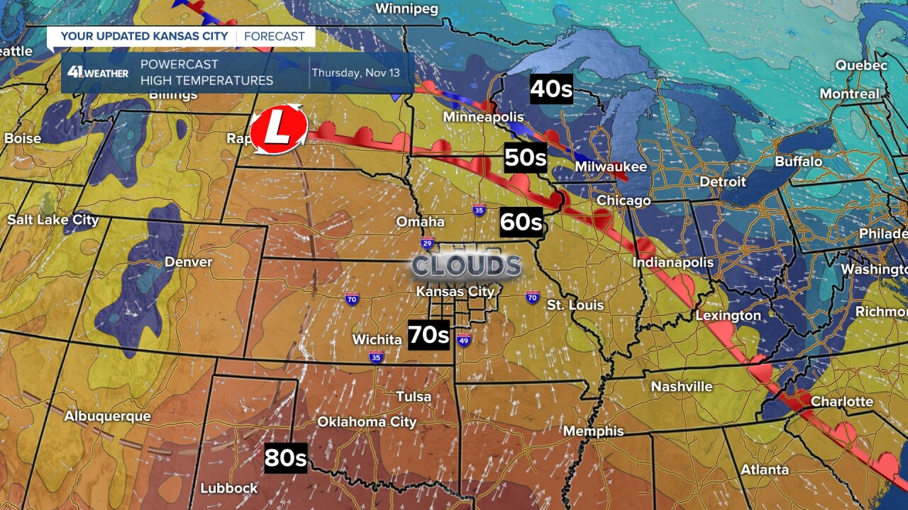

Saturday would be the day we could reach 80°, but a cold front may slip through around noon. If this happens, it will still be a nice day with highs in the mid-70s. If the front moves through around 3 to 4 p.m.,, then we will reach 80°.

Sunday will be a nice day as well, but cooler in the 60s as the front stalls to the south. The first system we are tracking now looks like it will be west of Denver Sunday, which is good news for the Chiefs game. This is not totally set yet, but the trend is good.

NEXT WEEK:
A small system may bring us some rain showers next Monday-Tuesday, along with some snow across Nebraska and Iowa. This is trending towards being not much of a system, and it is the same one we are watching for Denver, Sunday.
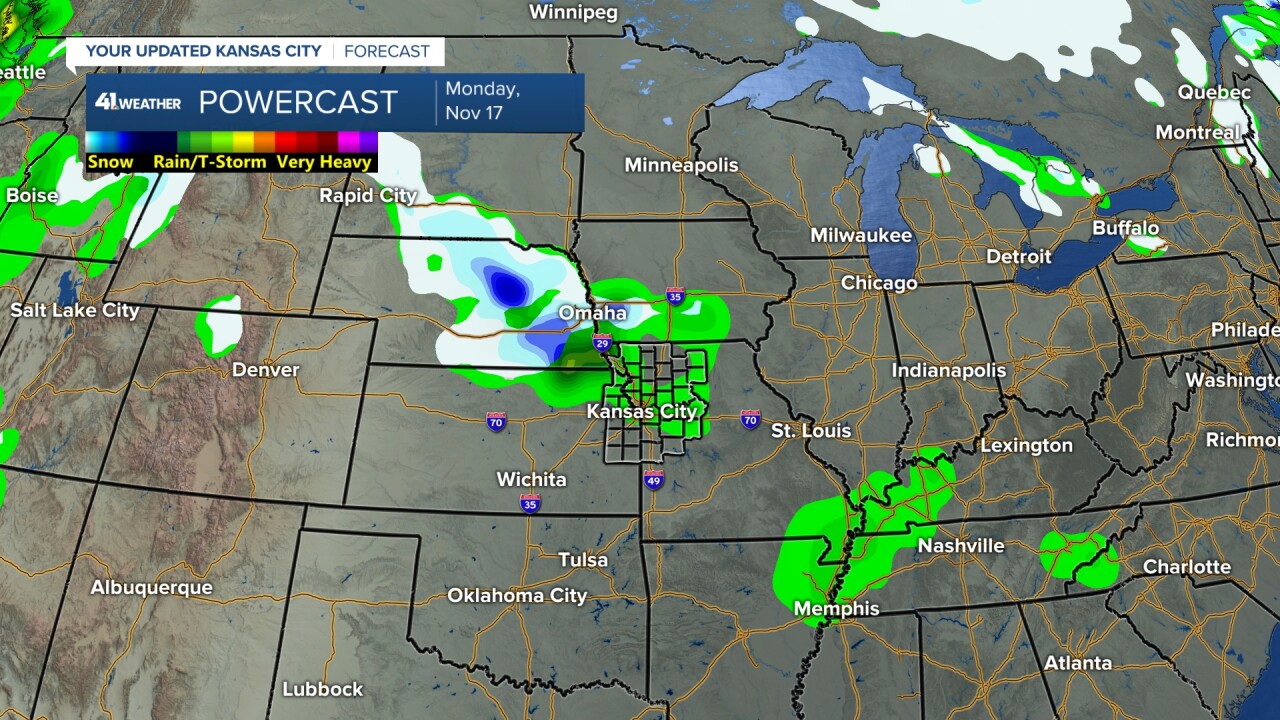
The end of next week is now looking like the best chance to see rain as we track a bigger storm system.
These rain chances are far from set, let's hope it trends wetter as we go through the week.

Have a great week
Stay healthy
