


KANSAS CITY, Mo. — Good Thursday bloggers,
We had scattered showers overnight and 0.06" fell at Kansas City International Airport, ending our 20-day dry spell. The main storm is on the way. We will go through the main storm and then look at Thanksgiving week.
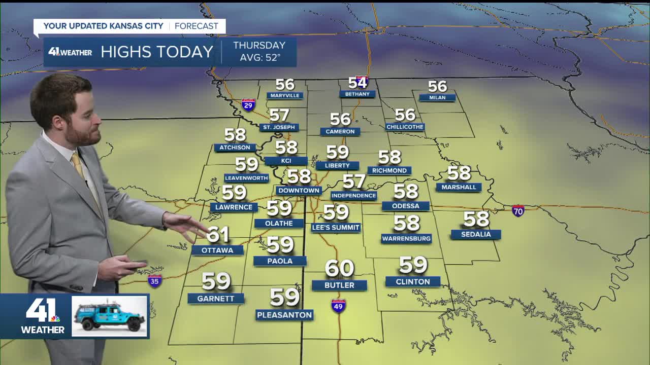
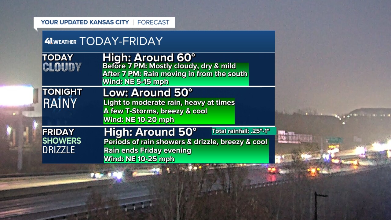
TODAY:
The main storm was centered south of Phoenix at 5:30 a.m. Hail covered the ground in Phoenix Wednesday from a thunderstorm caused by the storm system. The 0.06" in Kansas City came from a disturbance ahead of the main storm that was producing heavy rain in southern Missouri at 5:30 a.m. Thursday.
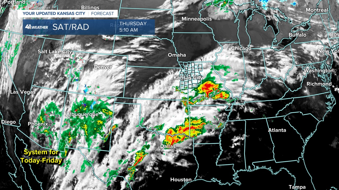
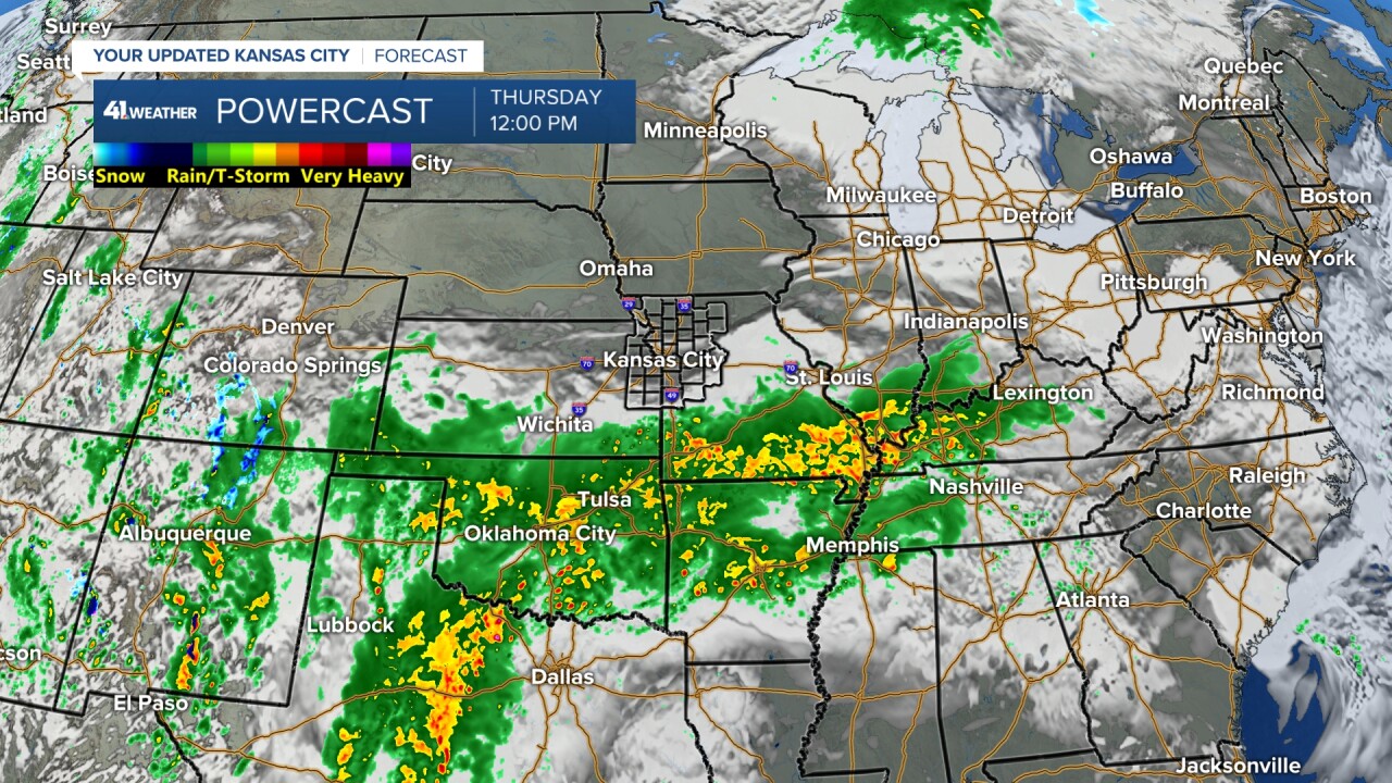
It will be mostly cloudy, dry and mild through 7 p.m. as the rain and a few thunderstorms increase and get closer from the south. Highs will be around 60°. There will be areas of dense fog this morning.
TONIGHT:
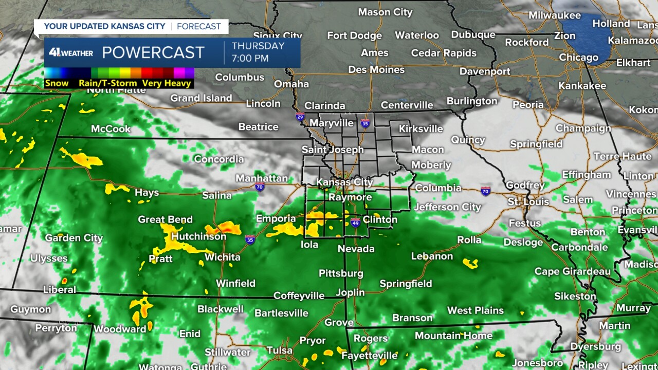
We will see rain, heavy at times, perhaps a thunderstorm affect all locations! Lows will be around 50°.
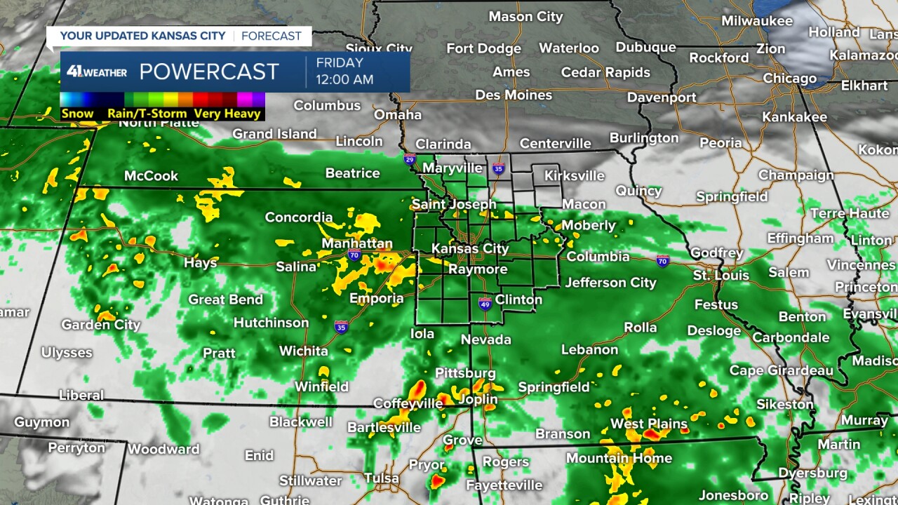
FRIDAY:
The main system will track east along Interstate 70 to near Kansas City by Friday afternoon as it weakens. So, we will see periods of lighter rain and drizzle. Highs will be around 50° with a northeast breeze at 10-20 mph.
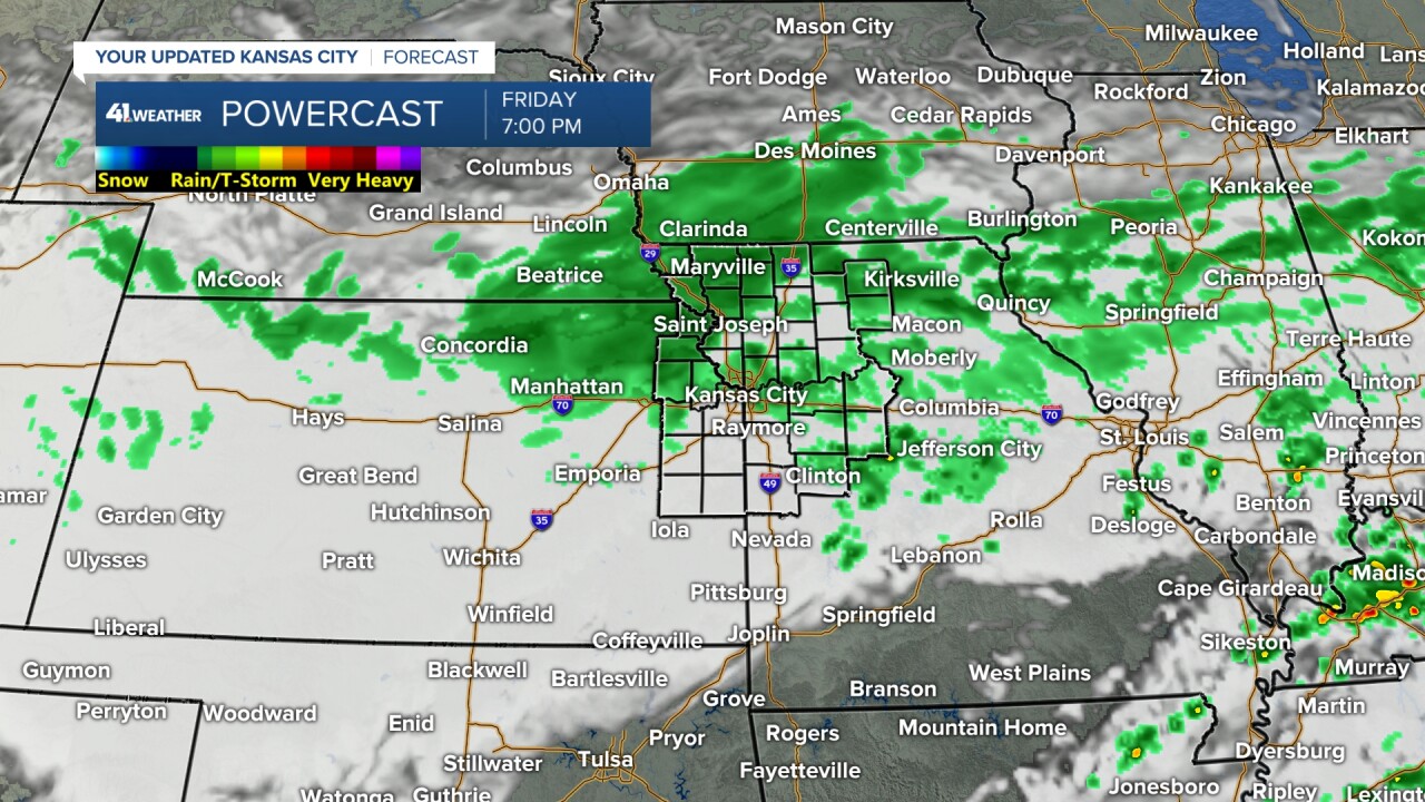
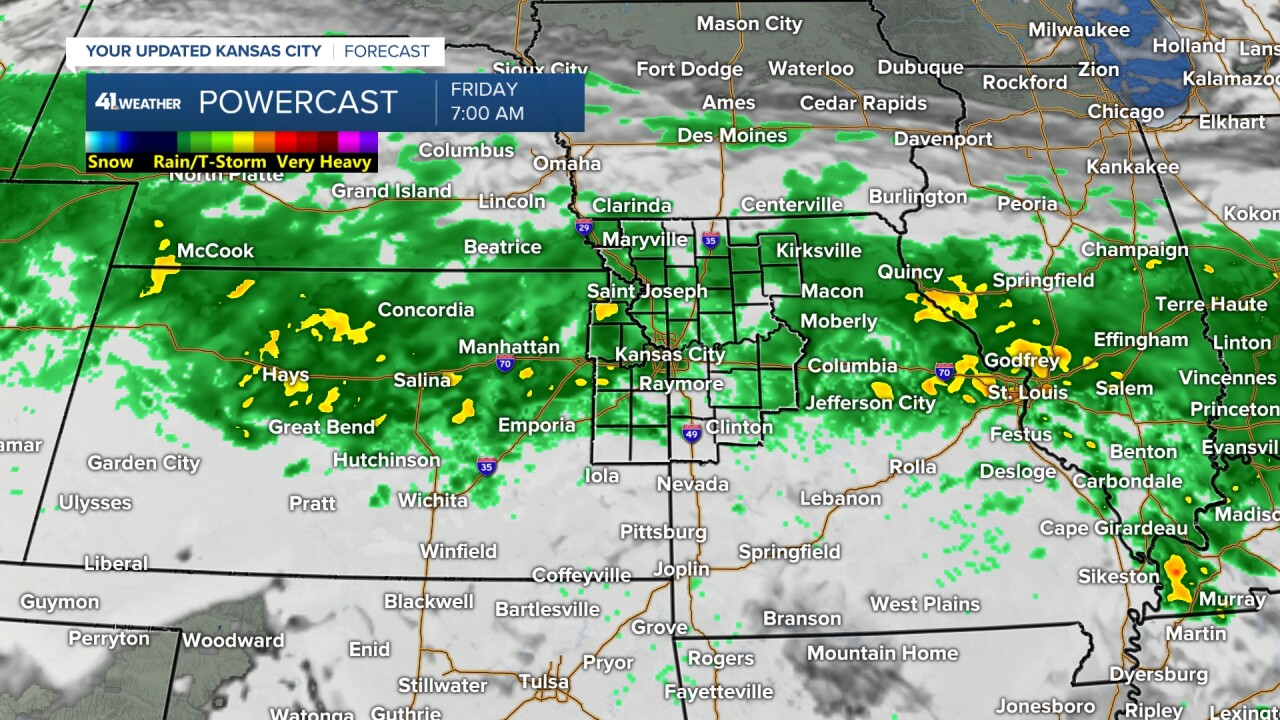
FRIDAY NIGHT-SATURDAY:
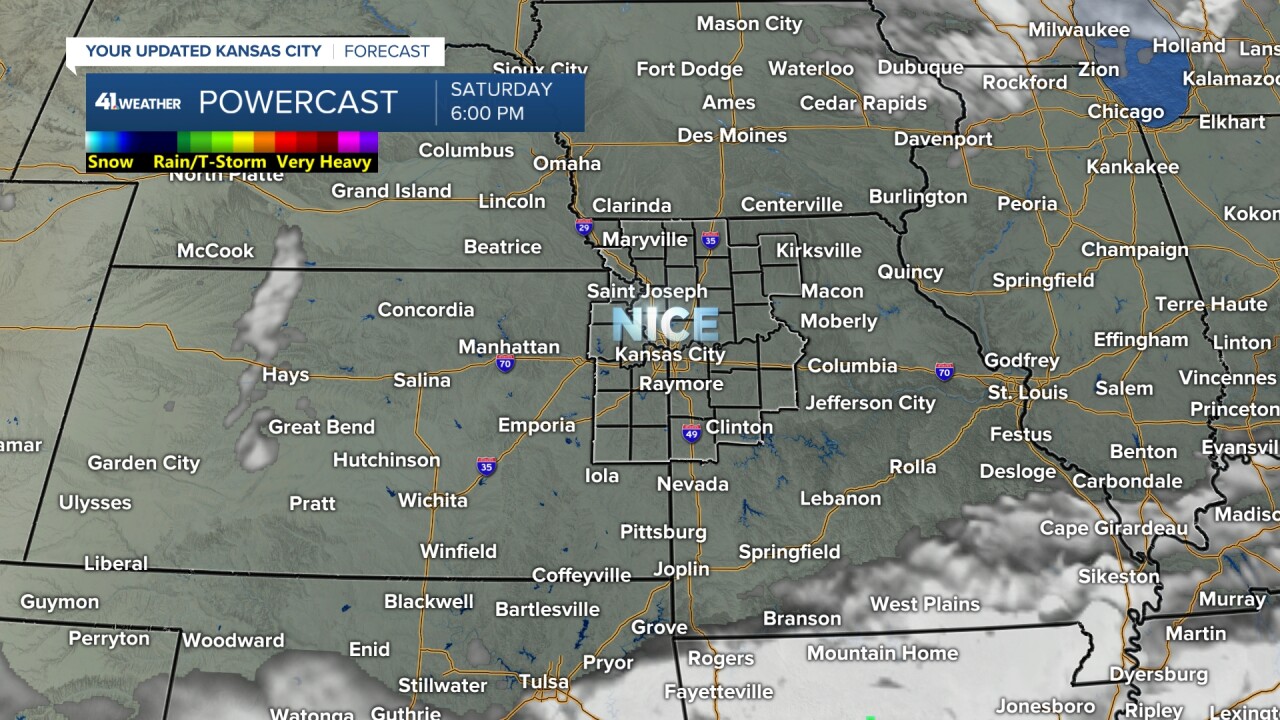
The rain will exit Friday evening followed by some low clouds and fog into Saturday morning. Then, the sun returns Saturday afternoon, making for a nice day with highs in the 50s.
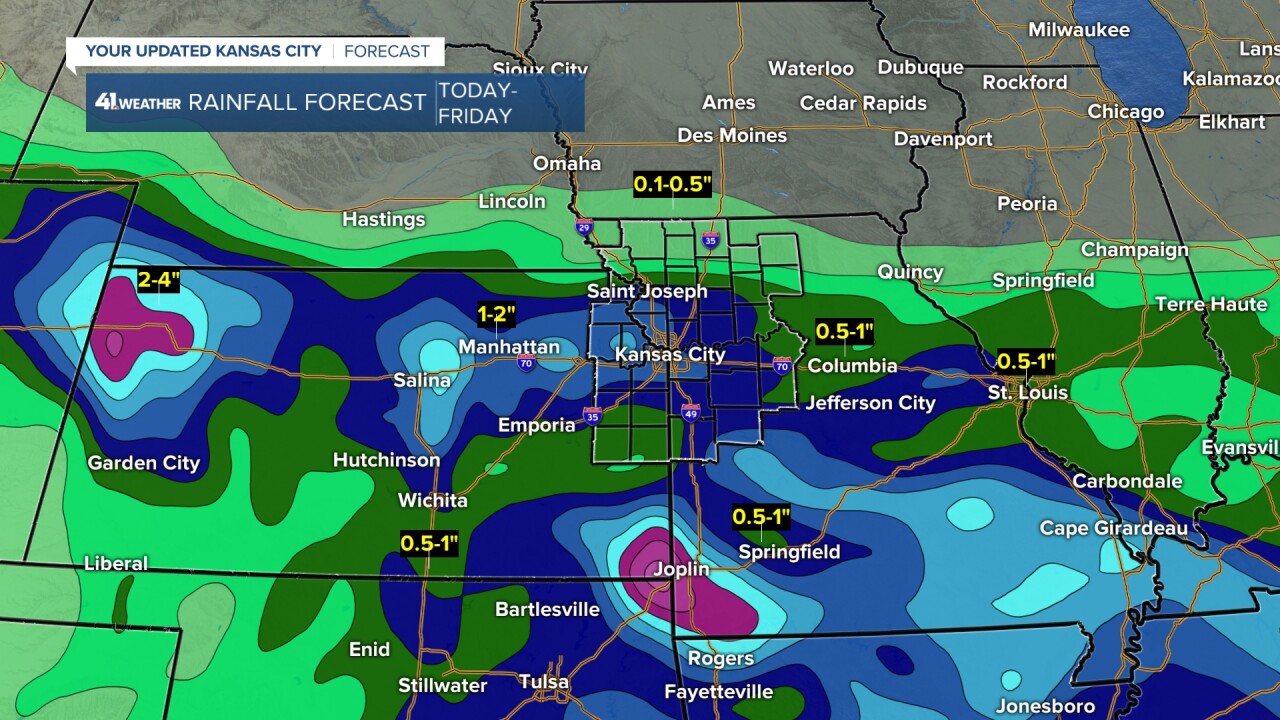
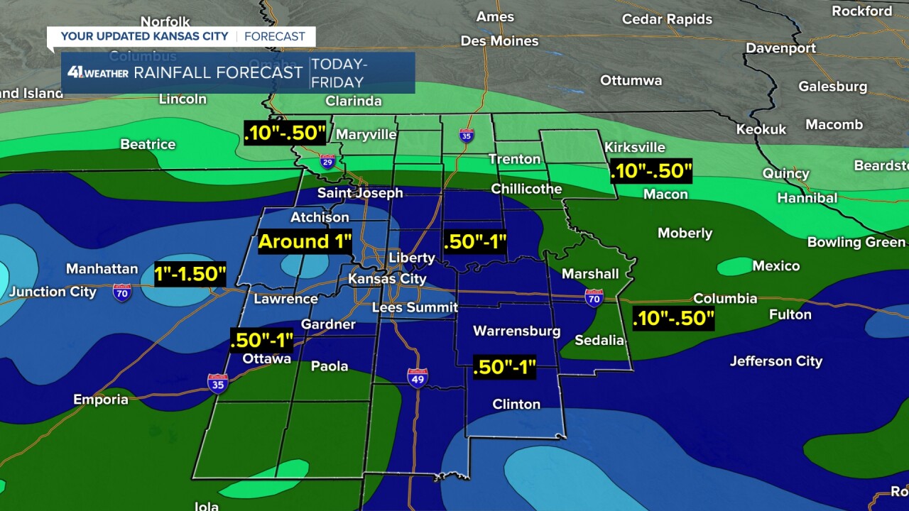
RAINFALL FORECAST TODAY-FRIDAY:
There is not much change from yesterday as most locations will see .10"-.50" with areas of .50"-1" and pockets of 1"-1.50". The northern edge is still around the Missouri-Iowa/Kansas-Nebraska borders. And, the heaviest rain locations are still not set yet as it will depend where the embedded heavier showers and thunderstorms track.
WEATHER SUMMARY FOR TODAY-FRIDAY:
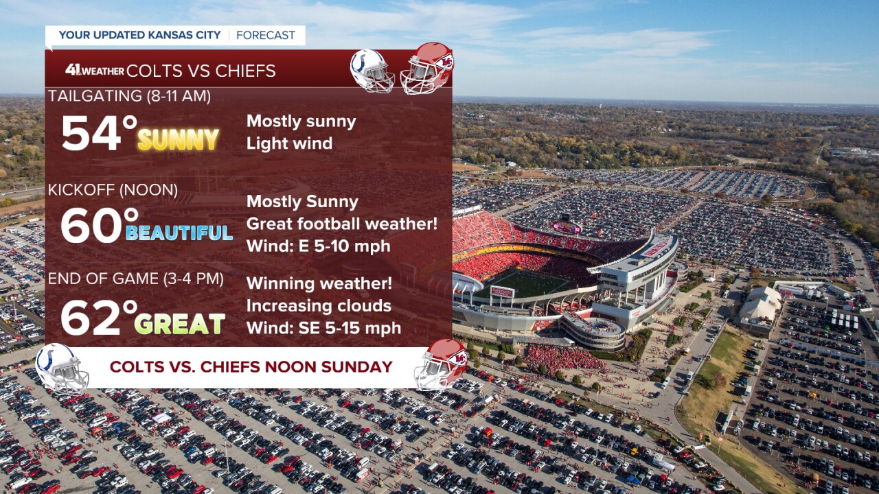
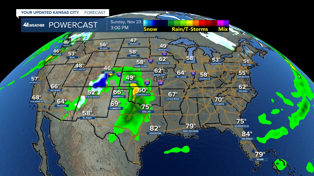
CHIEFS SUNDAY:
The weather looks great. Now, the Chiefs need to be great if they want this season to go past the regular season.
Now. let's take a look at Thanksgiving week.
MONDAY-TUESDAY:
A rain system will track east across the country. It is not a huge storm.
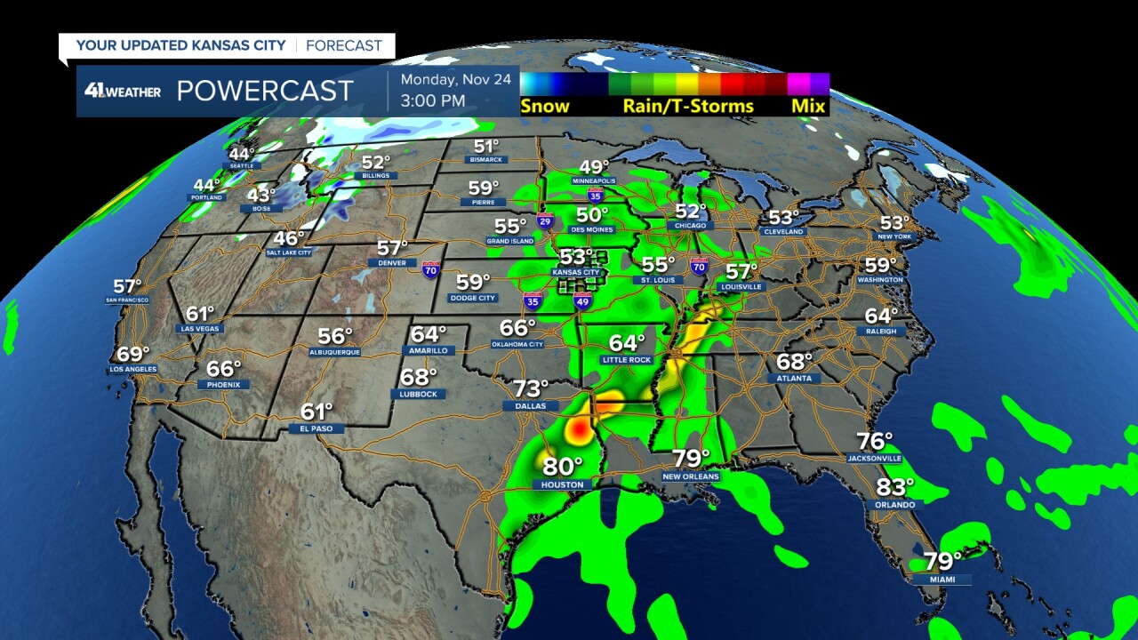
But, a second system may bring accumulating snow to the northern Plains Tuesday. That could be more of an issue.
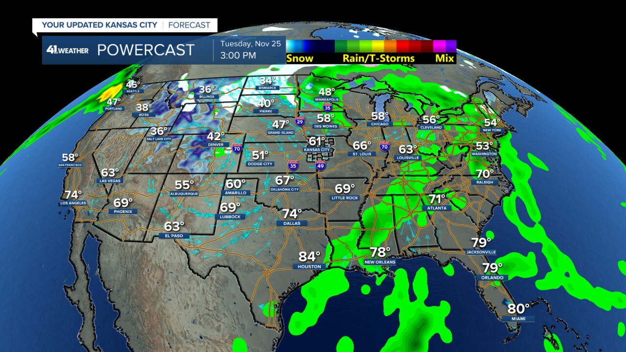
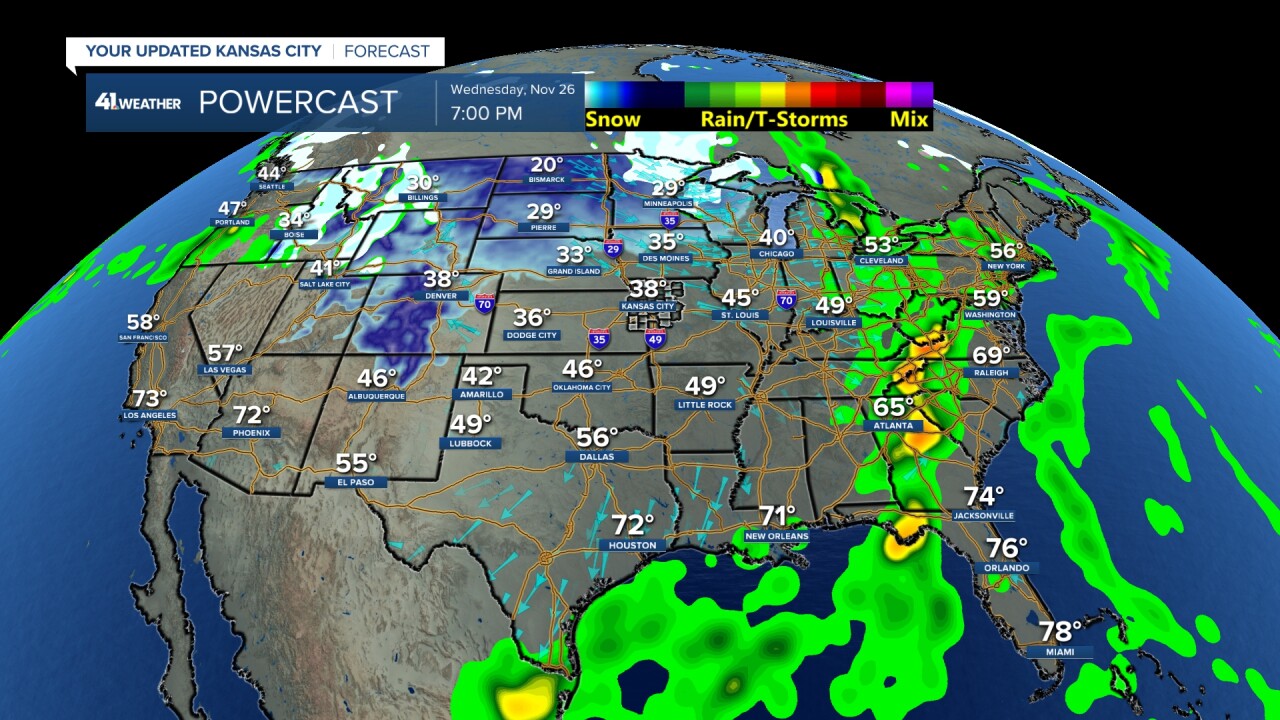
WEDNESDAY:
The biggest travel day of the year we will see a band of showers and thunderstorms from Texas to the Tennessee Valley to the Great Lakes. The snow system is moving into Minnesota. The coldest airmass of the season is moving south across the Plains.
So, at this time we do not see any big storm across the USA to create major travel issues.
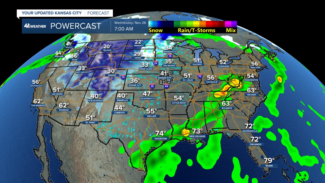
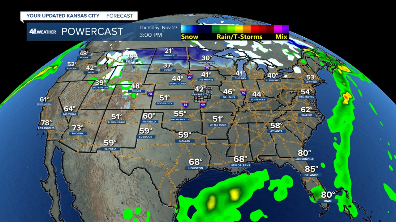
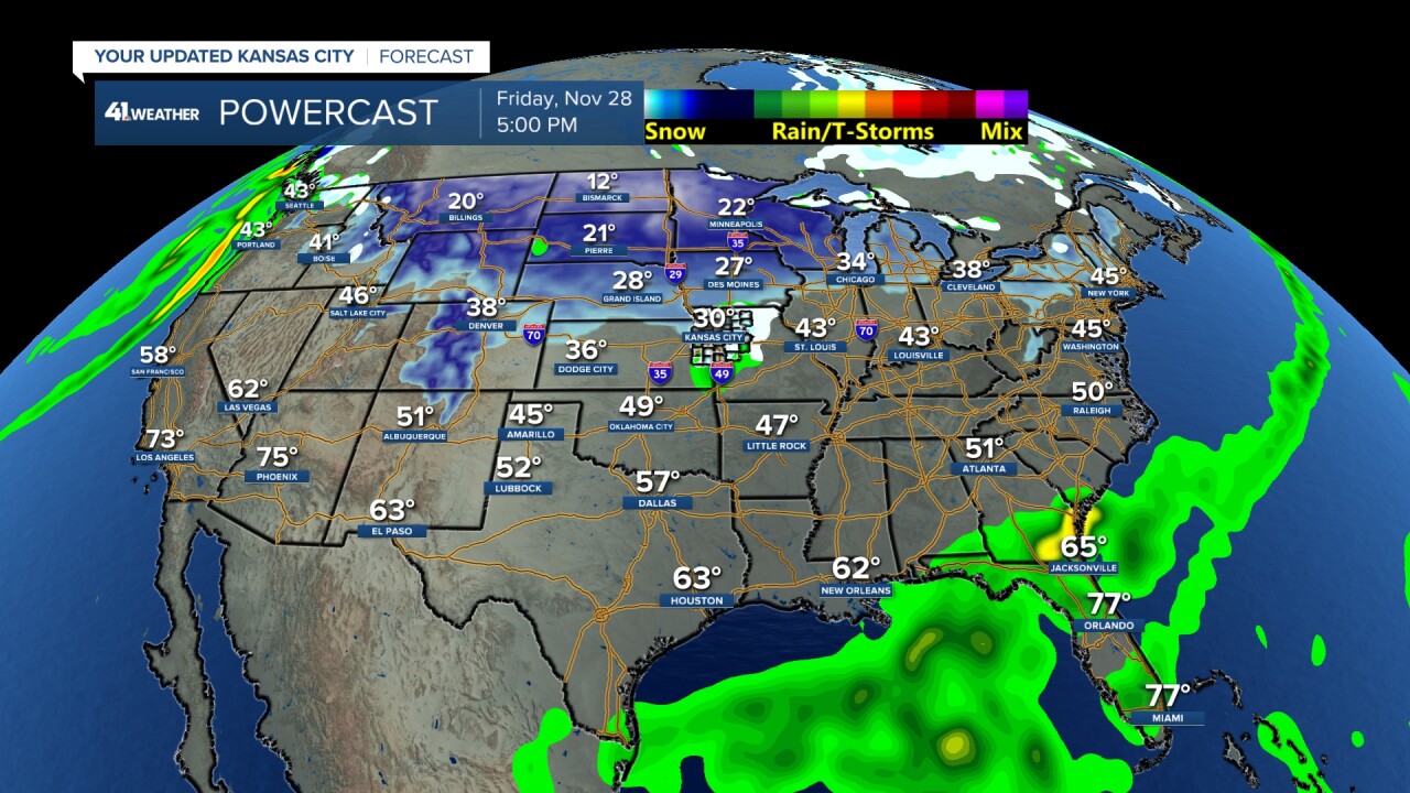
THANKSGIVING DAY-FRIDAY:
It looks mostly dry and chilly across most of the USA.
Two things to notice. One, Arctic air has crept into the northern USA and there is a small area of rain/snow in our area. Some data does not have that, but if it happens, it should not be a big deal.
SATURDAY-SUNDAY OF THANKSGIVING:
I am not showing any maps as there is much uncertainty on this forecast. Some data has a big storm and some data does not have much. We will see what it looks like tomorrow.
Have a great rest of your week and weekend
Stay healthy
