


KANSAS CITY, Mo. — Good Saturday bloggers,
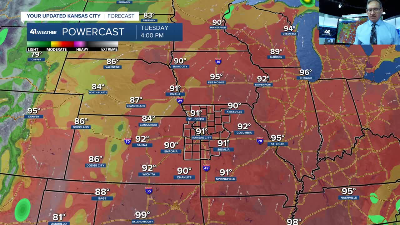
We are seeing the end of the rain chances and the start of dry and hot weather. The last day of rain chances for awhile is today as a few showers and thunderstorms will be around.
As of 8:30 a.m., most of the activity was southeast of KC. There has been some mist/drizzle around as well.

The water in the ground will be evaporating quickly the next seven days. Also, the plants, trees, etc. will be seeing considerable evapotranspiration.
Evapotranspiration is the combined process of water moving from the land surface into the atmosphere. It consists of two parts: evaporation (water turning into vapor from soil, open water, and plant surfaces) and transpiration (water absorbed by plant roots, traveling up the stem, and evaporating through tiny leaf pores).
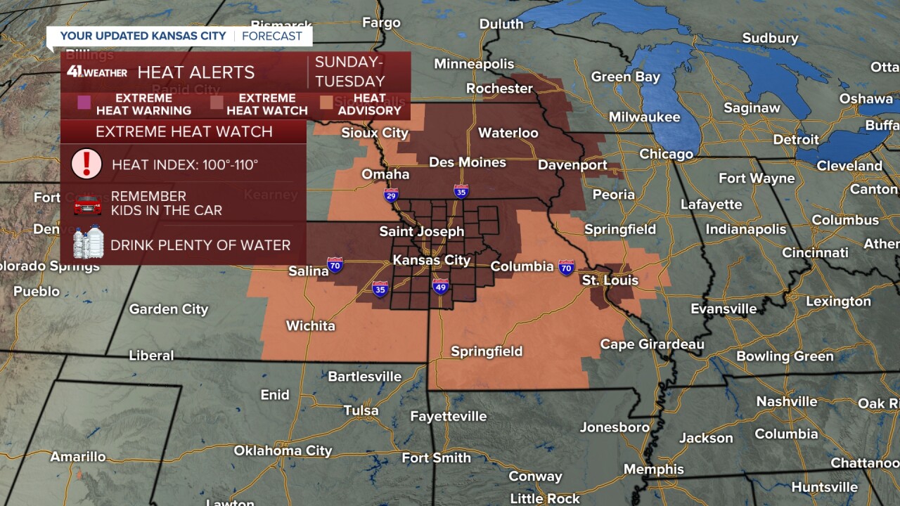
These processes will be increasing the humidity quite a bit with temperatures in the low 90s. This will take heat index values to around 105° which is why an Extreme Heat Watch begins Sunday.
Details on the heat and when the next chance of a cold front arriving is in the six and a half minute video below.
Have a great weekend. Stay healthy!
—
