


KANSAS CITY, Mo. — Good Monday, bloggers,
We have not seen measurable rain since Oct. 29, which has driven our dry spell to 18 days. Our rainfall deficit since July has grown to 8.25".
Well, we have two storm systems to track this week. How much rain?

The storm system that brought several inches of rain to southern California moves through today. It is currently moving through Utah and weakening.
The system for the end of the week is already in California. They are close together, but the second system will slow down as the first one moves along.
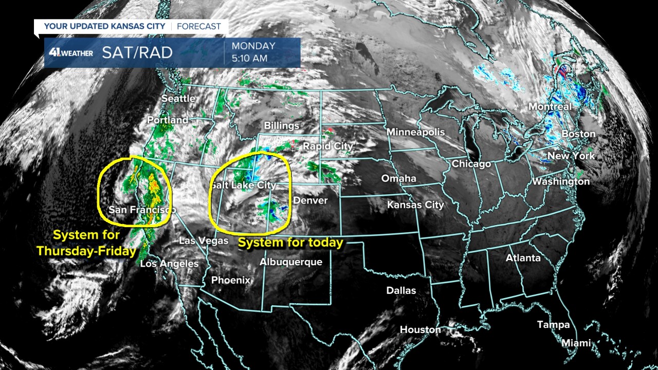
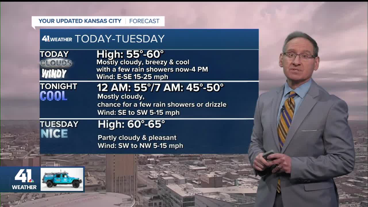
SYSTEM #1 (TODAY-TONIGHT):
A warm front will be set up to our southwest, so we will see highs around 60° while highs climb to around 70° from Garnett to Emporia.

TODAY AROUND NOON:
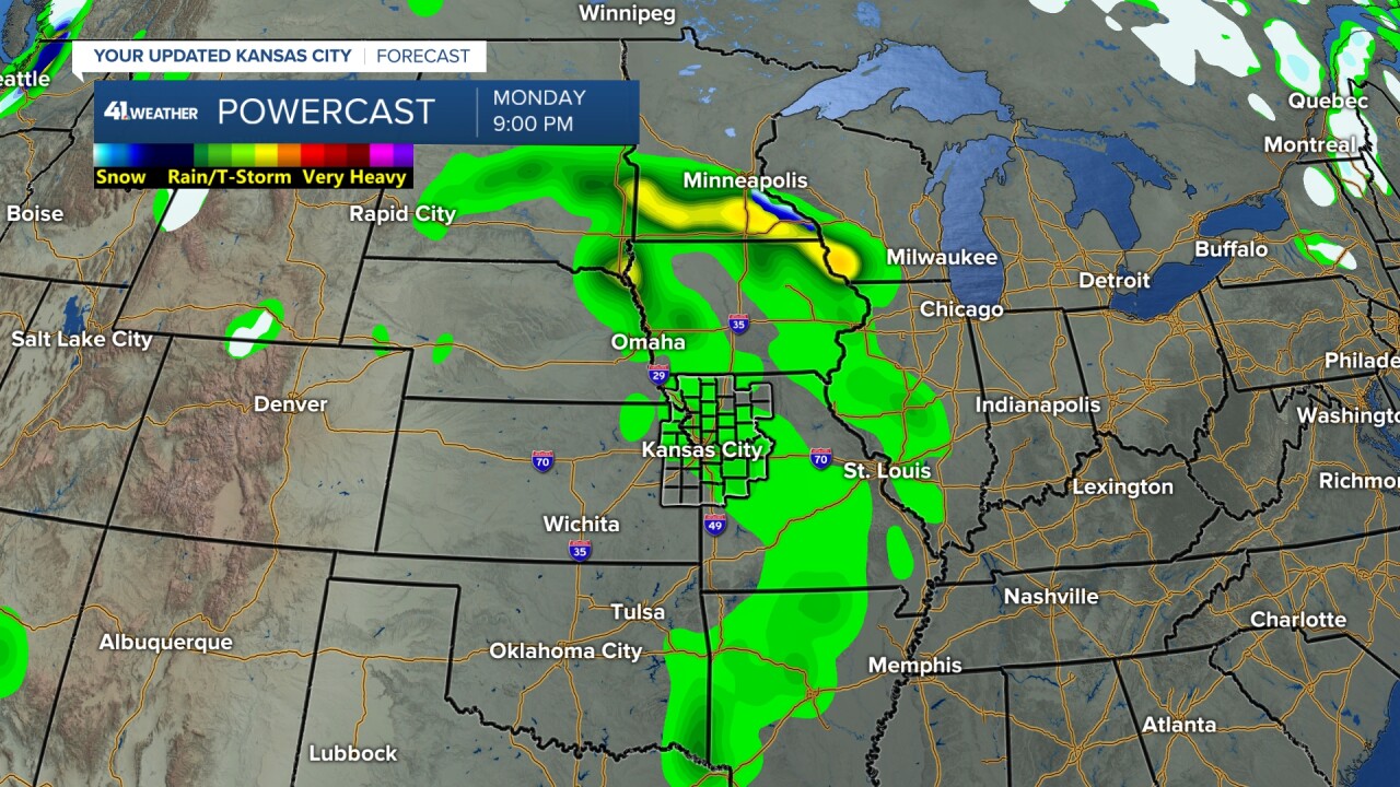
This warm front will help to generate a few rain showers/sprinkles as it approaches and the main system tracks along Interstate 80.

TONIGHT:
The system gathers some Gulf moisture, and we could see a few more showers and perhaps some drizzle as lows drop to the upper 40s. Temperatures around midnight will still be in the mid-50s.
Keep in mind, the average low is in the low 30s.
TUESDAY:
System No. 1 will exit, making for a nice day under a partly cloudy sky with highs around 60°.
Wednesday will also be a nice day with increasing clouds and highs again around 60°.

SYSTEM #2 (THURSDAY-FRIDAY):
The second system will begin to produce rain across the southern Plains Thursday morning. This rain will start to lift north and arrive along the Interstate 70 corridor Thursday night.
Thursday looks mostly dry until evening, with highs in the low to mid-60s.

The hope is that by Thursday night, we will get into a decent band of rain. There is still a question on how far north the rain band gets and how heavy it will be when/if it arrives.

FRIDAY:
The system will turn east and exit. Right now, Friday looks cloudy and cool with decreasing rain. Highs will be in the 50s.
The weekend will see the nice weather return with highs in the 50s to low 60s.

RAINFALL FORECAST TODAY-FRIDAY:
99% of this rain occurs Thursday-Friday, as the system for today is not much.
Right now, it looks like we could see 0.50"-1". But you can see amounts under 0.50" are north of Highway 36.
This system can still shift south by 50-100 miles and/or not be as big a rain producer. Also, remember we average 2" of rain in November, so it is hard to see a lot of rain this time of year.
This makes it difficult to erase an 8.25" rainfall deficit November-February.

There is a chance of a bigger system for Thanksgiving week. We will have more on that later this week.
Have a great week ahead.
Stay healthy.
—
