


Good Saturday bloggers,
We are in an active weather pattern through Monday as we track several chances of rain and thunderstorms. The last two weeks of May and the first two weeks of June are on average the wettest times of year with May being the peak severe weather month for our area.
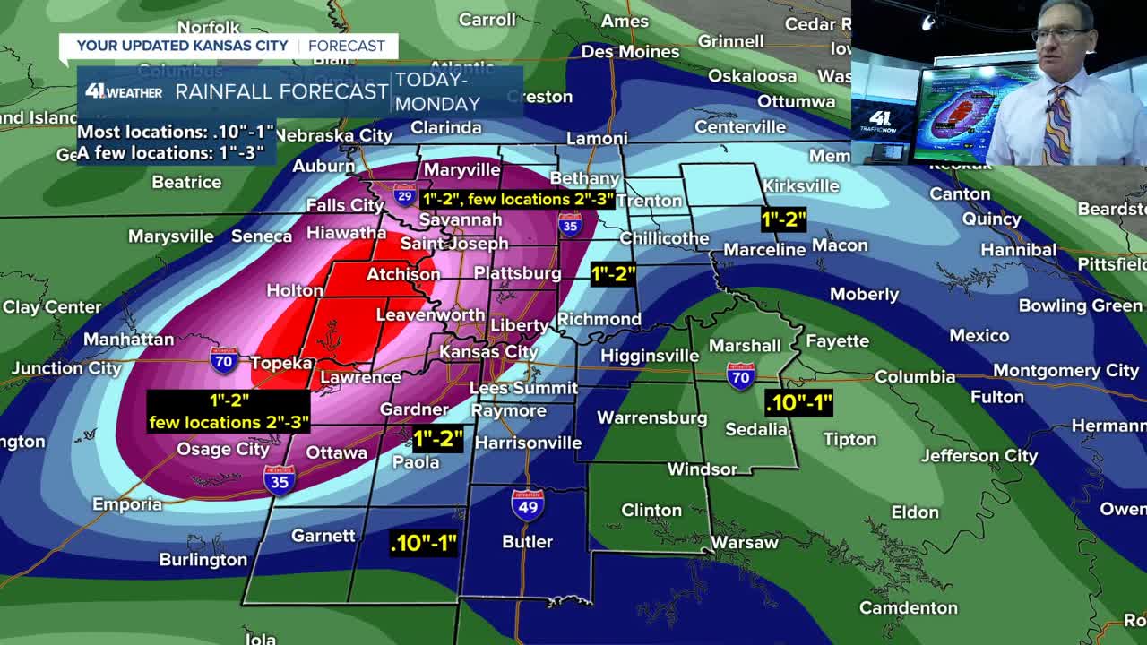
Well, the next two to three days will live up to the wettest time of year, but not necessarily the peak of severe weather season.
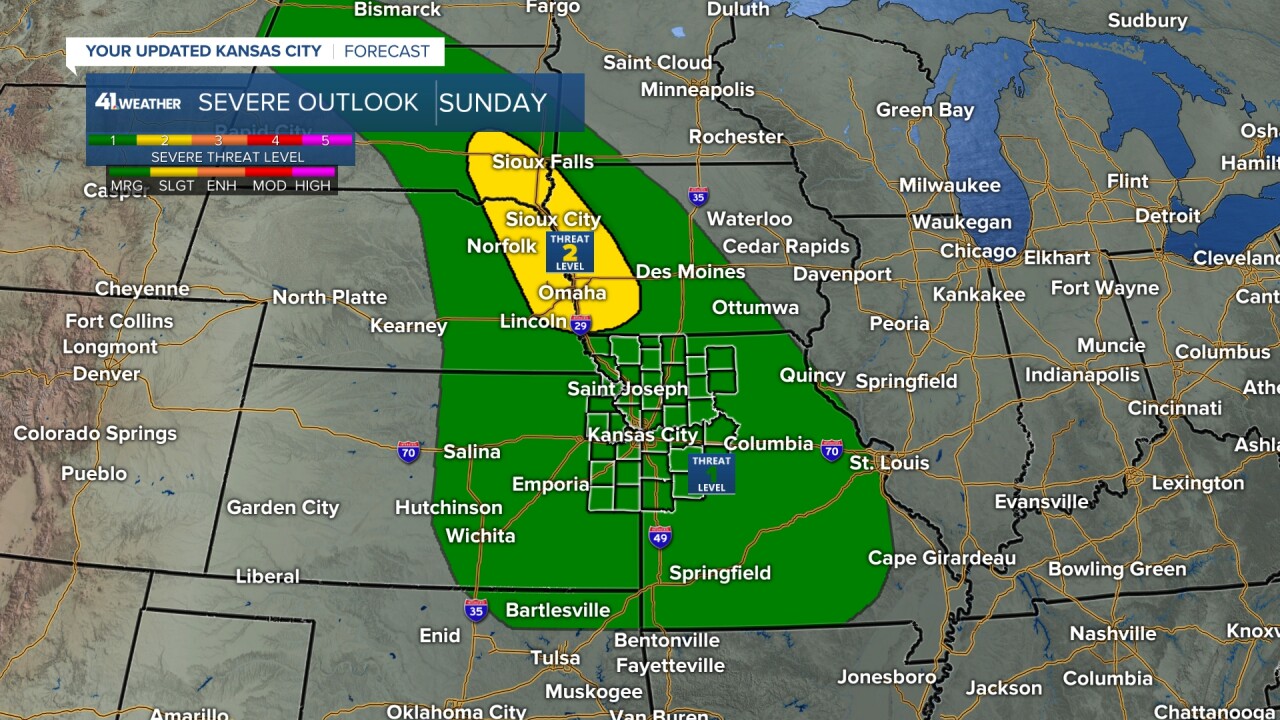
We are in a level 1 of 5 severe threat for later today, tonight and Sunday. The higher severe threats are west and northwest of our area and these are level 2 of 5. The thunderstorms tonight and possibly Sunday night may contain 30 to 50 mph winds and some hail. It takes 58 mph wind or greater and quarter sized hail or larger to be severe. A few thunderstorms may reach severe limits.
But, the greatest threat from the thunderstorms is something that kills more people per year than tornadoes and lightning, that is flash flooding — remember "Turn Around Don't Drown." Six inches of flowing water can float an SUV.

Details on the thunderstorms are in the 7 minute video below.
Have a great weekend, stay healthy.
—
