


Good Monday, bloggers,
We are in an unusual August weather pattern as an unseasonably cold air mass has settled into the eastern half of the U.S.
Temperatures are running 10-30 degrees below average. Our average low is around 65° with an average high around 85°.
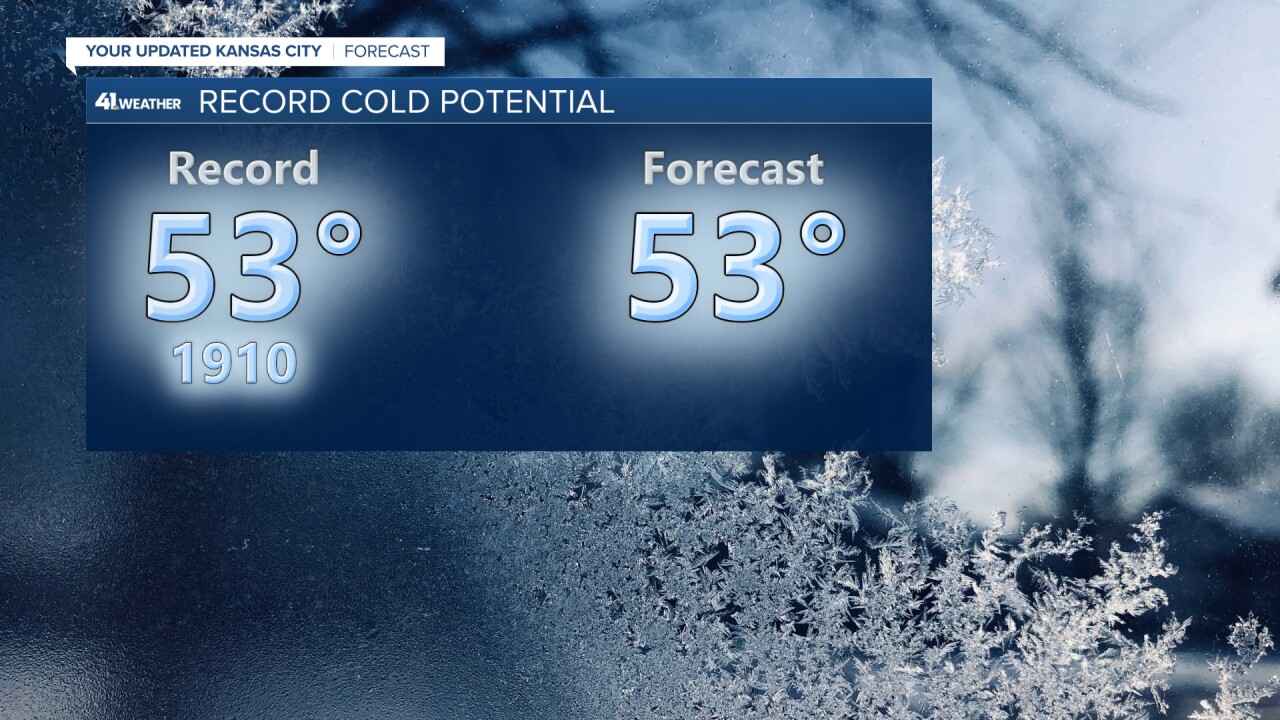
Lows tonight will be 10-15 degrees below average, which may lead to a record low. The record low for Tuesday is 53°, which was set in 1910, and we are going for a low of 53°.
The weather pattern is one where we have unseasonably cool air over much of the Plains and Midwest, with the summer heat across the southern Plains. There is a zone of thunderstorms between the two air masses.
This is going to be the pattern for much of this week. There is a chance the zone of t-storms shifts northeast a few hundred miles by the end of the week before this pattern breaks down.
The amount of miles it shifts northeast will determine if we see rain in Kansas City this week.

Let's go through the week.
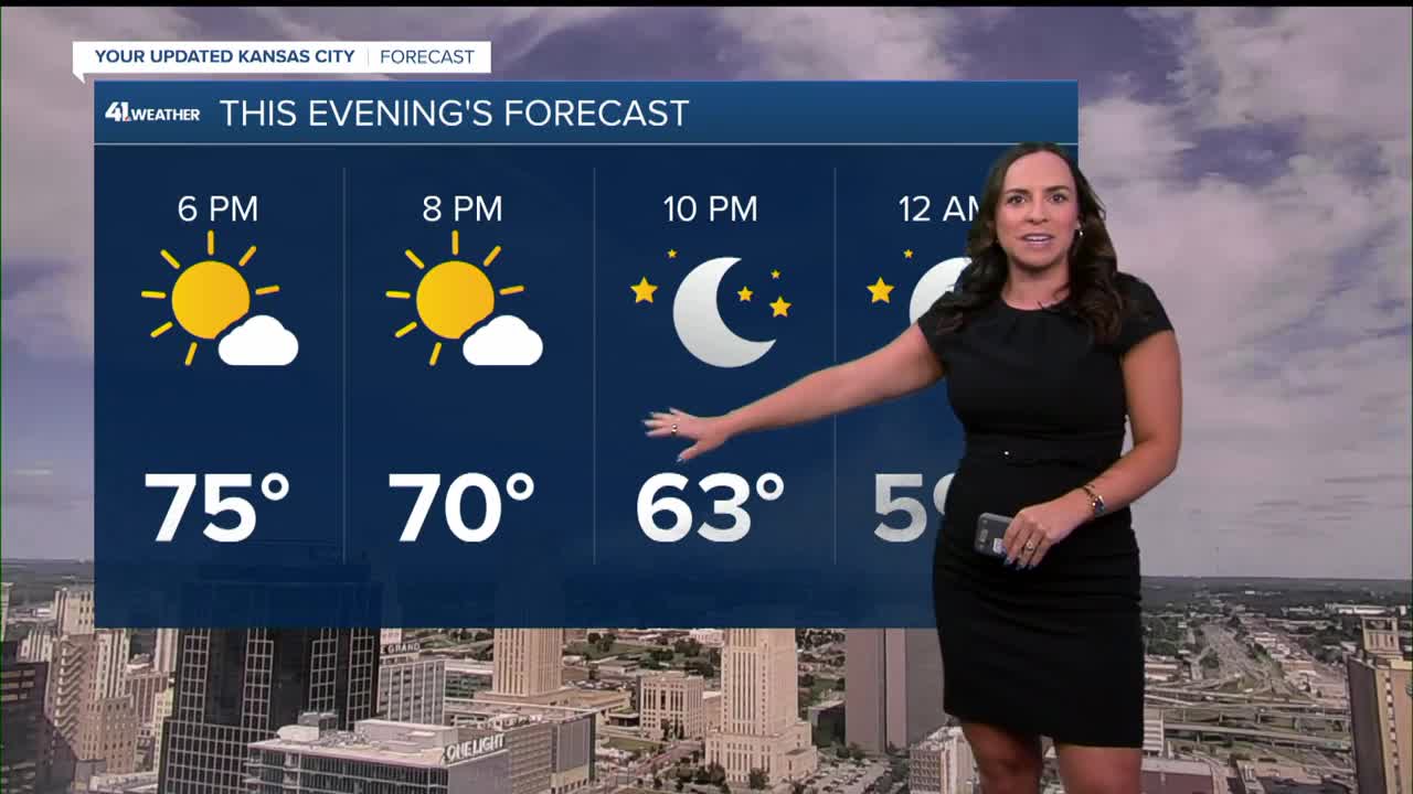
TODAY:
We will see highs in the 70s with periods of clouds. Highs will be in the 60s from western Kansas to western Arkansas.
Their average highs are in the mid-80s to near 90°, so this is 20-30 degrees below average.

TONIGHT:
We will very likely tie or break the record low of 53° set in 1910. We have come close to a record low this morning.
The record this morning is 53°, set in 1958. As of this writing, it is 55°.

TUESDAY:
The pattern will continue as we see highs in the mid to upper 70s, with 60s, rain and thunderstorms from western Kansas to southwest Arkansas.
We will have plenty of sunshine and a light wind — a very nice August day.

WEDNESDAY:
The zone of thunderstorms will get closer, but new data is trending to the rain staying mainly west and south of Kansas City.
So Wednesday-Thursday, we will see more clouds with a chance of showers and thunderstorms, mainly south and west of KC.
We will still see highs in the 70s with lows in the 50s and 60s.

RAINFALL FORECAST TODAY-FRIDAY:
There will be 1"-4" rainfall amounts from Colorado to Arkansas.

The northeast edge of the heavy rain is about 50-100 miles southwest of Kansas City.
There will be a sharp cutoff to the rain, so, as of now, Kansas City is in the none to .10" rainfall potential. We will watch the data this week to see if there is a northeast shift.

Right now, Labor Day weekend is looking good with highs around 80°, lows around 60°. There will be 1-2 slight chances of showers, thunderstorms.
We will have a closer look at this throughout the week.
Have a great week.
Stay healthy.
—
