


KANSAS CITY, Mo. — Good Monday, bloggers,
I hope you had a happy New Year and a merry Christmas.
What will the first full week of 2026 bring? Well, the mild weather pattern we have been in since the end of December continues here in January.
Today-Wednesday will be dry with temperatures running 15-25 degrees above average. This means highs in the 50s to near 60.
Record highs range between 64° and 71° the next week, and we will likely fall short, but temperatures will still be mild.
The unseasonably warm air is dominating much of the U.S.

This unseasonably warm air is being caused by a weather feature that has been rather prominent over the last several weeks. That feature is the opposite of a storm system, a ridge.
Our next storm system is now near San Francisco.

Let's go through this.
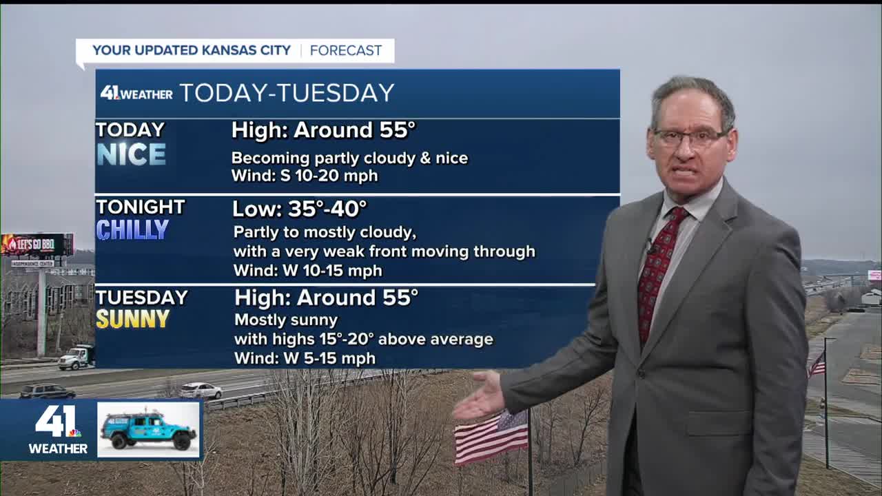
TODAY:
We will see morning low clouds and some fog. These clouds will give way to filtered sunshine through high clouds.
Highs will be in the 50s to near 60.
If the low clouds hang on into the early afternoon, we will see highs in the low 50s.

Also, you may be noticing the wet roads, such as Interstate 70 this morning. This is not from rain but from condensation.
It is the same thing that happens when you bring a glass of ice water outside on a summer day. The glass gets wet as the humid summer air cools near the glass and the moisture condenses out.
So the wet roads are an indication of warmer and more moist air moving in over the colder roads. The low clouds are an indication of this as well.
You can see the red GEHA Field at Arrowhead Stadium lights reflecting off the low clouds.

TUESDAY:
A very weak front/trough will move through tonight, which you can see on the Monday map above. It will push the moisture and low clouds to the east.
This means Tuesday will be sunny with highs in the 50s.

WEDNESDAY:
We will see more sunshine with highs around 60° and the wind turning back to the south.

THURSDAY:
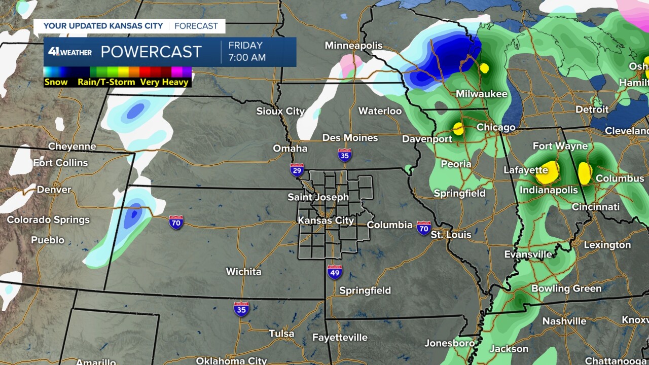
The storm system, now in San Francisco, will be tracking northeast into the Plains. It will bring a nice area of rain and some thunderstorms to most locations.
We are on the western edge of the storm, and we will look at the rainfall totals below. Highs will be in the 50s.

FRIDAY:
The rain will exit Thursday night, leaving a partly to mostly cloudy Friday with highs in the 40s to low 50s.
A second system will enter the western Plains, bringing scattered areas of snow and some rain.
FRIDAY NIGHT-SATURDAY:
The second system may bring some wet snow to far northwest Missouri and much of Nebraska and Iowa. It will also bring more seasonable temperatures as highs will drop to the 30s with lows in the 20s.

SUNDAY:
The sun returns Sunday with highs in the 40s.
Notice the red-colored winds from the south. Yes, that is a warming wind, and we will see temperatures back to near 50° in a week.

RAINFALL FORECAST THURSDAY-SUNDAY:
We are on the western edge of the significant rain. As of now, we are in the 0.25"-1" zone with 1"-2" from southeast Kansas to northeast Missouri to Chicago. Trace-0.25" is just to the west.
If this shifts, it will most likely shift east, putting our area in the trace-0.25" zone.

SNOWFALL FORECAST THURSDAY-SUNDAY:
One year ago today, we showed a snowfall forecast map that had 10"-15" along I-70 from Kansas to Kentucky. Jan. 5-6, 2025, we had ice, then a blizzard.
I had never shown a snowfall forecast map like that and been 100% confident in the forecast.
Jan. 5-6, 2026, there is no snowfall forecast map to show, but there is a snowfall forecast map to show for Jan. 8-11. Right now, it looks like Nebraska and Iowa will see a dusting to 2" with more than 2" of snow for Wisconsin and northeast Iowa.

Have a great first full week of 2026.
Stay healthy.
—
