


KANSAS CITY, Mo. — Good Saturday bloggers,
We are in an active weather pattern through Tuesday, as we will be tracking several rounds of severe thunderstorms.
This is being caused by a front wavering back and forth from western Kansas to Iowa as a big trough forms in the western USA. This puts the Plains/Midwest in a disturbance-laden southwest flow over the front, setting up several rounds of severe weather and flash flooding in the frontal zone.
The front will become a cold front and head southeast toward Kansas City Monday night.

What does this mean for KC? Let's go through this.
SATURDAY MORNING:
A large area of non-severe rain and thunderstorms just south and east of KC will slowly decrease and end by noon, clipping southeast Jackson County.

SATURDAY AFTERNOON:
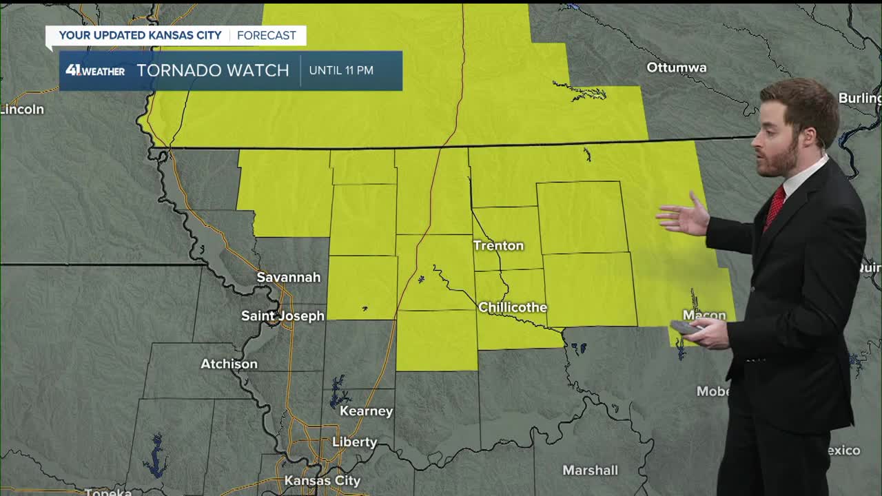
The focus of attention turns to Nebraska, Iowa, northwest Kansas to far northern Missouri as there are level 2/3 of 5 severe threats for Saturday afternoon and night.

We will be partly cloudy, breezy (S 10-20 mph), very warm and humid as thunderstorms begin to form between 3 to 5 p.m. across southern Iowa, perhaps into far northern Missouri. Highs here will be in the mid-to-upper 80s with a south breeze at 15-25 mph.

SATURDAY NIGHT:
There will be several rounds of thunderstorms tracking across Nebraska, Iowa into far northern sections of Kansas and Missouri. Kansas City will be windy (S 15-25 mph), warm and humid with lows around 70°. So, it looks good in KC for all the graduations and outdoor activities and also locations that are seeing rain this morning. Northern Missouri is a different story.
SUNDAY:
The main severe threat is again from northwest Kansas to Iowa. We are in a level 1 of 5 severe threat, as there is a chance that thunderstorms form during the afternoon in south central Kansas. If they form, there is a slight chance they roll into KC Sunday evening and night. Should this occur, we would see severe weather in KC Sunday evening, the chance is 20%.

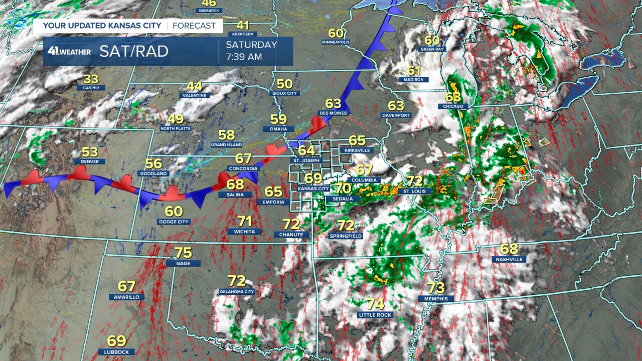
SUNDAY 7 AM:
We will see the thunderstorms weaken as they track east-northeast along Interstate 80 from Iowa to Ohio. We may see a few rain showers, but overall it will be dry, mostly cloudy, breezy (S 10-20 mph) and mild with lows 65°-70°.

SUNDAY AFTERNOON/EVENING:
It will be partly cloudy, windy (S 15-30 mph), very warm and humid with highs in the mid-to-upper 80s. You can see thunderstorms forming from northern Nebraska to western Oklahoma. If these hold together, we would see a chance of severe weather here Sunday evening.

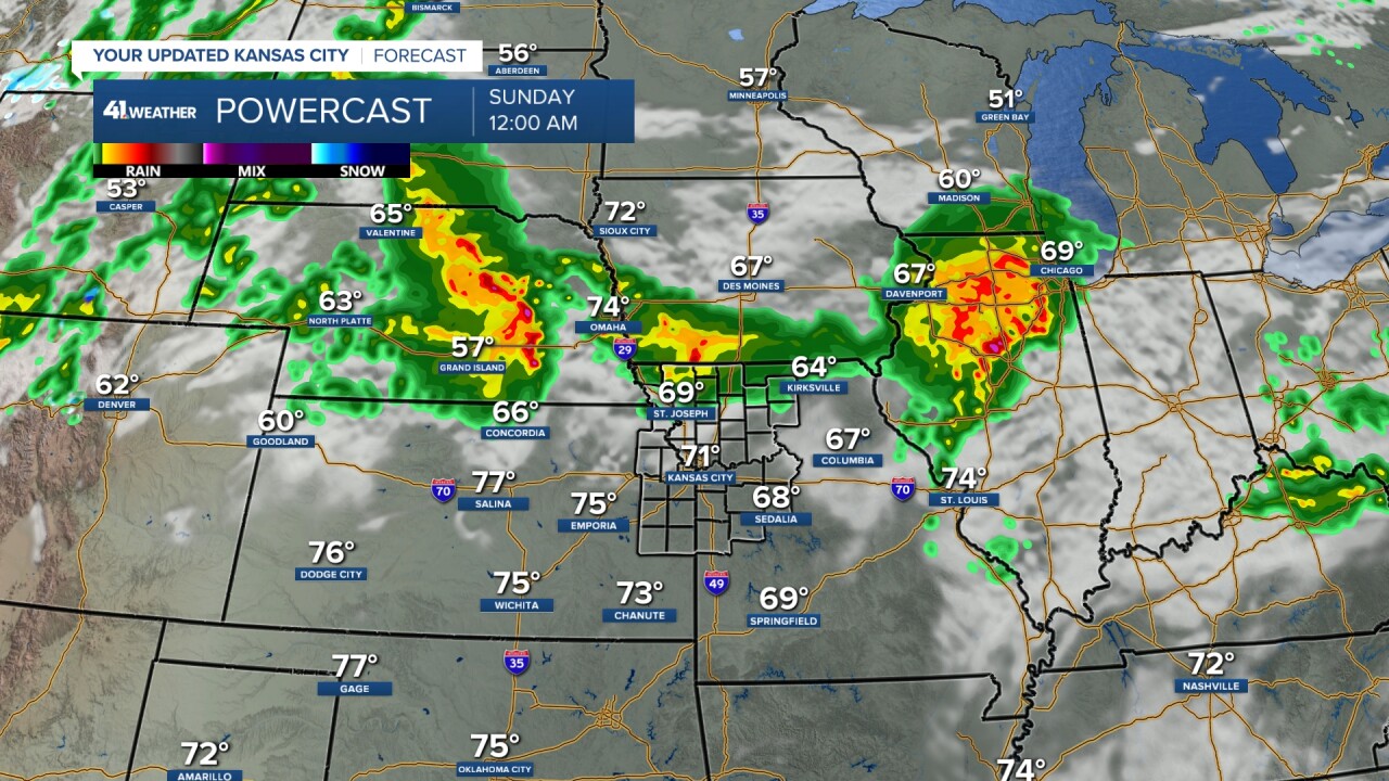
SUNDAY NIGHT:
But, the thunderstorms across Kansas and Oklahoma will fall apart before reaching eastern Kansas and western Missouri. The thunderstorms in Nebraska will grow, become severe, and track east across Iowa. There is a chance they clip far northern Kansas and northern Missouri. KC will see lows around 70° with south winds 15-30 mph.

MONDAY:
The severe threat now shifts southeast into our area.

MONDAY AFTERNOON:
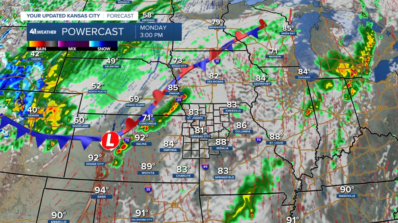
The main storm is heading out into the Plains, which will deepen the surface low in western Kansas. The surface low will form a triple point where the cold front, dry line and warm (stationary) front meet. This is the kind of setup we saw in April.
So, between 2 to 4 p.m., we will see thunderstorms form from southwest Kansas to southwest Iowa near the features mentioned above. We will be partly cloudy, windy (S 15-35 mph), very warm and humid with highs in the 80s.
MONDAY EVENING/NIGHT (5 PM-MIDNIGHT):
The thunderstorms will become a line of strong to severe thunderstorms from southern Kansas to southeast Minnesota. The faster the line arrives in our area, the higher the chance it has to be severe. This is because it will have more heat of the day to work with. However, even at midnight, it may be close to 80° and humid, which would be plenty of juice for severe weather.
This is one of those lines that could have brief, small tornadoes on the front.

MONDAY NIGHT-TUESDAY MORNING (12-7 AM):
The line will either have moved through or be moving through. Hail, damaging wind, a brief small tornado and flash flooding are all on the table. Again, the later this moves through, the lower the severe threat. You can see temperatures are in the 70s ahead of the line and 40s/50s behind the line.
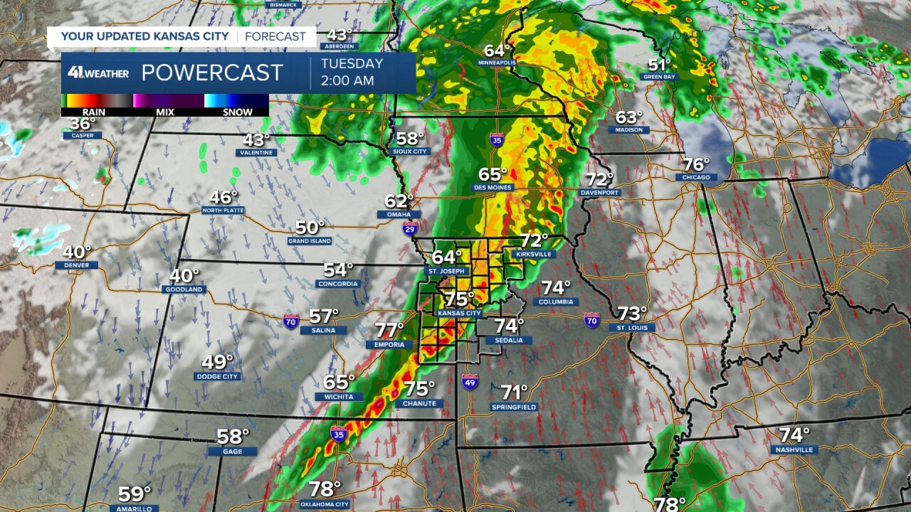
TUESDAY:
The severe threat shifts to a zone from central Oklahoma to Michigan through the southeast 1/2 of Missouri.

TUESDAY MORNING:
We may see some lingering rain as temperatures drop to the 50s.

TUESDAY AFTERNOON:
We will see increasing sunshine as any rain ends with highs much cooler around 70°. You can see thunderstorms forming in southeast Missouri.

RAINFALL FORECAST LATER TODAY-TUESDAY:
Since the end of the wet April, it has been dry during the first half of May in many locations with rainfall under 1". Average for the 1st half of May is 2.50"-3" of rain. It takes 1" of rain per week to keep the yard green.
The heaviest rain looks to be from central Kansas to southern Iowa, through far northwest Missouri, where amounts will be 1"-4" with some locations seeing 4"-7"+.

When we zoom in, amounts look to be .50"-2" in our area. It will hinge on what we get Monday night. Take a look at the northwest corner of Missouri. There is potential to see 7"-10" of rain! The 7"-10" rainfall amount is not out of the question, but the location is not set yet. It could end up 50 miles farther north or south.
So, if your yard or farm can wait until Monday night for free water, that would be great.

Have a great weekend
Stay healthy
Stay with KSHB 41 and we'll keep you advised.
