


KANSAS CITY, Mo. — Good Monday, bloggers,
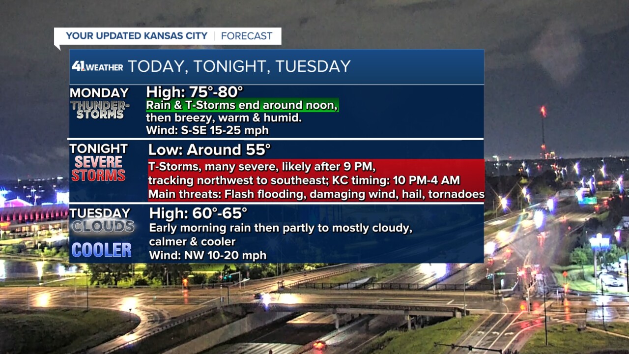
We are tracking two rounds of thunderstorms. The first round arrived after midnight last night and will end around noon today. Let's go through this.
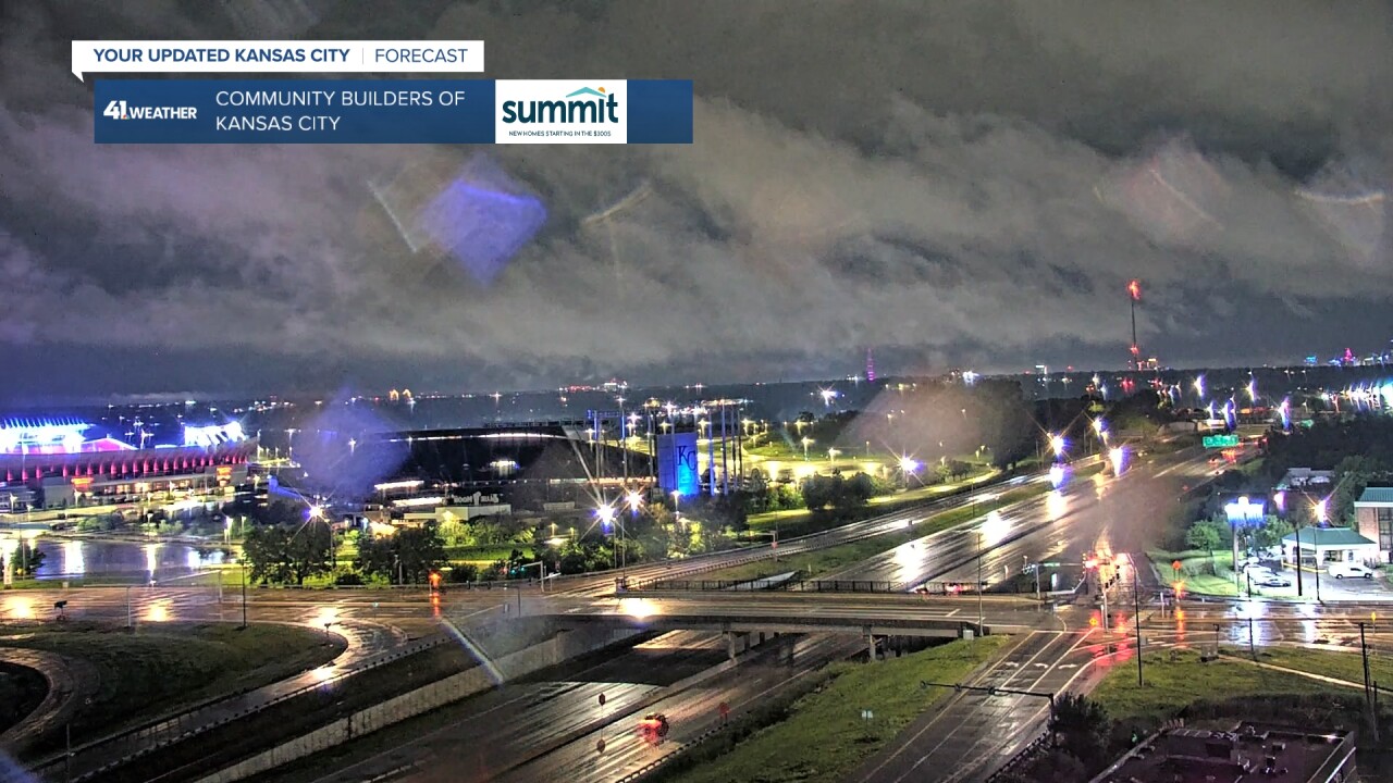
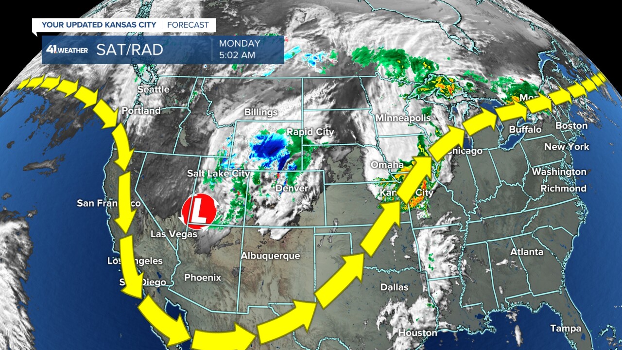
The rain and thunderstorms made for quite a pre-dawn sky with low cumulus, stratocumulus clouds tracking south under the layers of clouds producing the rain and thunderstorms.
Will the Royals get their game in today that starts at 6:40 p.m.? Answer below.
TODAY (THROUGH NOON):
The rain and thunderstorms have created a large rain-cooled airmass. Once the current rain and thunderstorms end, the outflow boundary that was heading south toward Wichita will stall and head back north.
This boundary from the rain-cooled air will have a big impact on how the severe weather will set up. Along and south of the boundary, it will be very unstable and allow for significant severe weather.
Also, the boundary increases the directional shear in the atmosphere, which increases the tornado threat. North of the boundary, it will be cooler with thunderstorms, mainly causing a wind and flash flooding threat.
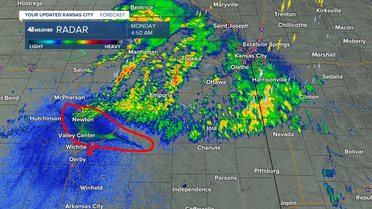
This morning at 5 a.m., the boundary was still drifting south.
Look at all of the tornado reports Sunday from southwest Minnesota to northwest Kansas.
The main storm was located in southern Utah this morning. It will turn northeast later today and rip out into the Plains/Midwest tonight. This will create the conditions aloft for widespread severe weather.
But conditions at the surface are important, and it will depend on the much-mentioned boundary.
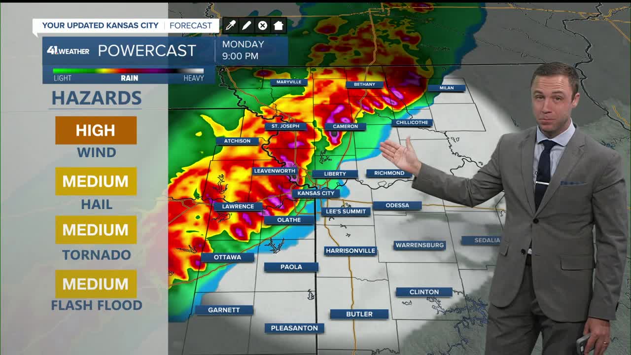
SEVERE THREAT:
We are in a Level 3/4 of 5 severe threat, which is no change from the Sunday forecast from the Storm Prediction Center.
The southeast viewing area is in a Level 2.
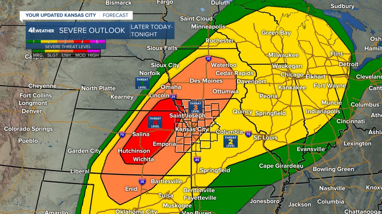
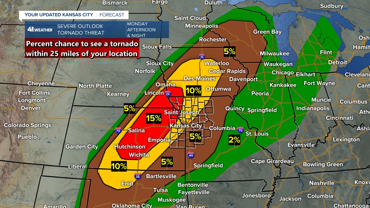
The chance of seeing a tornado within 25 miles of your location hasn't changed either, ranging from 5% southeast of KC to 15% northwest of KC.
This is low, but when you consider that most days the chance is 0%, 15% is rather high.
The entire area is in a flood/flash flood watch. This is a change from Sunday, as it was greatly expanded from where it was in northern Missouri.
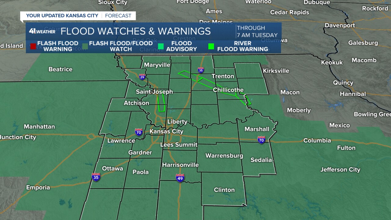
The flood/flash flood watch extends from southeast Nebraska to central Missouri.
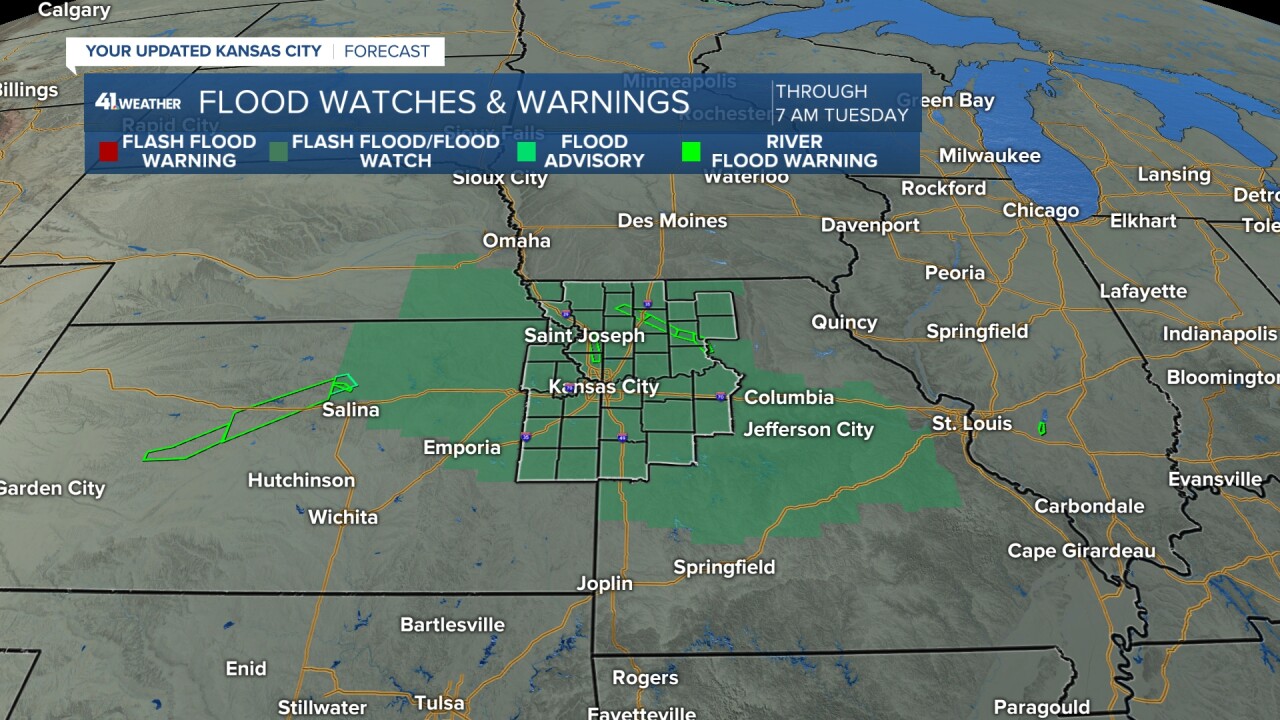
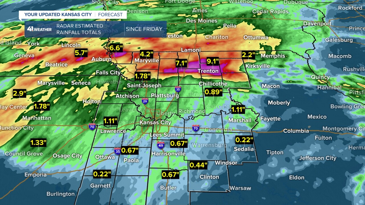
The watch is wise as the thunderstorms tonight will fall on saturated ground in many locations, especially northern Missouri to northeast Kansas, where 4"-9" of rain has occurred over the last 2-3 days.
The KC area has seen 1"-1.50" of rain with 0.50"-1" across southern sections of Johnson and Jackson counties. But with rainfall rates 1"-2" per hour tonight, all locations will be susceptible to flash flooding.
Remember, flooding kills more people per year than tornadoes and lightning. 6" of flowing water can float an SUV. Turn around, don't drown.
Also, when it is raining heavily, it makes it easier to hydroplane, which is when water gets under the tires of your car. It is almost like driving on ice. The way to decrease the chance of hydroplaning is to drive slowly.
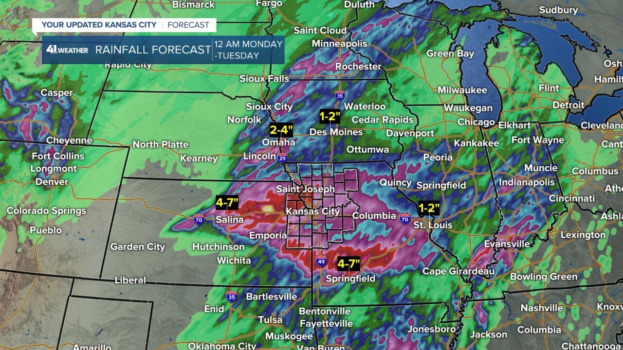
RAINFALL FORECAST:
This map shows the rainfall potential when you add the rain from last night and the rain we will get this morning and tonight.
You can see most locations will see 2"-4" of rain with pockets of 4"-7".
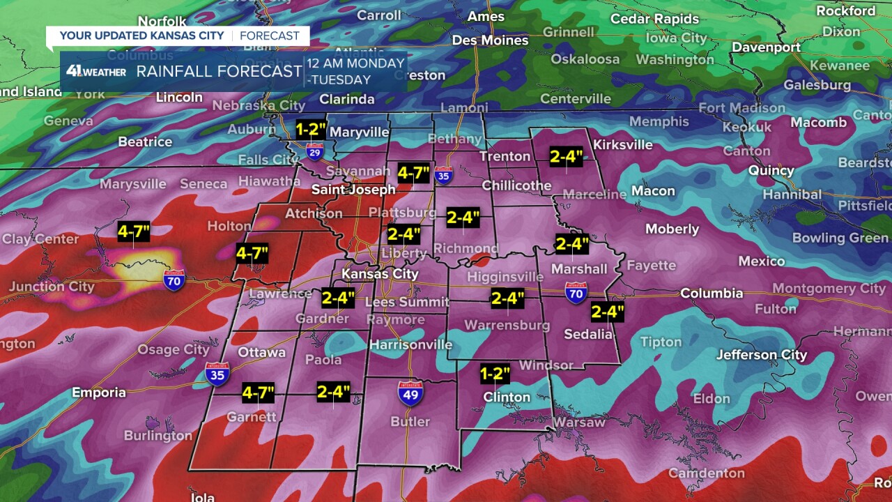
A wider view shows why there is a flood/flash flood watch from southeast Nebraska to central Missouri.
Now, let's go through the setup. This is a POTENTIAL setup as it is still unclear where the aforementioned boundary will be this afternoon and evening.
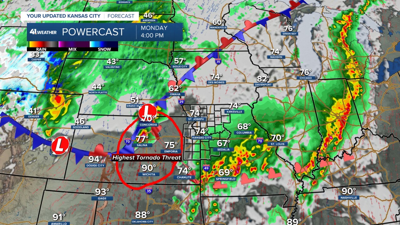
MONDAY 4 PM:
This data shows the boundary from northcentral to southeast Kansas, where it trails southeast from a surface low. The highest tornado threat will be in the upside down "V" warm sector to locations just east and north of the boundary.
The million-dollar question is where this boundary will be located when thunderstorms explode.
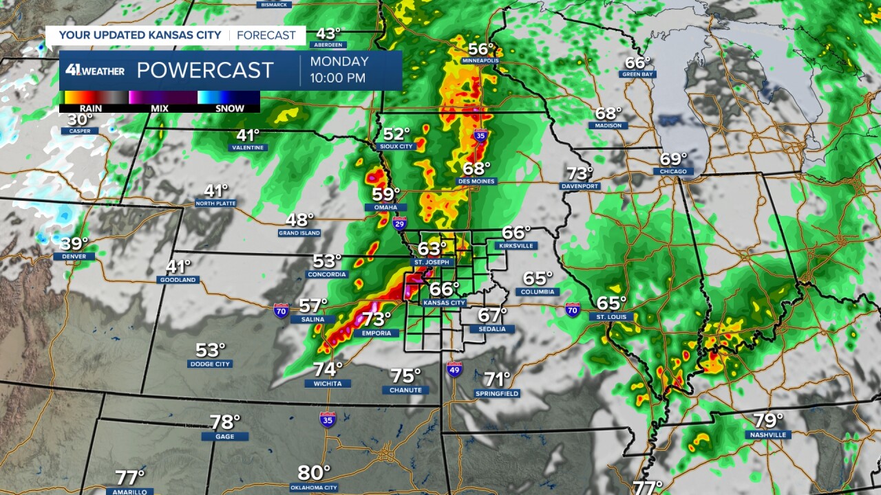
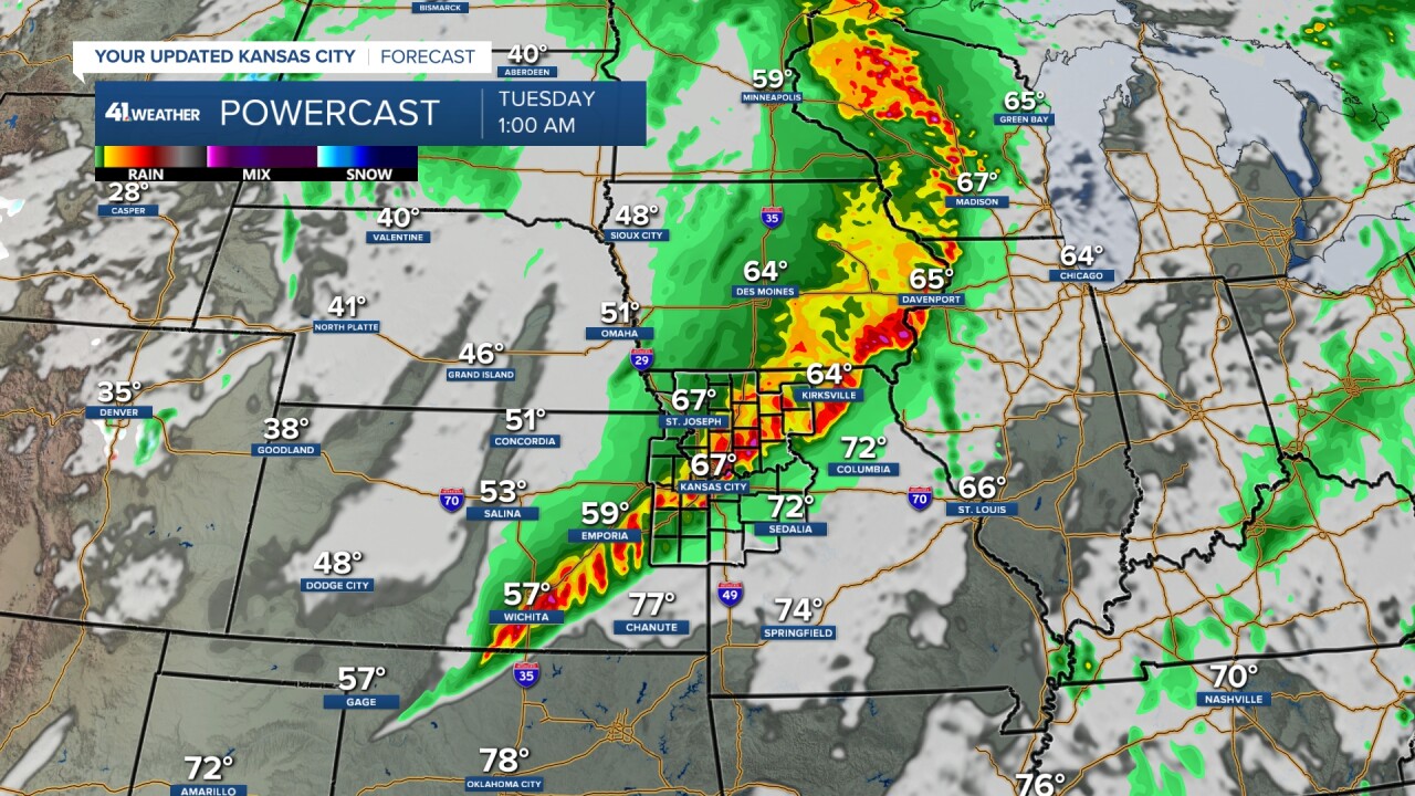
MONDAY 4 PM-TUESDAY 1 AM:
Thunderstorms will form on a line from southern Kansas to southern Minnesota. The part of the line that is south of the rain-cooled outflow boundary will have the higher tornado/damaging wind/hail/flash flooding threats.
The thunderstorms to the north will have a much lower tornado threat. Now, it is such a volatile setup that some thunderstorms north of the boundary may still produce a brief, small tornado on the front end of the line, along with the damaging wind, hail and flash flooding threats.
Also, any thunderstorms that are ahead of the main line and south of or along the boundary will have a higher tornado threat.
As the night goes on, regardless of where the boundary sets up, the tornado threat will drop as the line tracks southeast.
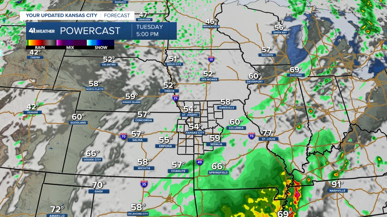
TUESDAY:
Some rain may linger early in the morning with lows in the 50s. If low clouds hang tough all day, it will stay in the 50s all day.
But I think we will see some sun, which would take us to the low 60s and is about 15 degrees below average.
There are more rain and thunderstorm chances Thursday and Friday with little to no severe threat. The Memorial Day weekend has a few slight thunderstorm chances.
WEATHER SUMMARY:
The line of thunderstorms will track northwest to southeast across the viewing area between 9 p.m. and 6 a.m. The threat in KC is between 10 p.m. and 4 a.m. So the Royals should get their game in.
Stay with KSHB 41, and we'll keep you advised.
Have a great week ahead.
Stay healthy.
—
