


Good Saturday bloggers,
We are in for an active day of weather as we track a cold front from the northwest and a warm front from the southwest.
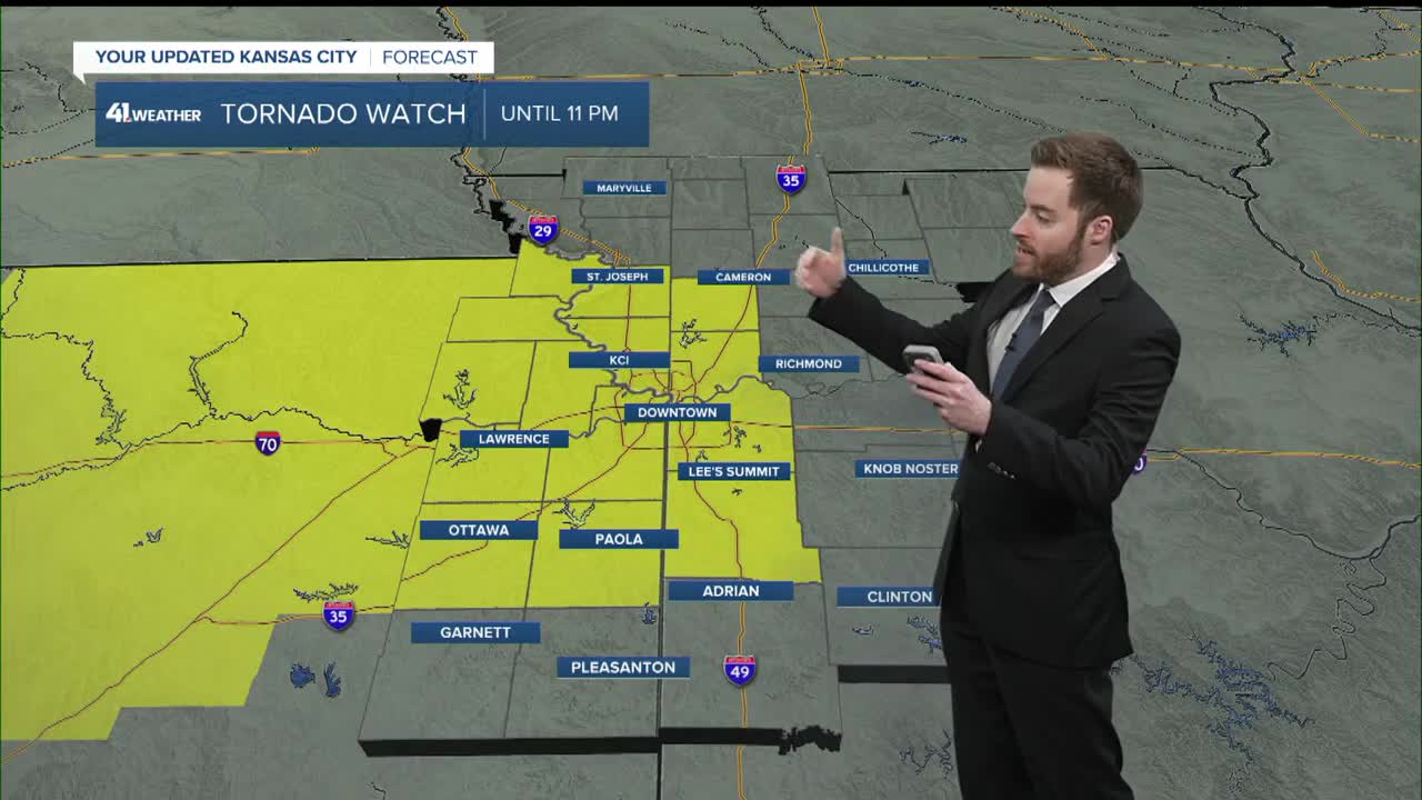
Locations east and northeast of the warm front and southeast of the cold front have the best chance to see strong to severe thunderstorms later today and tonight.

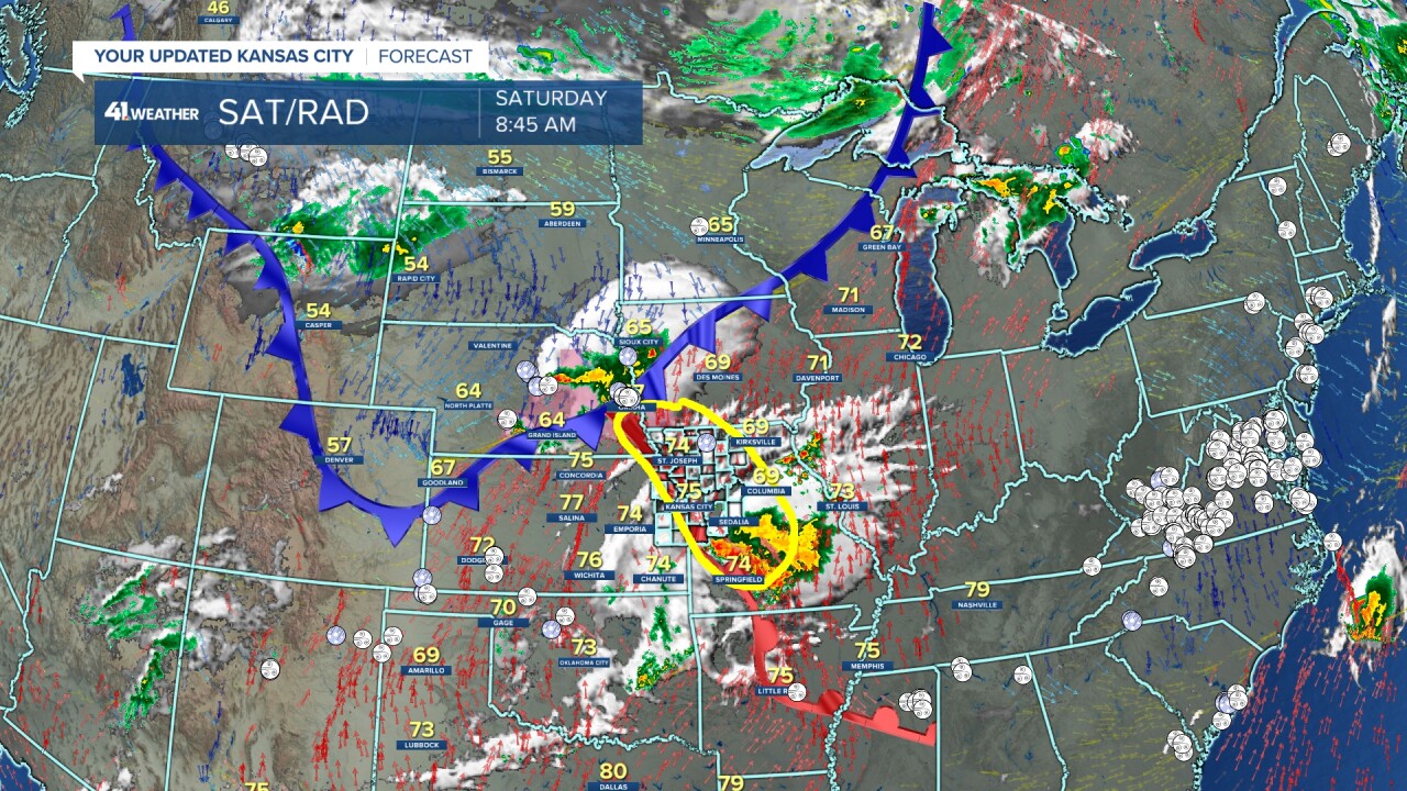
I circled the area most likely to see severe thunderstorms in yellow. The ongoing area of rain and thunderstorms across southern Missouri will most likely keep the warm front from moving much farther east than it is now. So, this puts eastern Kansas and western Missouri in the zone.
We had thunderstorms this morning that made for a pretty sunrise. We had a ripply looking sky with a rain shaft near the horizon.

Details on this next round of potential severe weather and flash flooding are in the little over six-minute video below.
Have a great weekend
Stay healthy
Stay with KSHB 41 and we'll keep you advised
