


KANSAS CITY, Mo. — Good Thursday bloggers,
We are in for another nice day before we get into an extended period of cloudy and rainy days. The $64,000 question is how much rain will we get from the next two storms?
Let's take a look at the upper-level flow where the storm systems and non-storm systems dictate what goes on at the surface.
UPPER LEVEL FLOW SATURDAY:
An upper-level low now in the southwest USA will be tracking slowly east into Kansas and Oklahoma Saturday. It arrives Friday, so rain chances start Friday.

UPPER LEVEL FLOW SUNDAY:
The upper-level low is weakening as it tracks east-southeast toward the Tennessee Valley. Also, a second system is trying to evolve in the western USA. But, it is mostly just flat, strong flow. At the same time, an upper-level high (non-storm system) is forming in the Great Lakes. This upper-level high is too weak and, being the end of October, won't be enough to be a "heat wave creating machine." But, it is forming a high-over-low block with the system that affects us.

UPPER LEVEL FLOW MONDAY:
The first system is drifting east across the eastern Midwest, while the second system is forming in western Canada, but there is a lot of energy zipping across the Rockies. If you look closely at our area, there is a small ridge. This means it may not rain at the Chiefs game. The upper-level high is still blocking the flow in the Great Lakes.

UPPER LEVEL FLOW NEXT THURSDAY:
The first system and energy from the western USA combine to form a big storm in the eastern USA. This puts our area on the back of the storm system, which means it is looking dry and cool for Halloween.

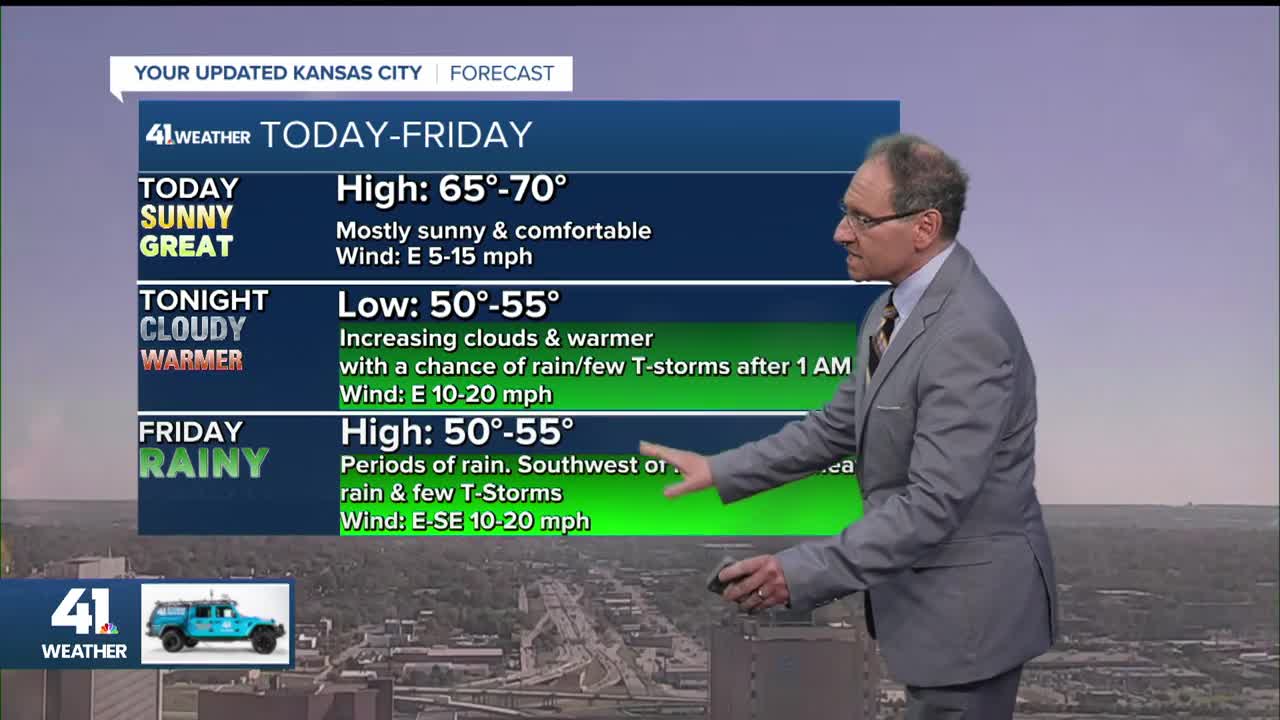
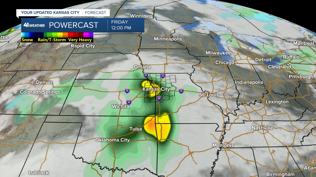
FRIDAY WEATHER:
Rain is looking likely all day. We may see some heavy rain and perhaps a thunderstorm during the morning. If it does get here, it will most likely be the heaviest rain we see between Friday and Monday. If it stays southwest of Kansas City, then our total rainfall through the weekend may be a bit low. Temperatures will be in the low to mid-50s all day.
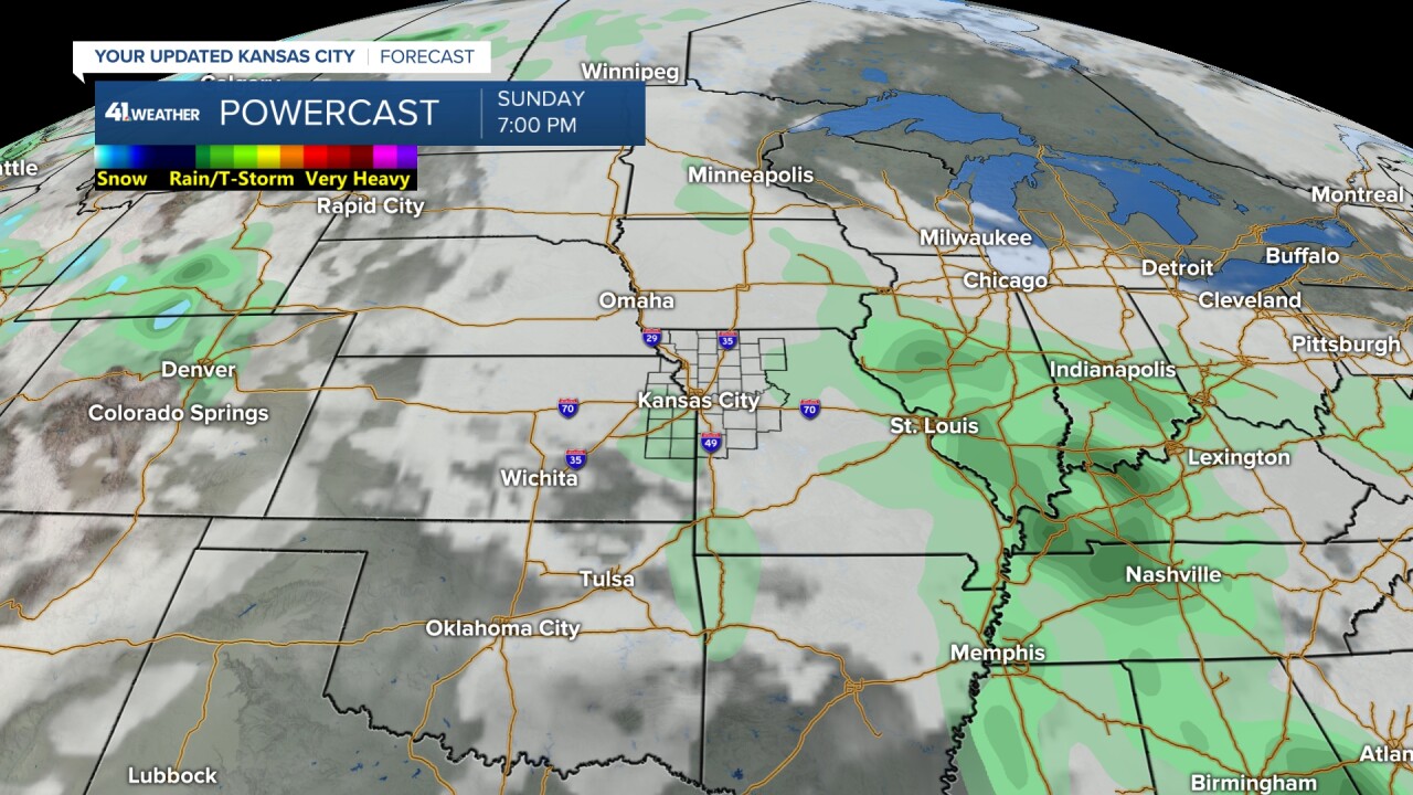
SATURDAY-SUNDAY WEATHER:
It will be cloudy with periods of mostly light to moderate rain and drizzle. Lows and highs will be in the 50s with east-southeast wind at 10-20 mph.

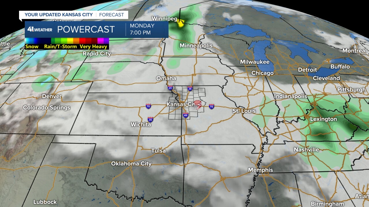
MONDAY WEATHER:
Right now, and I stress the words "right now", but it looks mostly cloudy with a low to no chance of rain. Temperatures would stay in the 50s. This includes Monday night.
RAINFALL FORECAST FRIDAY-TUESDAY:
The heaviest still looks to be across Oklahoma, northwest Arkansas into far southwest Missouri, and southern Kansas. Amounts will range from 2"-4" with some locations seeing 4"-7". That is a lot of rain for October and a lot for any time of year in this part of the USA.
As you can see, we are on the northeast edge of the heaviest rain.

When we zoom in on this data, there is widespread 1"-2" rainfall with a few locations seeing 2"-4" of rain just west and southwest of Kansas City into the southwest side of Kansas City. The rest of the Kansas City area is in the .50"-1" range with .10"-.50" to the northeast of Kansas City.
This is still not set yet, as yesterday it looked like the heaviest would be southwest to southeast of Kansas City. The one consistent item is that Kansas City is mostly in the .50"-1" range with 1"-2" amounts close or into some part of the southern part of the city.
The key to whether we see 1"-2" of rain or .50"-1" or less is what happens Friday, because the rest of the weekend the rain will be mostly light.
Heavy rain and thunderstorms will be tracking across Kansas later tonight into early Friday. As the rain area moves east, it will weaken. The models are all over the place on where it weakens. We have solutions ranging from all locations seeing .10"-.50" to 1"-2".

The rain may be long gone by Monday Night Football, but it will be around for the Sunflower Showdown Saturday in Lawrence.

TROPICAL SYSTEM MELISSA:
Melissa is still a tropical storm with 50 mph winds. This weekend into Monday, Melissa will drift west through the Caribbean Sea and intensify to a major hurricane (Cat 3 or 4).

We can see what will most likely happen to Melissa next week be revisiting the upper-level flow.
Monday you can see Melissa near Puerto Rico.
Next Tuesday-Thursday Melissa gets picked up by the big storm that forms in the eastern USA and gets flung into the Atlantic Ocean.
So Melissa will likely miss the continental USA, but wil affect many Caribbean islands and perhaps Bermuda.
Have a great rest of your week and weekend.
Stay healthy
