


KANSAS CITY, Mo. — Good Friday bloggers,
We have three weather topics to talk about. They are the weekend cold blast, the ongoing drought, and a huge warm-up next week. Let's go through all three, starting with the blast of cold.
WEEKEND COLD BLAST:
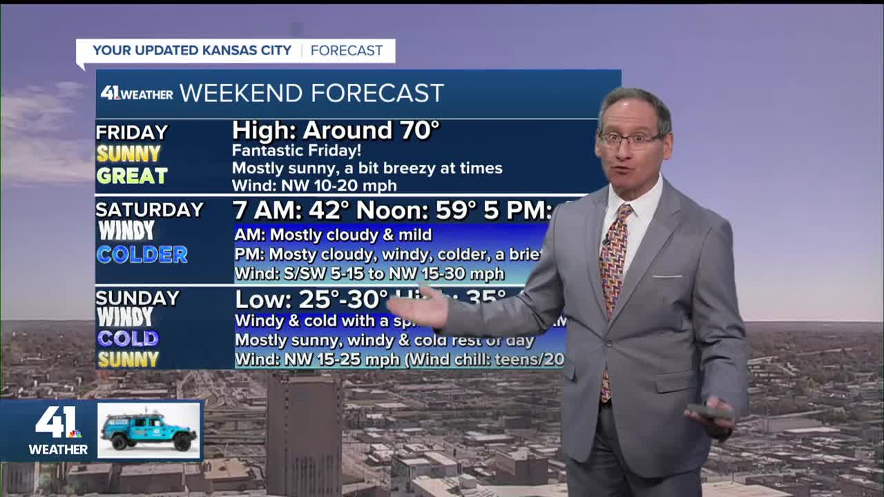
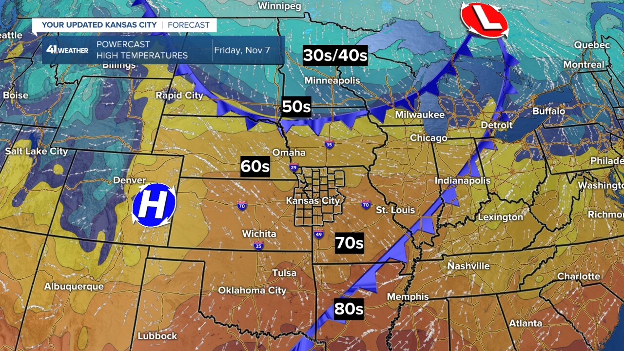
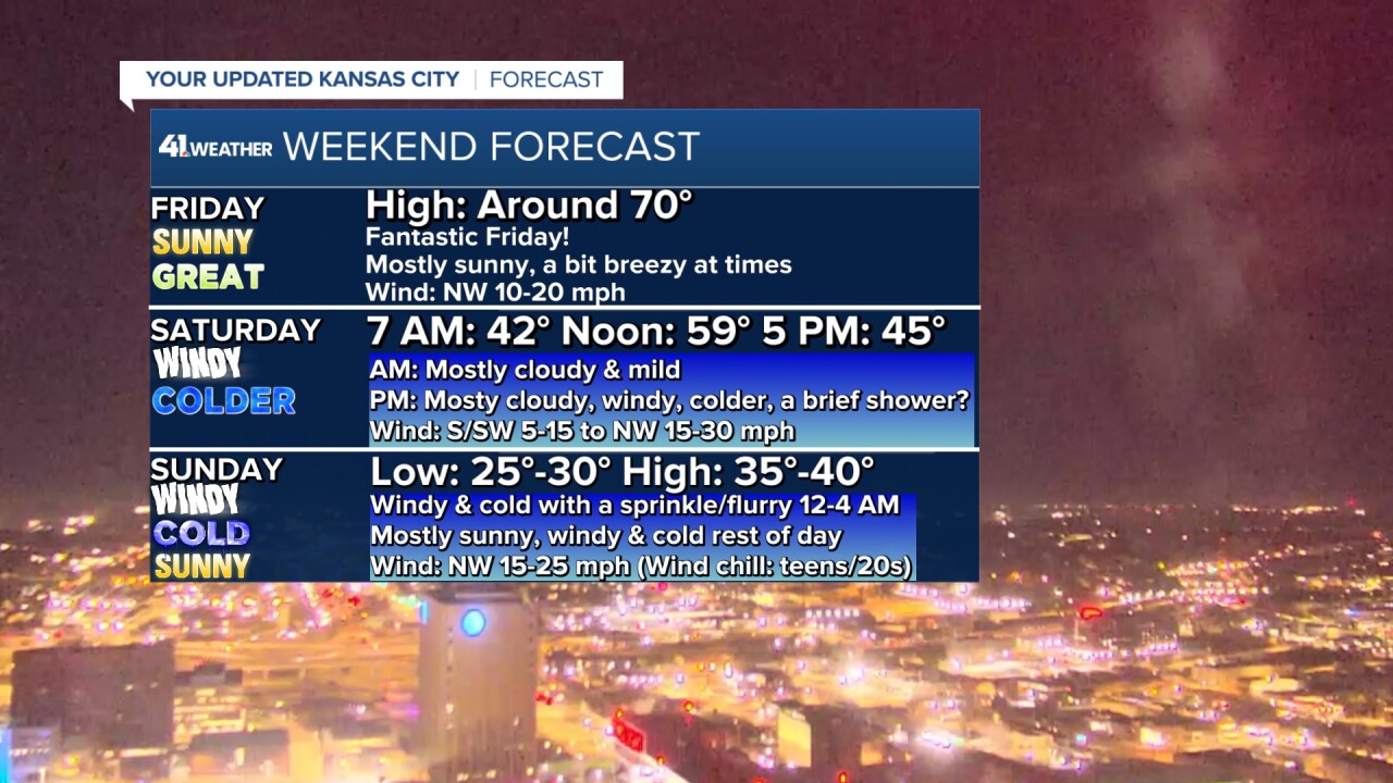
Today will be nice with highs around 70° ahead of the weekend cold.
Saturday will start decent with lots of clouds, perhaps a brief shower/sprinkle, and temperatures warming to around 60° with a light south breeze.
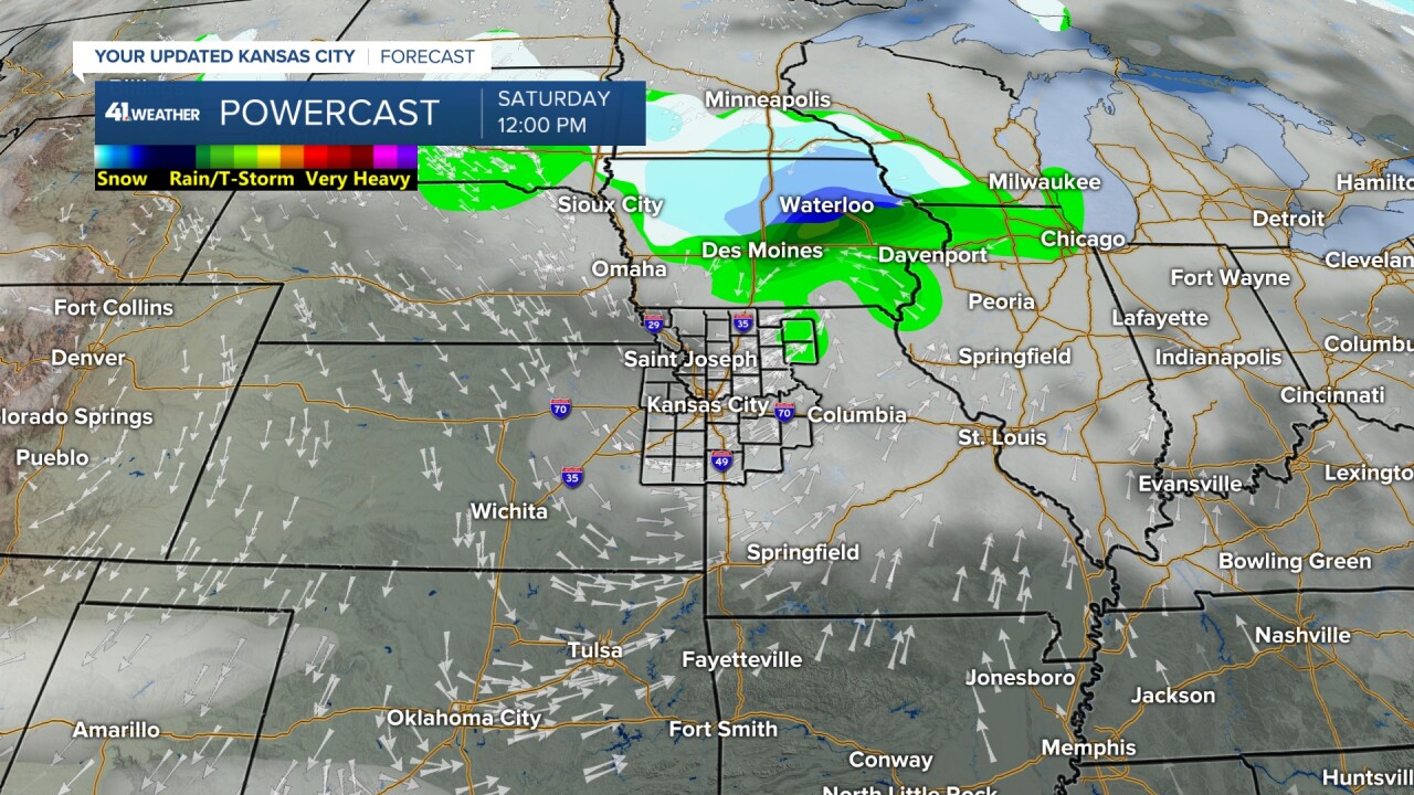
Rain and snow will be increasing from eastern Nebraska to Iowa, mostly along and north of Interstate 80.
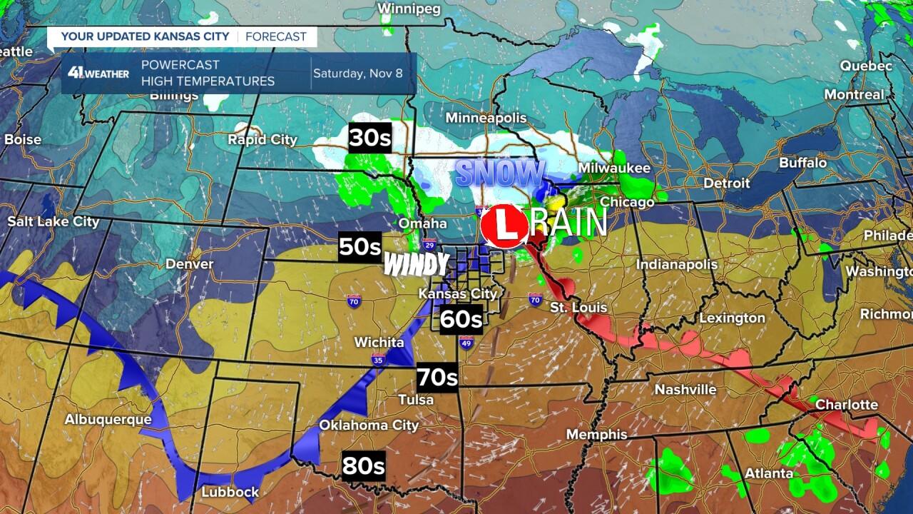
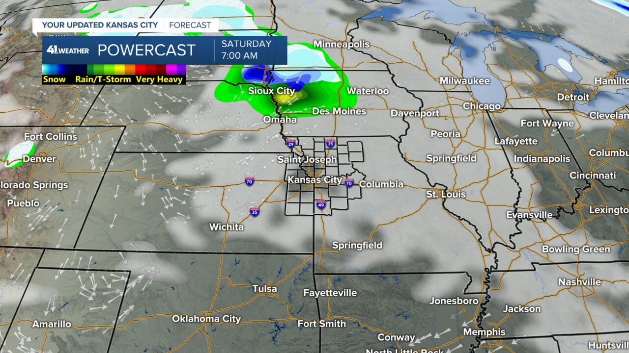
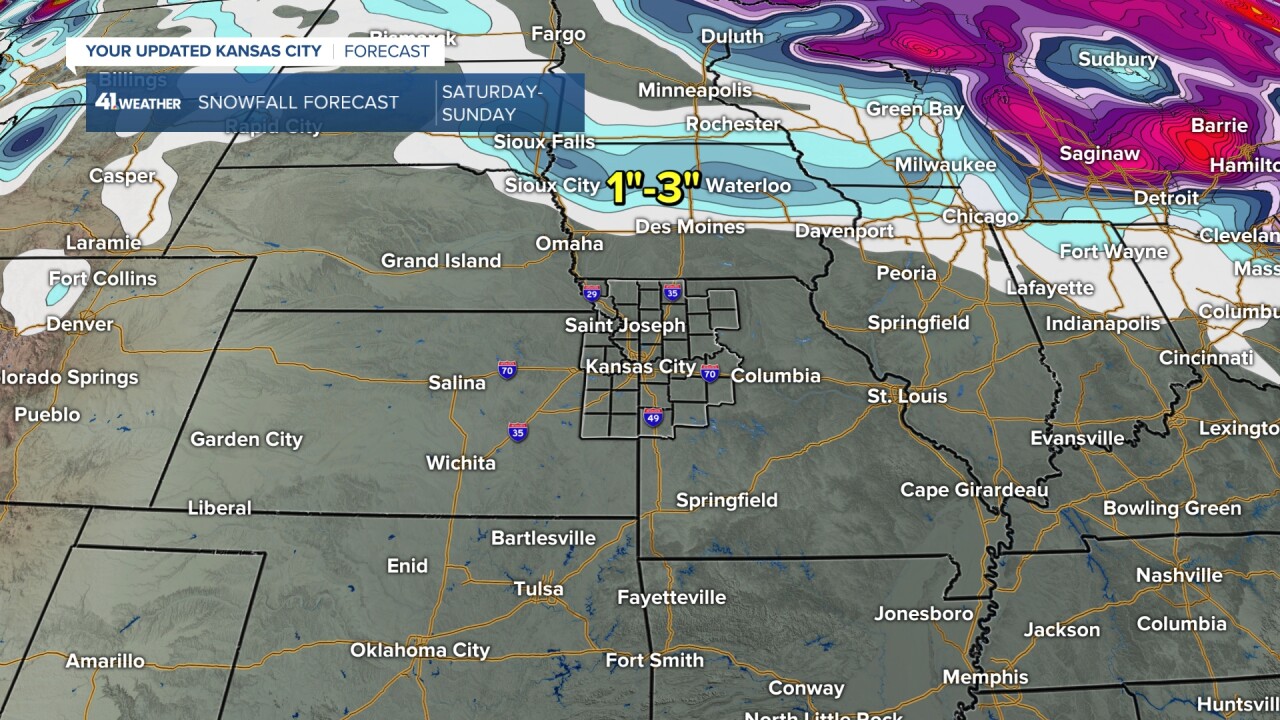
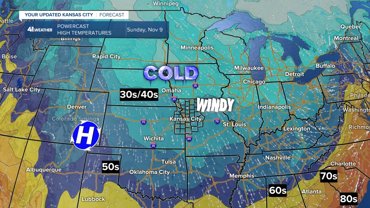
Then, around noon, a strong cold front will surge through with a wind shift to the northwest, increasing to 15-30 mph. Temperatures will drop to the 40s by evening, and we may see a sprinkle/rain shower Saturday afternoon. Rain and snow will be crossing Iowa. If you are heading north along Interstate 35/Interstate 29 to I-80 and north, keep this in mind as it will be slick there with 1"-3" of snow likely and some of that will stick to paved surfaces.
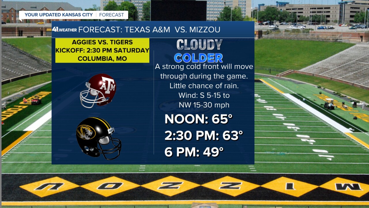
If you are heading to Columbia, Missouri, for the Mizzou football game, it will start nice, but end with wind and cold.
Saturday night will be windy (gusts to 30-35 mph) and cold (wind chill in the 20s) for all locations with a few rain showers and perhaps our 1st snowflakes. We do not expect any accumulation, as it won't be heavy enough or cold enough when the little rain/snow area moves through.
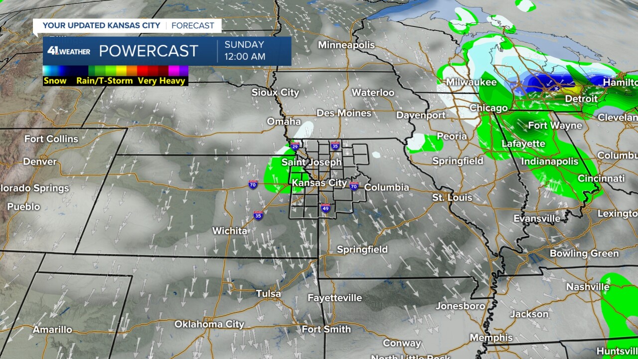
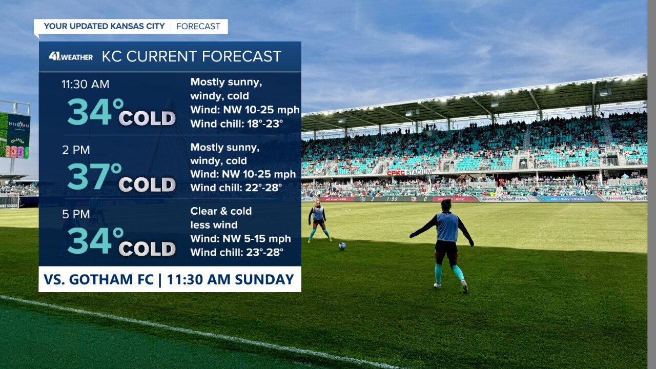
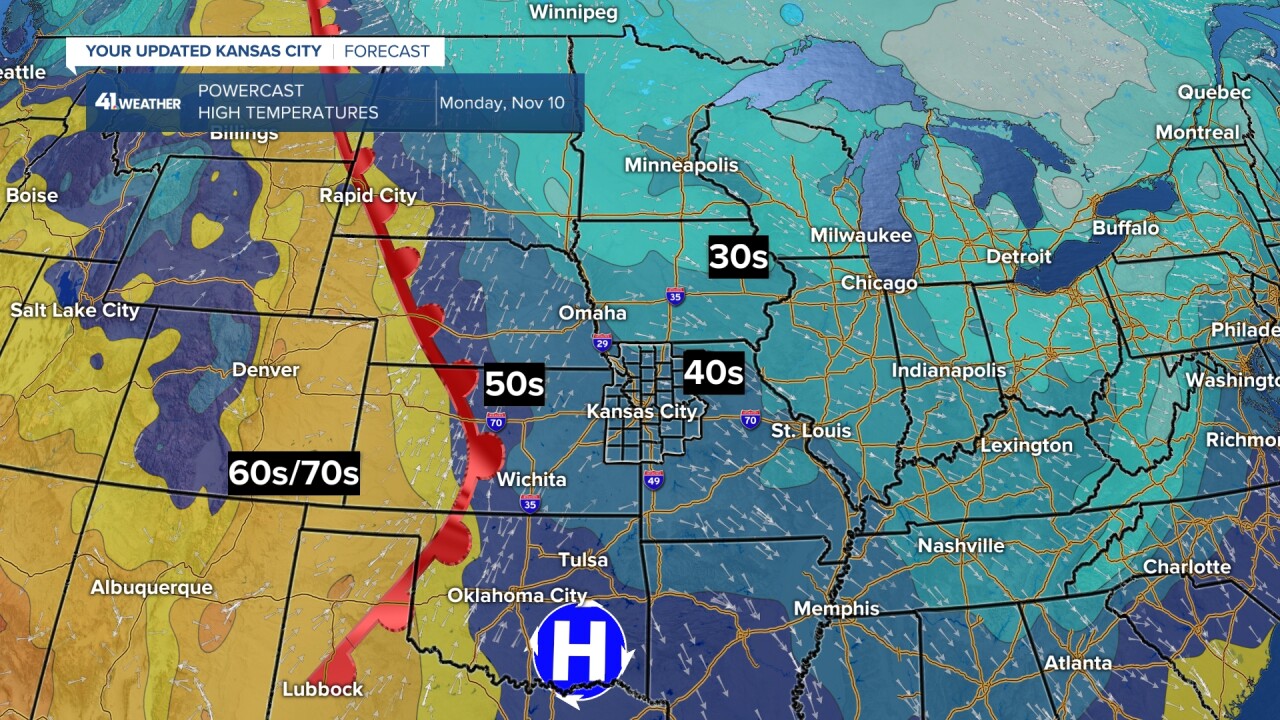
Sunday will be windy (NW 10-25 mph) and cold (wind chill 10s/20s) with highs struggling to 40° despite sunshine. If you are heading to the KC Current game that starts at 11:30 a.m., it will be rather cold with temperatures in the 30s and wind chill values in the 10s/20s.
Here is the weekend weather summary.
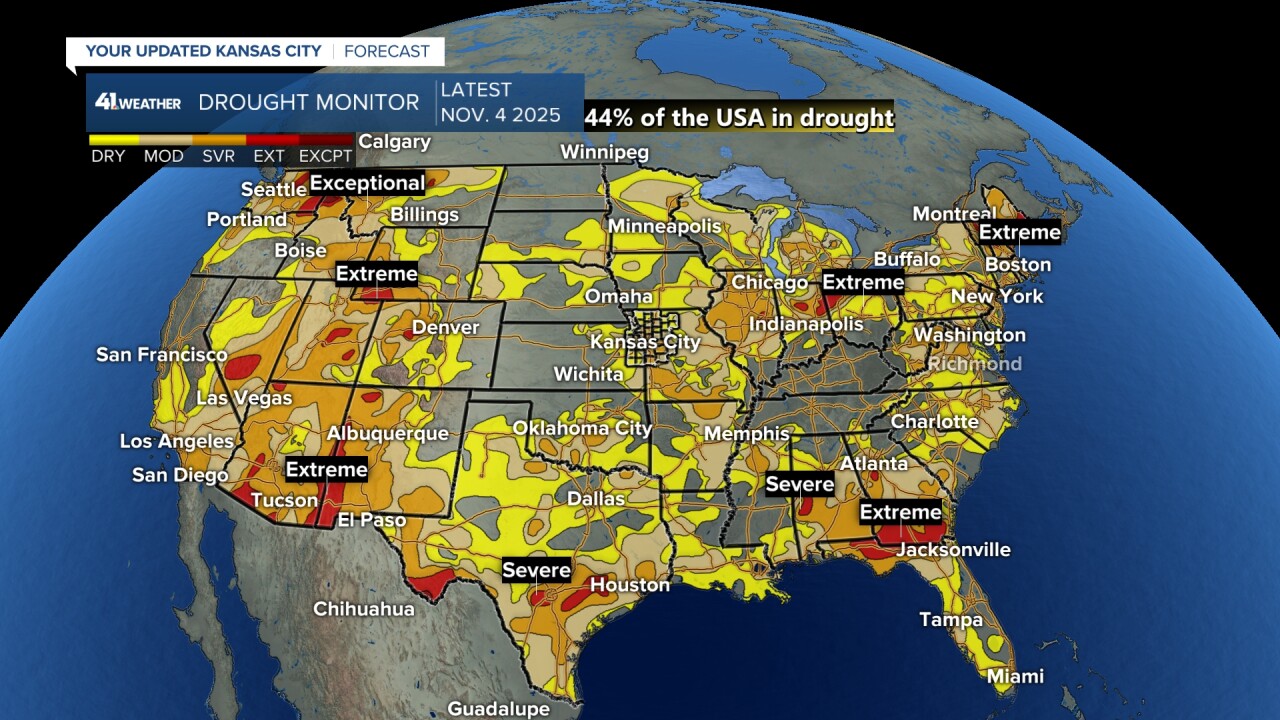
THE DROUGHT:
The latest drought monitor that came out Thursday, which includes conditions through Nov. 4, show much of our area in a moderate to severe drought, which is a level 1/2 of 4 (Abnormally Dry is one rung below a drought). The Kansas City area is in a severe drought.
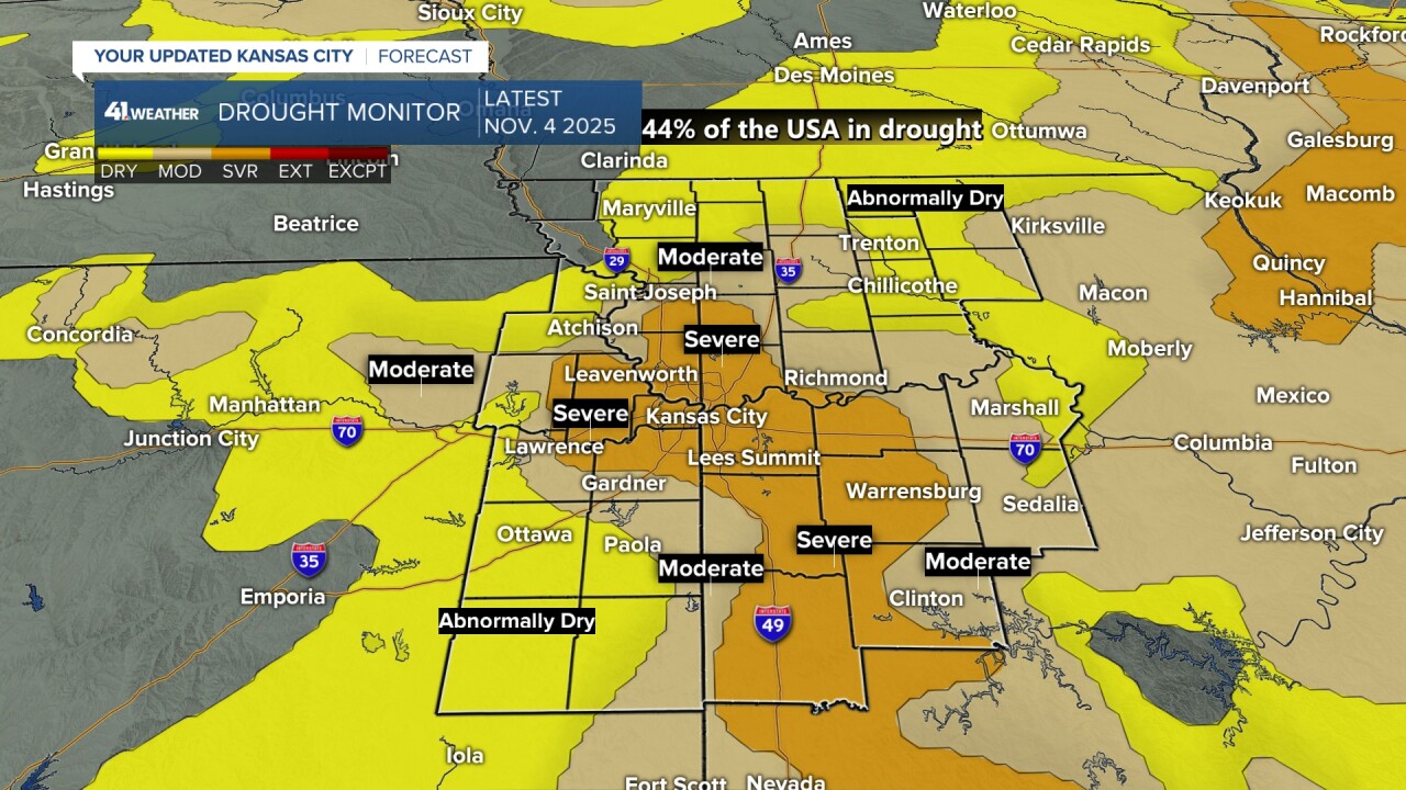
Roughly 44% of the USA is in a level 1-4 drought. The main zones are from Missouri to Ohio, north Florida to New England and south Texas to the southwest USA to west of the Continental Divide.
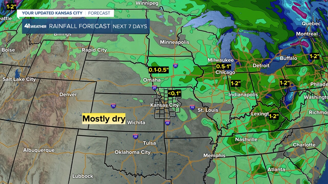
Rainfall the next seven to 10 days is going to give the drought a big win, as any meaningful rain will fall on the west coast from San Francisco to Seattle and from the Tennessee Valley to New England.
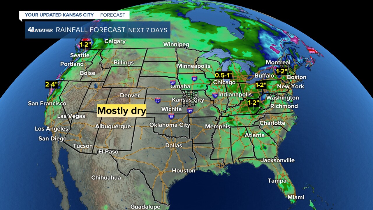
Our area will see a trace-.10" at most, and it would occur this weekend. The precipitation to our north is the weekend's rain and snow.
—————————————————————————————————————————————————————————
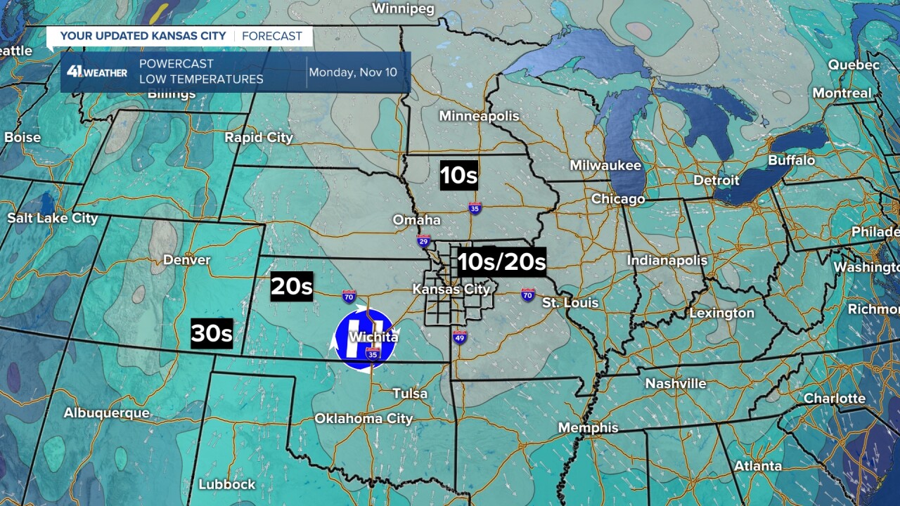
BIG WARM UP NEXT WEEK:
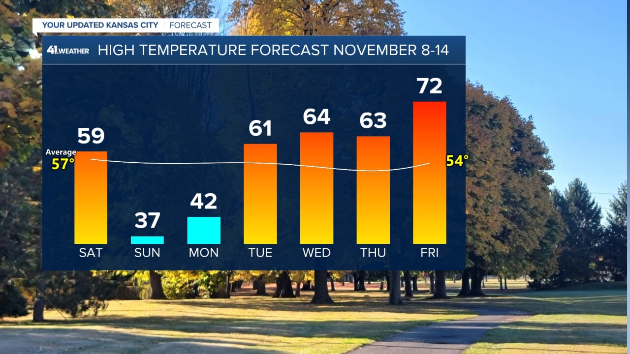
The week will start very cold Monday morning with lows in the upper teens to low 20s.
Monday will be mostly sunny and cool with highs in the 40s. But then...
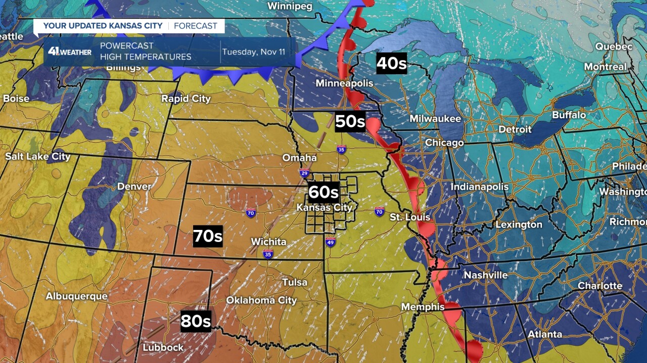
Tuesday will see highs in the 60s followed by more 60s Wednesday and Thursday. But then...
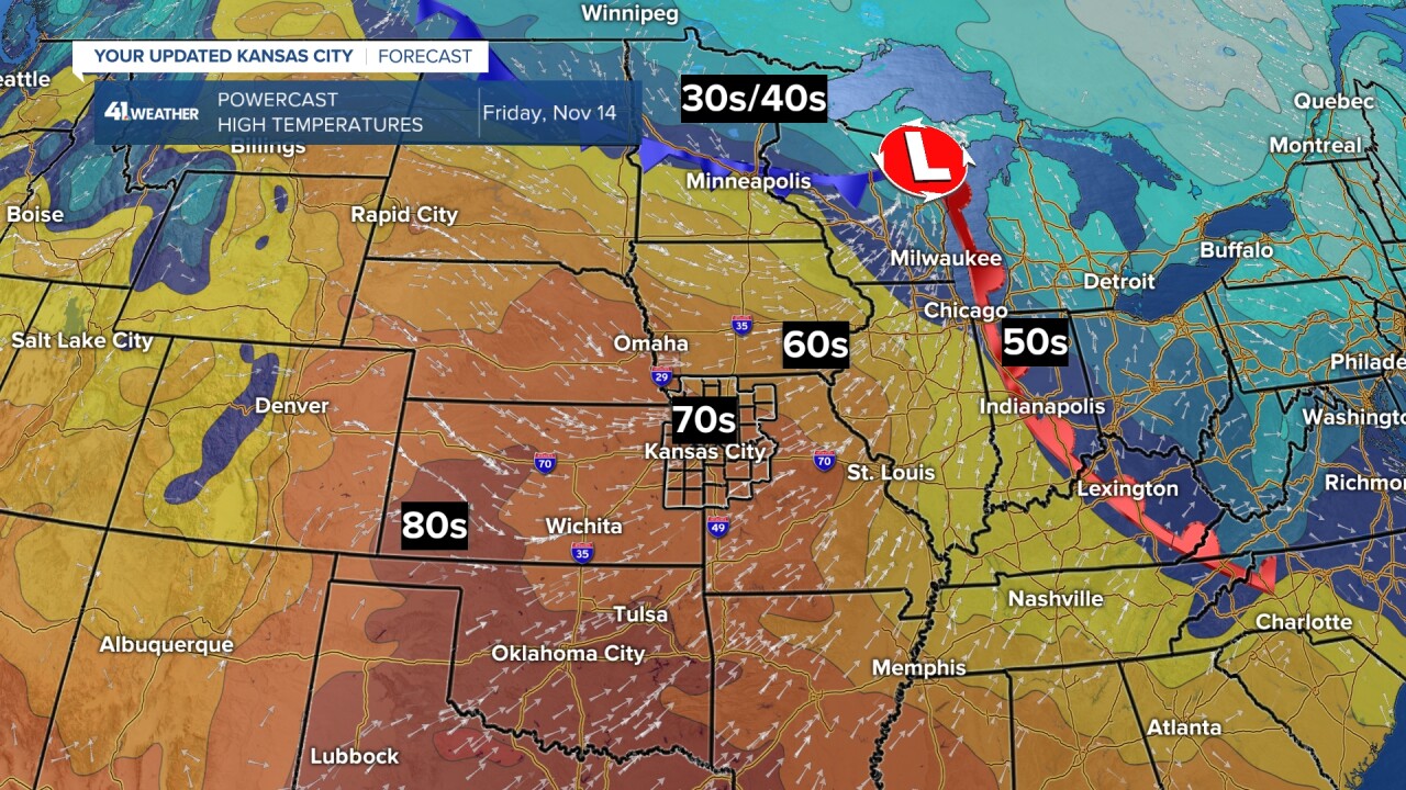
Friday has a good chance to see highs surge into the 70s. The record high for 11/14 is 81°. It may get close based on the data out this morning.
Average highs the next seven days drop from 57° to 54°. Our actual highs will be running 5-15 degrees above average, except Sunday and Monday, where highs will be 10-20 degrees below average.
Have a great weekend
Stay healthy
