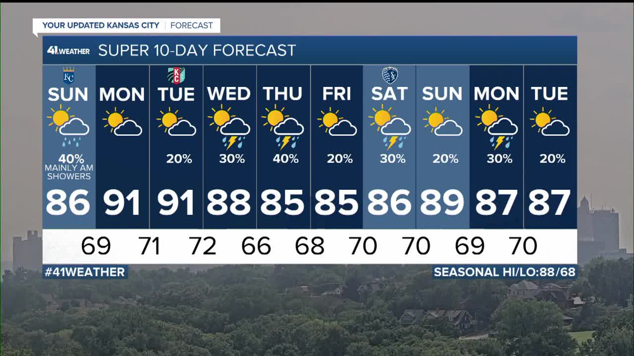


WEATHER HEADLINES
- Scattered showers and thunderstorms tonight into Sunday morning
- Back near 90 with heat indices near 100 Monday and Tuesday
- Several chances of showers and thunderstorms return Wednesday into next weekend
KANSAS CITY'S FORECAST
Tonight: Scattered showers and thunderstorms. Some may cause localized flash flooding and 20-40 mph wind gusts.
Wind: Light and variable
Low: 68º
Sunday: Early morning showers and thunderstorms then partly cloudy warm and humid.
Wind: S-SE 5-10 mph
High: 86º
Monday: Partly to mostly sunny, hot and humid.
Wind: S-SE 5-15 mph
Low: 69º High: 91º
Get more updates from our weather team:
View our interactive radar
Read our Weather Blog
Check out the current conditions in our area
The KSHB 41 Weather Storm Shield is a life-saving app that acts like an NOAA Emergency Weather Radio on your iPhone or Android phone. You will receive critical alerts via voice and push notification regarding major, potentially life-threatening weather events.
