

WEATHER HEADLINES
- Highs in the mid-60s tomorrow
- Showers may dot the area late Saturday night into Sunday morning
- Temperatures will be falling throughout the day on Sunday, leading to a very cold Monday
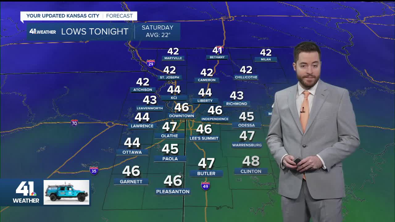
KANSAS CITY'S FORECAST
Tonight: Fog possible, which may be dense in spots.
Low: 44°
Wind: SE 5-10 mph
Saturday: A mostly cloudy day but still warmer than Friday.
High: 66°
Wind: S 10-15 mph
Sunday: Showers possible early in the morning, then plummeting temperatures. The warmest part of the day may be around 9 AM.
Morning low: 60°
Daytime high: 62° (around 9 AM)
3 PM: 32°
Wind: NW 15-30 mph
Get more updates from our weather team:
View our interactive radar
Read our Weather Blog
Check out the current conditions in our area
—
