

WEATHER HEADLINES
- A few showers, thunderstorms linger tonigh
- Hot & very humid, heat index near 105 Sunday-Tuesday
- Strong summer cold front arrives Wednesday-Thursday
KANSAS CITY'S FORECAST
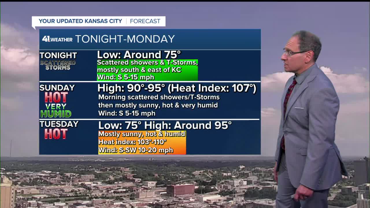
Tonight: A few showers and thunderstorms will linger all night. Otherwise, it will be a dry, warm and very humid night.
Wind: S 5-10 mph
Low: 75º
Sunday: Very hot and humid under a mostly sunny sky. Heat Advisory starts at 11 a.m. Sunday and runs through Tuesday evening.
Wind: S 10-15 mph
High: 93º
Heat Index: 105º
Monday: Another hot day with triple digit heat index values.
Wind: S 10-15 mph
Low: 75º High: 94º
Heat Index: 107º
Tuesday: Mostly sunny, ,hot & very humid
Wind: S 5-15 mph
Low: 75º High: 93º
Heat Index: 106º
Get more updates from our weather team:
View our interactive radar
Read our Weather Blog
Check out the current conditions in our area
The KSHB 41 Weather Storm Shield is a life-saving app that acts like an NOAA Emergency Weather Radio on your iPhone or Android phone. You will receive critical alerts via voice and push notification regarding major, potentially life-threatening weather events.
