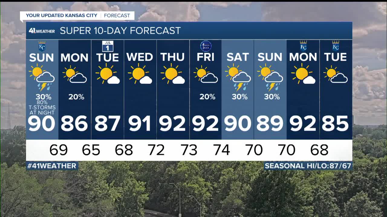


WEATHER HEADLINES
- Scattered showers and thunderstorms Sunday, severe thunderstorms possible Sunday night
- Main threats: Damaging wind, Flash flooding
- Slightly cooler and less humid Tuesday-Wednesday
KANSAS CITY'S FORECAST
Tonight: A nice night with a chance of scattered showers and thunderstorms after 4 AM.
Wind: S 5-15 mph
Low: 73º
Sunday: 60% chance of scattered showers & thunderstorms during the morning, dropping to a 30% during the afternoon.
Wind: S 10-20 mph
High: 90º
Sunday Night: 80% chance of thunderstorms at night. Some may contain strong wind and cause flash flooding.
Wind: Gusts over 40 mph in some thunderstorms
Low: 69º
Monday: Any showers and thunderstorms end early. The rest of the day will be partly cloudy with slowly decreasing humidity
Wind: N-NW 5-15 mph
High: 86º
Tuesday: A nice summer day. Mostly sunny, lower humidity and a light wind.
Wind: N 5-10 mph
Low: 65º High: 87º
Get more updates from our weather team:
View our interactive radar
Read our Weather Blog
Check out the current conditions in our area
The KSHB 41 Weather Storm Shield is a life-saving app that acts like an NOAA Emergency Weather Radio on your iPhone or Android phone. You will receive critical alerts via voice and push notification regarding major, potentially life-threatening weather events.
