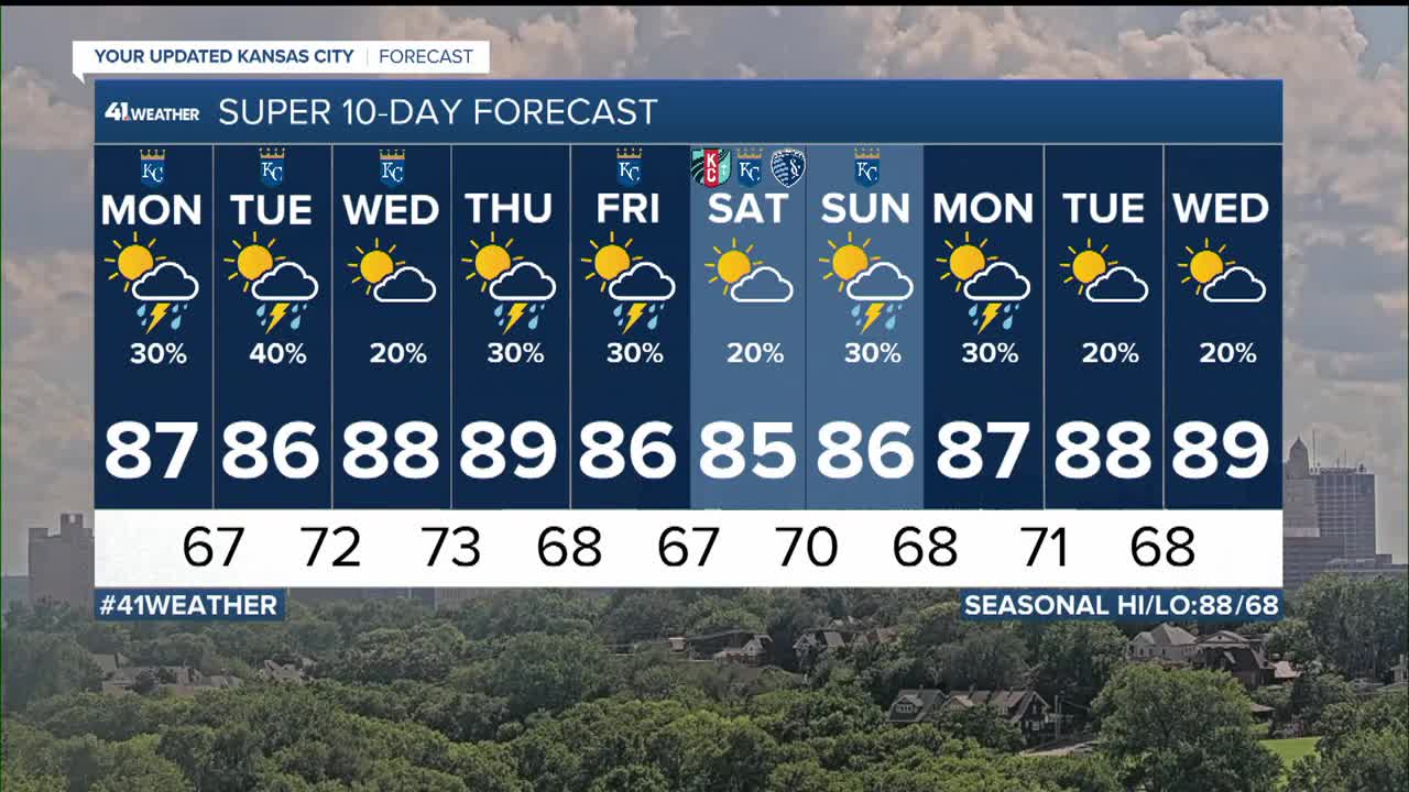


WEATHER HEADLINES
- A chance of showers and thunderstorms nearly every day this week
- Not all locations will see rain every day
- Temperatures this week will be average for this time of year; highs 85°-90°, lows around 70°
KANSAS CITY'S FORECAST
Tonight: Partly cloudy and warm. Thunderstorms south of KC will end this evening.
Wind: E-NE 5-10 mph
Low: 72º
Monday: Partly cloudy and humid with a 20% chance of thunderstorms during the day, 40% chance of thunderstorms at night.
Wind: SE 5-15 mph
High: 87º
Tuesday: Partly cloudy and humid with a 40% chance of thunderstorms.
Wind: Light & variable. Gusty in any t-storms
Low: 67º High: 86º
Wednesday: Partly cloudy, very warm and humid with a 20% chance of thunderstorms.
Wind: E-SE 5-15
Low: 72º High: 88º
Get more updates from our weather team:
View our interactive radar
Read our Weather Blog
Check out the current conditions in our area
The KSHB 41 Weather Storm Shield is a life-saving app that acts like an NOAA Emergency Weather Radio on your iPhone or Android phone. You will receive critical alerts via voice and push notification regarding major, potentially life-threatening weather events.
