

WEATHER HEADLINES
- A strong cold front will rapidly drop Thursday afternoon temperatures.
- Light snow possible Friday evening and night, with light accumulation
- A cold weekend ahead
KANSAS CITY'S FORECAST
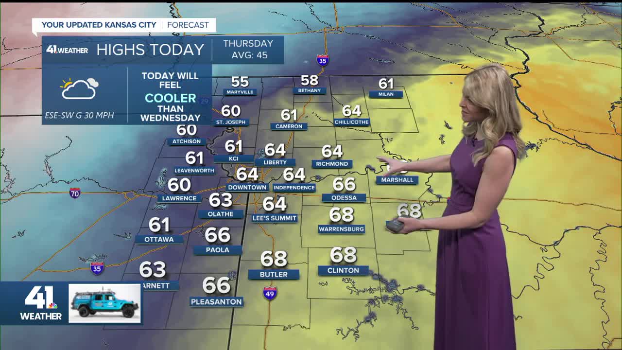
Thursday: A strong cold front arrives during the afternoon under a partly to mostly sunny sky. A light shower is possible in the morning, flurries overnight.
High: 61° (noon), 39° (7 PM)
Wind: SW 15-25 mph switch to NW 20-40 mph
Thursday night: Mostly cloudy with flurries possible. Blustery and much colder.
Low: 24°
Wind: NW G 30 mph
Friday: Increasing clouds in the afternoon and much colder with a chance of light snow during the evening and night. Morning wind chill values in the teens.
Low: 24°
High: 39°
Wind: NW 10-15 G 20-25 mph
Get more updates from our weather team:
View our interactive radar
Read our Weather Blog
Check out the current conditions in our area
