

WEATHER HEADLINES
- Arctic air returns Thursday with wind chill values near zero
- A 2nd Arctic front moves through Friday, dropping wind chill values to as lows as -15
- Signs of a storm system then warm up next week
KANSAS CITY'S FORECAST
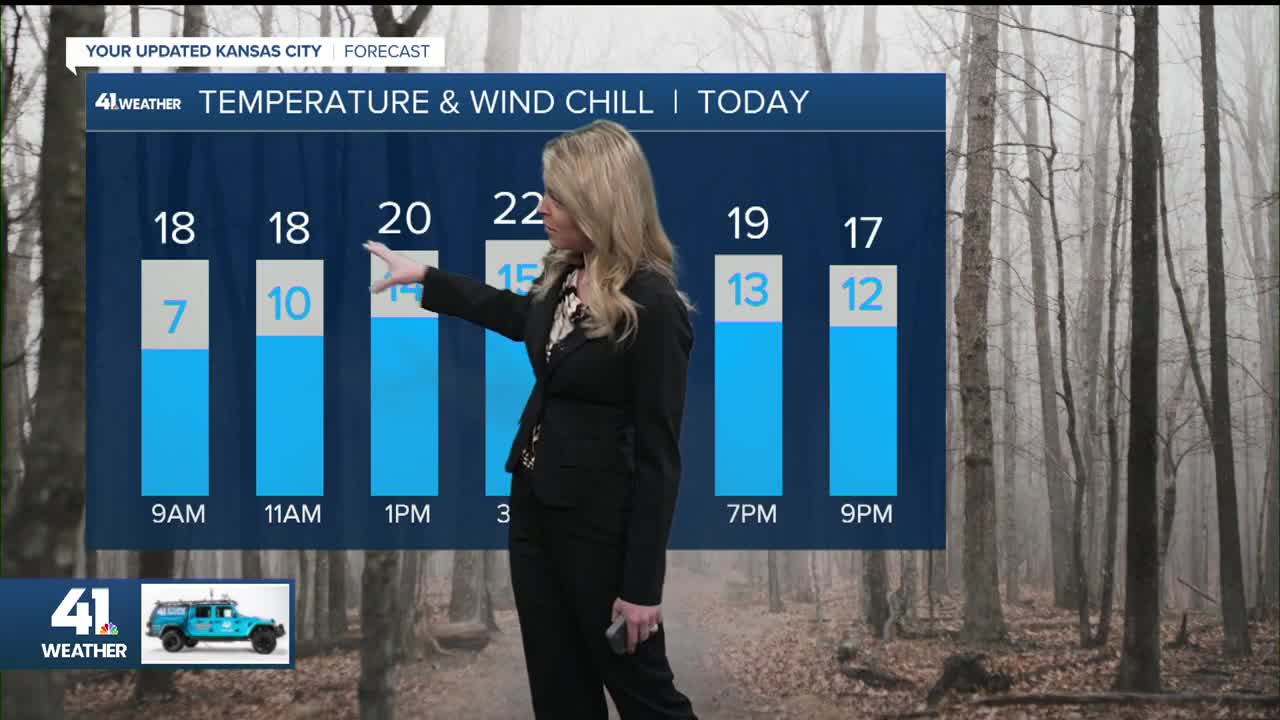
Thursday: Flurries and light snow possible, especially in northern MO. A quick dusting possible. Then cloudy most of the day, with some late-afternoon sunshine. Single-digit wind chills in the morning.
High: 23°
Wind: NE 10-20 mph
Thursday night: Flurries possible then mostly cloudy. A frigid night.
Low: 11°
Wind: NNE 5-10 mph
Friday: Partly cloudy and bitterly cold, with wind chill values as low as -15°. Flurries possible.
Low: 11°
High: 19°
Wind: N 10-20 mph
Saturday: Mostly sunny and brutally cold, with wind chill values as low as -15° in the morning.
Low: -2°
High: 18°
Wind: NW 5-15 mph
Get more updates from our weather team:
View our interactive radar
Read our Weather Blog
Check out the current conditions in our area
