

WEATHER HEADLINES
- Thunderstorms may be severe tonight in northwest MO and northeast KS
- The rest of our area may get ordinary rain or strong storms late into the night
- Severe storms take aim on parts of Missouri and Kansas tomorrow evening, which will likely be an after-dark event for us
KANSAS CITY'S FORECAST
Sunday night: Storms will move into northwest MO and northeast KS after 10 PM. Some may be severe. Weakening will occur as the storms enter the rest of Missouri.
Low: 64°
Wind: S 25 mph
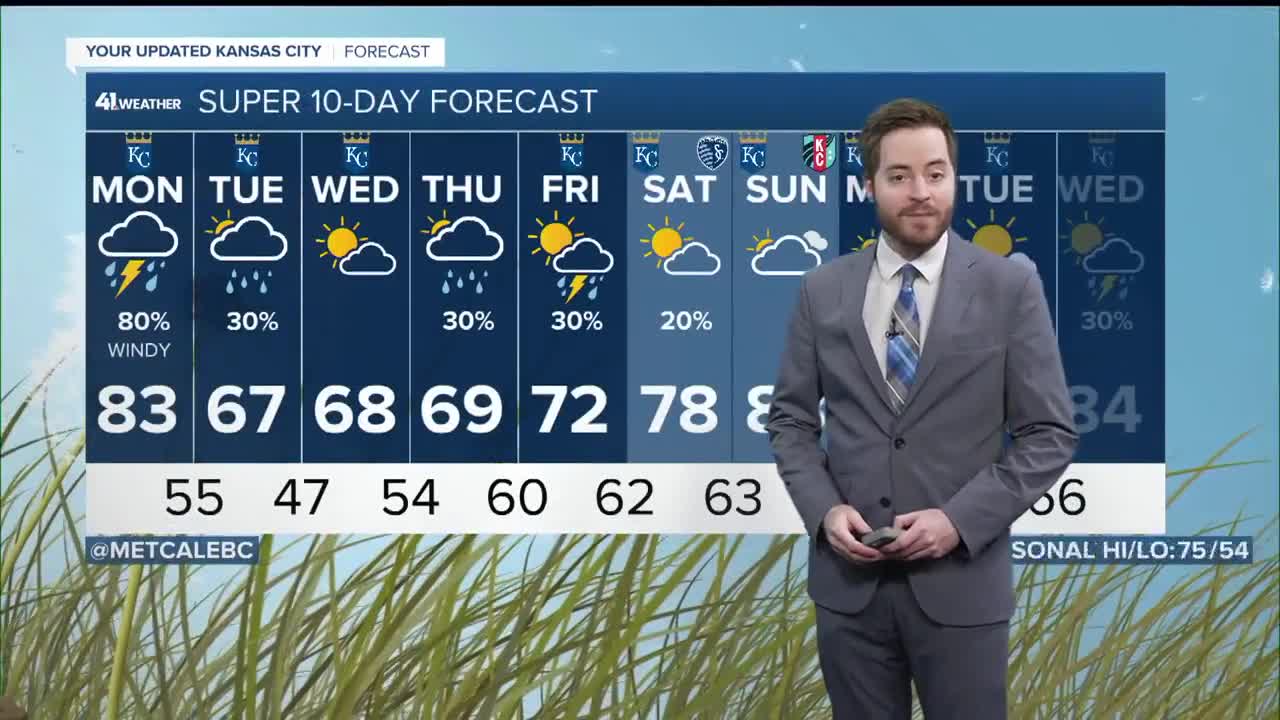
Monday: Rain and thunder may linger after sunrise. Storms will march our way after dark. Monday evening and Monday night will pose the threat of all severe weather hazards.
High: 83°
Wind: S 15-25 mph
Tuesday: Just a little bit of rain leftover early in the morning. Sun will find its way in during the afternoon. Cooler.
Low: 55°
High: 67°
Wind: N 15 mph
Get more updates from our weather team:
View our interactive radar
