

WEATHER HEADLINES
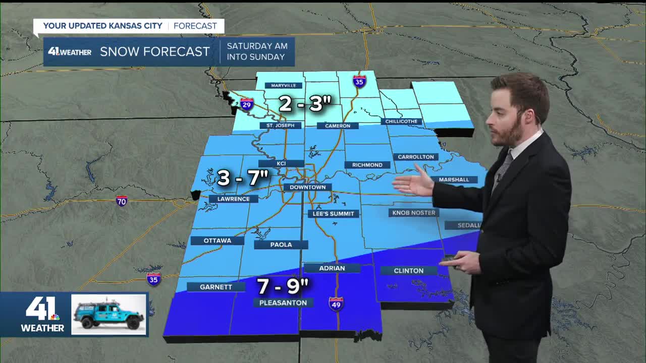
- Snowfall moved into the Kansas City area overnight. It will last through much of Saturday
- Accumulations up to 6 inches in parts of the area. Highest amounts will be south of I-70 and east of I-35.
- Actual temperatures may be the coldest on Monday morning
KANSAS CITY'S FORECAST
Saturday: Dangerously cold with wind chill values between -20° and -10°. Snow will come and go through most of the day.
High: 6°
Wind: NE 10-15 mph
Sunday: Snow will likely exit in the morning, but the last of the flurries may stick around into the early afternoon.
Low: 2°
High: 10°
Wind: N 10 mph
Get more updates from our weather team:
View our interactive radar
