

WEATHER HEADLINES
- Flash flood watch in effect through Saturday morning
- Rain ends by Saturday morning with scattered storms by afternoon
- Rain chances around daily for at least the next week
KANSAS CITY'S FORECAST:
Tonight: Periods of showers and storms, very heavy rainfall south of Kansas City where widespread flash flooding will occur. Low: 70°
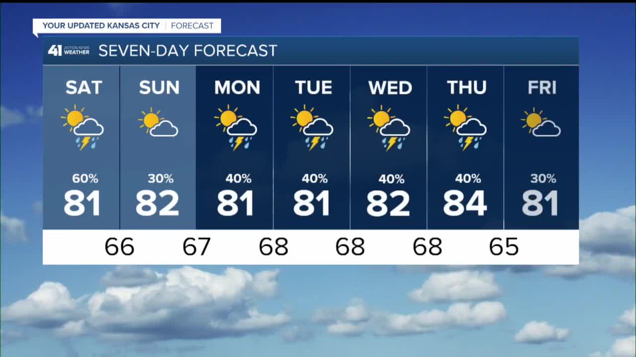
Saturday: Rain and thunderstorms shift south and end during the morning. Partly cloudy, warm and humid during the afternoon with new scattered thunderstorms possible, ending at night. Wind: SW 10-25 mph. High: 83°
Sunday: Most stay dry but a few lingering showers and thunderstorms can't be ruled out. The severe risk stays low. Wind: NW 5 mph. Low: 67° High: 82°
Monday: Scattered shower and storms, especially in the afternoon will be around. Wind: SE 5 mph. Low: 68° High: 82°
Get more updates from our weather team:
View our interactive radar
Read our Weather Blog
Check out the current conditions in our area
The 41 Action Weather Storm Shield is a life-saving app that acts like an NOAA Emergency Weather Radio on your iPhone or Android phone. You will receive critical alerts via voice and push notification regarding major, potentially life-threatening weather events.
