

WEATHER HEADLINES
- Another warm day ahead with highs reaching the low 80s
- Our next storm arrives Tuesday night through Thursday with a period of rain and thunderstorms possible later Tuesday night into Wednesday, some may be strong
- Wednesday night-Thursday will be windy and colder with rain showers
KANSAS CITY'S FORECAST
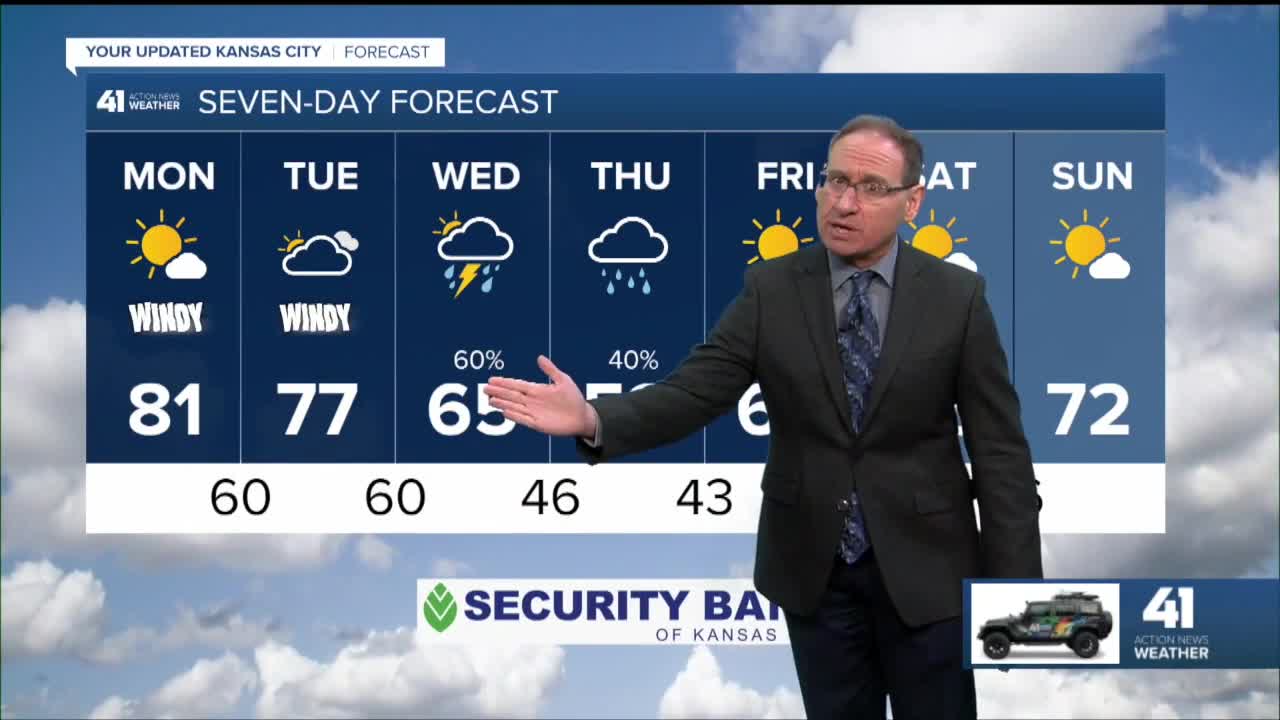
Monday: Partly to mostly sunny, more wind and warmth. Wind: S 15-30 mph. High: 81°
Tonight: Partly cloudy, breezy and mild. Wind: S 15-25 mph. Low: 60°
Tuesday: Partly to mostly cloudy, windy and warm with more humidity. Main severe threat is across central and western Kansas. Wind: S 15-30 mph. High: 77°
Tuesday Night: Any thunderstorms that form in central Kansas will have a chance to move in after midnight. They will be weaker, but we have to watch for some severe weather. Wind: S 15-30 mph. Low: 60°
Wednesday: A good chance of mainly morning rain and thunderstorms. The afternoon will turn colder with a few showers possible. Wind: SW 15-25 Low: 60° High: 65°, Drop to 45°-55° during the aftrernoon.
Get more updates from our weather team:
View our interactive radar
Read our Weather Blog
Check out the current conditions in our area
The 41 Action Weather Storm Shield is a life-saving app that acts like an NOAA Emergency Weather Radio on your iPhone or Android phone. You will receive critical alerts via voice and push notification regarding major, potentially life-threatening weather events.
