

KANSAS CITY, Mo. — WEATHER HEADLINES
- Another Arctic Blast will arrive in the morning
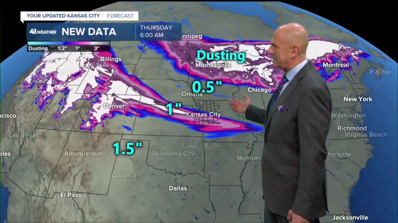
- Snow is possible by Wednesday night
- Accumulations of 1 to 3 inches in a few spots are expected
KANSAS CITY'S FORECAST
Tonight: Mostly clear and turning colder. Low: 25°
Wednesday: Increasing clouds with a 30% chance of snow by the end of the day. High: 28°
Wednesday Night: Snow will spread in from the northwest. Areas north, like Trenton and Maryville, may not even have a flake. Accumulations of a dusting to 3" are likely within 75 miles of KC. There will be some impacts for Thursday morning.
Thursday: Brutally cold with wind chills below zero. There may be a few lingering snow showers. High: 13°
Get more updates from our weather team:
View our interactive radar
Read our Weather Blog
Check out the current conditions in our area
The KSHB 41 Weather Storm Shield is a life-saving app that acts like an NOAA Emergency Weather Radio on your iPhone or Android phone. You will receive critical alerts via voice and push notification regarding major, potentially life-threatening weather events.
