

Good morning bloggers,
In today's blog we will do an in-depth analysis of next Sunday Night's weather forecast for the big game!
Look at this pattern on Tuesday:

- Look at the circle over Arkansas
- This is an upper level storm drifting southwest and west
- We will likely see some moisture move in from the east with clouds and higher humidity Tuesday into Wednesday
Look at what happens by Thursday:
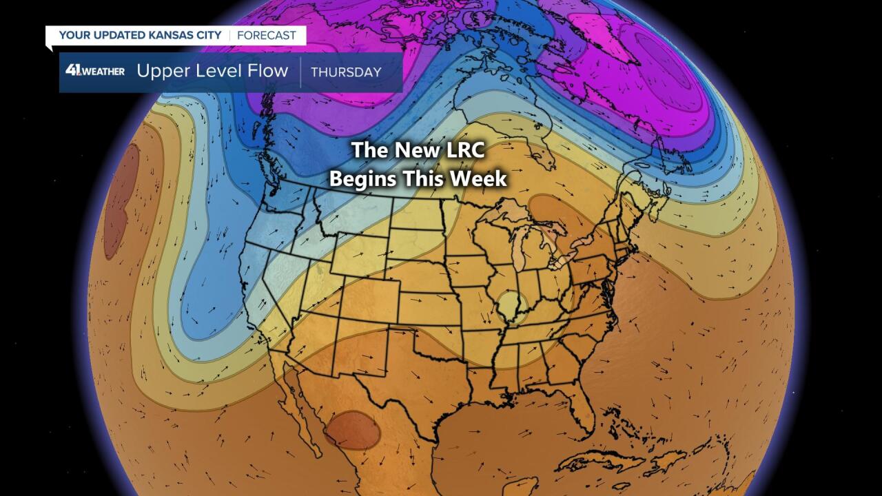
- The new LRC will have started by Thursday
- What is the LRC? The bloggers of this blog named it the LRC for "Lezak's Recurring Cycle" close to 20 years ago. A unique weather pattern sets up in the early fall and then cycles through the rest of fall, winter, spring, and through next summer.
- This pattern is just now forming, so we are not able to make any assumptions yet. The storm that is forming east of us and tracking west is caught in this massively changing pattern over the Northern Hemisphere
Look at what happens by Sunday:
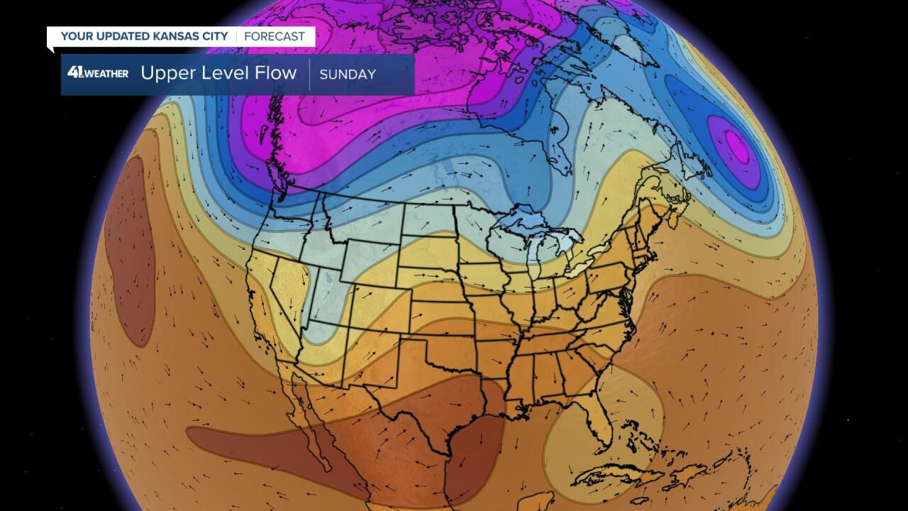
- The Chiefs have a huge home game against the Buffalo Bills Sunday night. The new pattern is interesting
- We are seeing the new LRC here, but what does it mean for this weekend?
- It means there will be a huge warm-up once again, and then we will see what happens with that dip in the flow, that Utah system that is being kicked out by a big trough coming into the Pacific Northwest
Okay! So, this is really complex. What does all of this really mean? Here is the latest surface map showing Sunday's set up for 7 PM Central Time, a few minutes before kickoff:

The first thing to remember this morning about this complex weather pattern is that we are still in the old pattern this morning. The new LRC is evolving and we have identified day one of every year's LRC to happen closer to October 6 or 7. So, just another couple of days and we will begin seeing the true new weather pattern. Right now, the models begin with the old pattern, and more errors than usual are happening within these models. With that said, there is a storm system forecast to be in our area late next weekend. This map below shows the surface forecast associated with the forecast map above:

This forecast above shows a band of rain showers extending out over KC. This is a forecast for the six hour time frame from 7 PM to 1` AM Sunday night. Now, this shows us in the weaker area of showers and thunderstorms, but it does have us in the band. We will be monitoring these developments closely. Out ahead of this system, a big warm up is again likely. And, we need some rain. This year's LRC started out bone dry in October, and it ended extremely dry in September.
Kansas City Weather Time-Line:
- Today: Mostly sunny and nearly perfect weather. Light winds. High: 80°
- Tonight: Mostly clear and mild. Light winds. Low: 54°
- Tuesday: Increasing clouds & becoming cloudy during the afternoon. Light northeast winds 5-15 mph. High: 72°
We will be going in-depth on KSHB-41 News today and tonight as the new data rolls in. Here are Sunny & Rainbow The Weather Dogs posing in front of a beautiful tree over the weekend!

Thank you for spending a few minutes of your day reading the weather blog, and sharing in this weather experience. Have a great day!
Gary
