

Good morning bloggers,
The day begins wet with a large area of rain with a few thunderstorms. These are not severe thunderstorms, and they are just adding to our rainfall totals this week. Some spots have had close to 4" of rain this week already, and there is a fourth storm in the series of storm systems due in late Thursday.
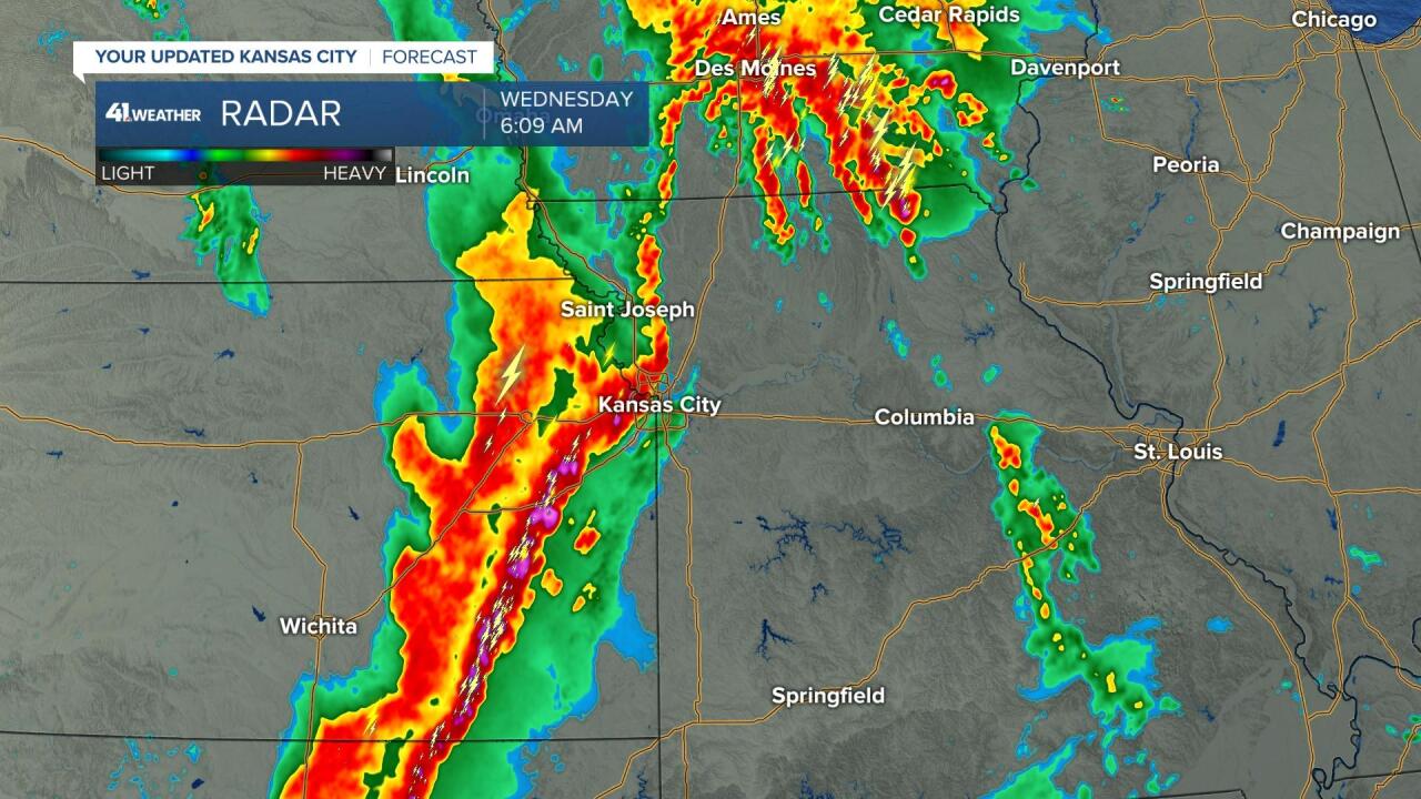
Look at that line of thunderstorms above, and the zoomed in version below:

This area of rain and thunderstorms will be moving across Kansas City and surrounding areas through around mid-morning, and then the rain will end and a surge of sunshine will spread in by this afternoon. Temperatures will warm into the 70s with the wind shifting to the west. This is the third storm in a series of four storm systems. The fourth storm is a bit weaker and it will spread in a good chance of rain and possibly thunderstorms tomorrow afternoon and evening.
1 PM Forecast:

By 1 PM this afternoon the strong storm system causing our rain will be moving north over North Dakota. We will see a wind shift to the west and the clouds will clear leaving us a gorgeous Wednesday afternoon. And, then the fourth in this current series of storm systems will move across us Thursday night and Friday.
These thunderstorms, this morning, have not been severe in our area, so just expect heavy rain, lightning, thunders, and some minor flooding.
Thank you for spending a few minutes of your day sharing this weather experience. Have a great Wednesday. Stay with KSHB-41, and we'll keep you advised.
Gary
