

Good morning bloggers,
A strong cold front is about to blast cold air into KC soon. It was 47 degrees at 7 AM when I took the dogs out for a walk, and the front is now moving across the city. Expect a wind shift and a wind increase to nearly 40 mph by noon, and a chance of snow.

This band of snow is growing, but also moving fast. It is like a line of thunderstorms, and it won't last long. There may be a dusting to an inch of snow, and mostly on grassy surfaces.
8:15 AM Update:
If temperatures drop to below 32 during the snow, it will quickly accumulate to around 1/2" to 1". We are monitoring this closely.

The Battle Between The Models Continues:
Yesterday, I posted on social media the European Model and the American Model snowfall totals for the next seven days. These numbers have already been cut in half on the latest data. So, the trend is down. Here are these two models.
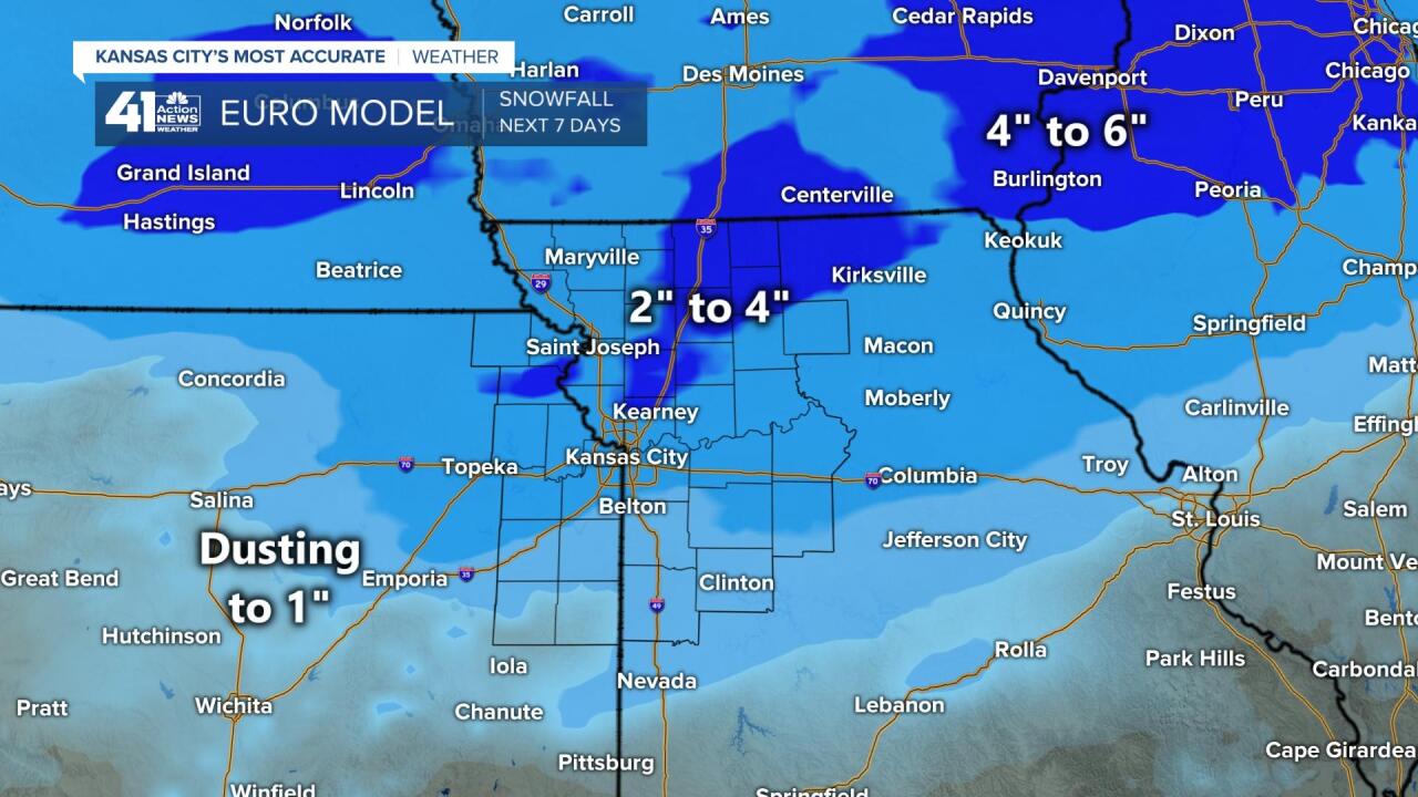

New data will be rolling in soon, and we will keep you updated on KSHB.com and 41 Action News. Have a great day. I will try to update the blog later today.
Thank you for spending a few minutes of your day reading the Action Weather Blog. We will keep you updated.
Gary
