


Good morning bloggers,
Our Winter Weather Special Will Be On KSHB-41 News at 6:30 PM Thurday!
The calm weather continues across the United States. There are signs of a major change developing between now and the Chiefs game next Sunday. It can't stay this mild forever, can it? Well, this morning did dip to our coldest morning of the year after a Thanksgiving Day high only in the 30s. The official low fell to 20° at KCI Airport while a few spots dipped into the teens. The wind has now shifted to the south and it will be a nice afternoon in the 50s today. Did you go to the Plaza Lightning. I had Emceed the event for eleven years, and I missed doing the countdown and picking a child last night. But, we had our American Century Skyview recording the moment. Here is a look at just a minute after the lights came on for the season:
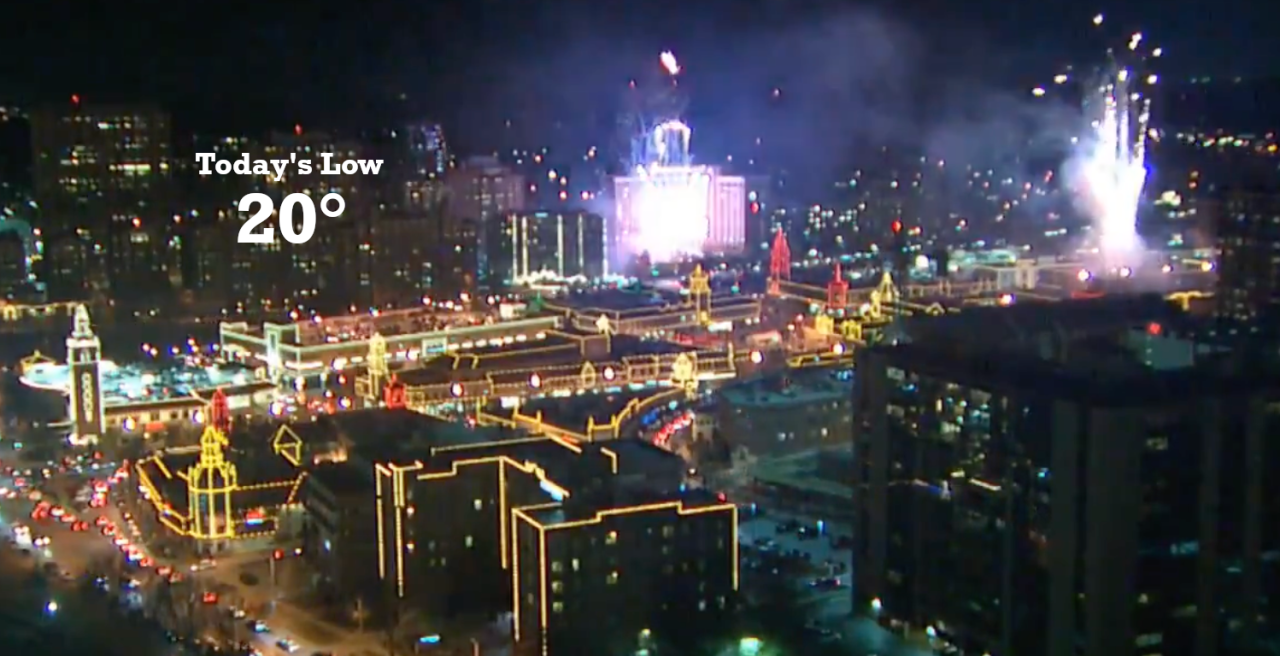
While it may have been cold, 30° at the time the lights flipped on, there was no wind last night. This calm weather pattern will be changing soon. Look closely at this 234 hour forecast map showing the flow aloft, and at the surface valid at 6 PM, an hour and 25 minutes before kickoff next Sunday, December 5th:
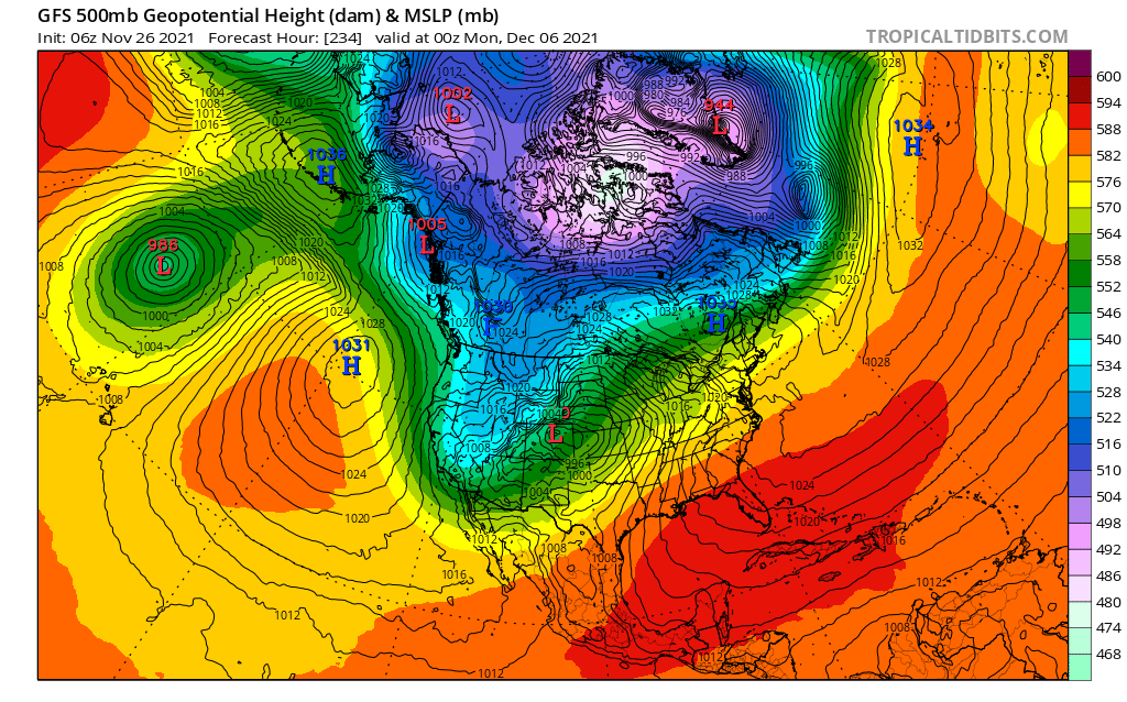
This shows the development of a major storm over the western United States. This is how the LRC began in October, and we have been patiently waiting for it to recycle. Well, it appears it is about to do just that. This would be a major change in the pattern we have been experiencing. We are still waiting for our first inch of snow, but Kansas City is not alone. Denver, CO has set their record for their latest measurable snow ever recorded. In fact, Denver has not even had 0.1" or any measurable snow yet this season, so their record has been smashed. This will likely change in the next two weeks as the LRC recycles, and it may produce Kansas City's first inch of snow too before the middle of December.
Here is another forecast from last night's data:

This map shows that energy over the western states blasting out into the plains around December 7th. This has severe thunderstorms over eastern Missouri with a snowstorm over Kansas. The models have been all over the place on this storm. They have had dry for another 15 days, to these stormier solutions. I am favoring the stormier solution as this is how the LRC began in October. There was very little cold air for that first LRC cycle. This should not be an issue for the second cycle of this year's pattern.
We have finished recording our winter weather special. This will air on Thursday, December 2nd. Just know, I am more bullish on snow despited a slow start. Set your DVR for 6:30 PM Thursday.
For now, the calm weather continues. It may make a run at 70 degrees a couple of days next week.
Thank you for sharing in this weather experience. Have a great Friday!
Gary
