Good Saturday bloggers,
This ridiculous Arctic outbreak is in its 10th and last day. How cold has it been? Its been so cold that the Kansas and Missouri rivers are iced over and they are not really flowing at the surface. They are flowing below the layer of ice.

The ice will begin to break up next week, hopefully there will not be any ice jams. That can cause flooding. It is going to be interesting to see how the rivers react to the warmer air and rain.
As the Arctic air exits, a series of storm systems will enter the middle of the USA. This is going to create a window where we could see slick spots.
Let's go through all of this.
TODAY:
We will see abundant sunshine, but it will still be frigid with highs around 10. The wind will be light as it shifts to the southeast.

TONIGHT BEFORE MIDNIGHT:
Temperatures will quickly drop back to around 5° with a light southeast breeze. The wind chill will still be around -15°.

TONIGHT AFTER MIDNIGHT TO 8 A.M. SUNDAY:
The wind will increase from the south pushing temperatures to the teens as the Arctic air exits. The wind chill will still be near zero, but that is 15 to 20 degrees warmer feeling than Saturday morning.

SUNDAY:
Clouds and a south wind will increase to 15-25 mph. This will push our high to around 32°. The wind will make it feel like the teens, but keep in mind, this is 30-40 degrees warmer feeling than this morning.

SATURDAY-SUNDAY SUMMARY:

SUNDAY NIGHT:
This is where it gets interesting. A small system is looking more likely to track through between 10 p.m. and 5 a.m. ahead of the main system Monday.
This small system will be encountering temperatures around 32° as it produces mostly light freezing rain, but some snow & sleet may be mixed in. It does not look like a lot of precipitation, perhaps just .01" to .10". But, with air temperatures around 32° and surfaces so cold, it won't take much to cause icy slick spots. Even if the temperatures are a bit above 32° we could see slick spots as the ground is so cold.

MONDAY MORNING:
The mixed precipitation will likely be over by 7 a.m. Monday. But, slick spots would remain with temperatures around 32°. So, between 10 p.m. Sunday night and noon Monday there is a window to see slick spots.

MONDAY AFTERNOON/EVENING:
This is when the main storm arrives. It will bring widespread rain with temperatures around 35°. This is just warm enough to keep it rain.

MONDAY NIGHT:
As the storm exits to the northeast, there may be a change to wet snow in northern Missouri and Iowa. Accumulations would be minor with temperatures at or above 32°.

TUESDAY MORNING:
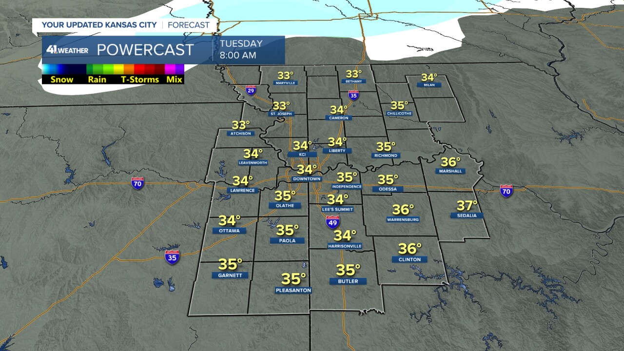
The storm is over and we are left with a cloudy sky and temperatures just above freezing. This will keep surfaces wet. There is going to be a lot of water out there from the rain and melting snow, so temperatures staying above freezing is critical.

TUESDAY AFTERNOON:
It will be a mostly cloudy day with highs around 40° and a light wind. It may feel like the Bahamas!

RAINFALL FORECAST SUNDAY NIGHT-NEXT FRIDAY:
Rainfall will range from around .50" northwest to 1.50" southeast across the area when you add up all the periods of rain next week. The systems for Sunday night and Monday may bring .25" northwest to .75" southeast.
This rainfall forecast can still shift north or south by 50-100 miles. Regardless, even .50" is a lot of rain for one week in January. We average 1.16" for the whole month. We have seen 1.13" so far this January, so we are looking at a wetter than average start to 2024.

When you look at the rainfall forecast to the south, that is a lot of rain for any place at any time of year. 4"-8" of rain is possible next week from southeast Texas to Tennessee after they dealt with winter weather.

The good news about all the rain to the south is that it is occurring over some very drought stricken areas. And, yes most of our viewing area is rid of the drought. This active pattern should gnaw away at the drought as we move to Spring.

Have a great weekend.
Stay healthy. Stay warm.


