


Good morning bloggers,
If you read yesterday's blog, then you know that last night's storm is one of the better LRC predictions made this season: the "Lightning Delay Storm" from Oct, 10, 2021! The thunderstorms intensified as they moved into the Kansas City metro area during our 10 p.m. newscast. They went from heavy raining thunderstorms with frequent lightning, to wind producing thunderstorms with even more lightning. This transition happened between 9:30 and 11 p.m. last night, and then the thunderstorms weakened.
Here is a picture I took last night looking north over Briarcliff in Kansas City north:

This is called a CG. "CG" stands for Cloud to Ground lightning. There is also an in cloud, or cloud to cloud lightning strike visible as well.
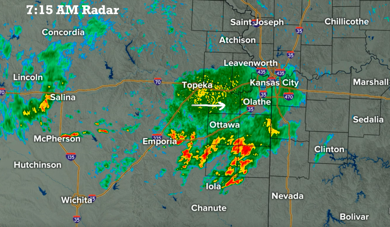
There is an area of rain moving across this morning with anchor thunderstorms between Iola and Ottawa, Kansas. This area of rain was moving slowly east. There is a second area of rain located out near Salina, Kansas, and this may hold together as it moves our way.
We are also north of a slowly moving cold front:

A light north to northeast breeze, combined with the clouds and rain, will bring us a much cooler day. There are still a few areas of light rain tracking across central into eastern Kansas later this morning into early this afternoon. These areas will weaken and eventually the sun will come out. Let's enjoy the cooler cloudy start to the day on this second day of summer.
Thank you for spending a few minutes of your day reading the weather blog and sharing in this weather experience.
Have a great Wednesday,
Gary
