


Good Friday bloggers,
We have seen several rounds of rain and thunderstorms since July 1. There are two zones that don't need rain and one distinct zone that still needs rain. Almost all locations needed rain going into July.
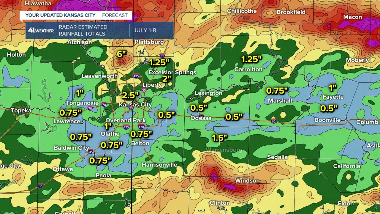
Below are images of the radar estimated rainfall totals July 1-8, so your rain gauge may read differently.
Northern Missouri and northeast Kansas is now a zone that does not need rain after two nights of thunderstorms. There was widespread 2"-4" rainfall amounts with pockets of 4"-7" amounts. The heaviest locations were around St. Joseph and Macon, Missouri.
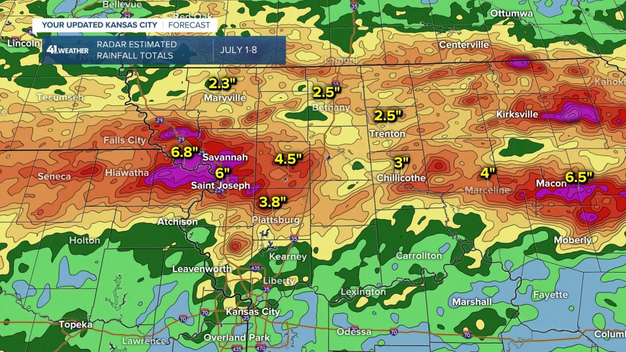
The second zone that does not need rain is located from Osage City, Garnett and Iola in Kansas to Jefferson City, Missouri. This band also received widespread 1"-3" of rain. There was an area of 4"-7" of rain between Warrensburg and Clinton. Iola, Kansas, to Nevada, Missouri, south still needs rain.

The zone that needs rain is located from Lawrence and Baldwin City in Kansas to Columbia, Missouri. Rainfall amounts were mostly just .25"-1". Sprinklers will be needed to keep the yard green as there is just one main rain chance for the next seven to 10 days.
THE FORECAST:
FRIDAY:
It will be cooler today but still humid. A few showers and thunderstorms are possible northeast and east of KC.

TONIGHT:
Low clouds will increase, leading to some patchy fog Saturday morning with lows 65-70. There may be some mist in the air by morning. Wind: NW to NE 5-15 mph.

SATURDAY:
The morning low clouds will give way to a nice afternoon under a partly cloudy sky. It will be humid, but less humid than the last few days. Highs will be in the low to mid-80s with a northeast breeze of 5-15 mph.

SUNDAY:
It will be a warmer day with highs around 90° after lows in the 60s. The humidity will come up a bit as the wind shifts to the southeast at 5-15 mph.
The cold front in Nebraska will arrive Monday night and Tuesday, bringing our next thunderstorm chance.

THE NEXT RAIN CHANCE:
As the front mentioned above moves through, it will bring a line of broken showers and thunderstorms Monday night-Tuesday. There is no guarantee that the driest locations will get the rain.
Have a great weekend.
Stay healthy.
