


Good Tuesday bloggers,
We have seen quite a few gorgeous sunrises and sunsets the last several days as the weather pattern has been rather calm. The systems have been weak, capable mainly of producing cirrus, cirrostratus, altostratus and altocumulus clouds. It is these cloud types, when not completely covering the sky, which can make for the spectacular sunrises and sunsets. Monday we had mostly cirrus clouds.

The setting or rising sun also creates the "golden hour" which photographers like. The "golden hour" was another good one Monday as you can see above Kansas City looking gold. The "golden hour" occurs right before sunset and right after sunrise making for vibrant pictures.
It has not just been a calm pattern, but an unseasonably warm one as well. Thanksgiving was the one main cold day since November 20th.
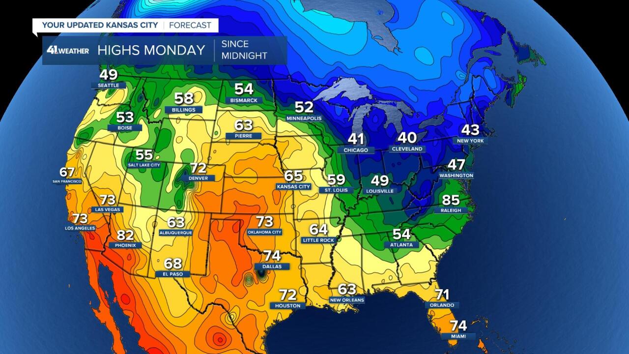
Monday we saw a high of 65° which is about 17° above average. Billings, MT saw highs in the upper 50s, which is about 20° above average. The coldest air in the USA was located from the Great Lakes to New England where highs were in the 40s. This is about average to a few degrees colder than average for those locations this time of year.
The first three days of December will have highs that are average for early October. We may break 1-2 records.

There are changes showing up for the weekend into next week. The 6 minute video below details the calm weather and the start of the changes.
Have a great rest of your week and stay healthy.
