


Good Saturday bloggers,
A large area of dense fog and low clouds formed 1-3 AM Saturday and as of 8 AM there was dense fog and low clouds over a large area of the southern Plains. The visibility was 1/2 mile or less from around I-70 to the Red River of Texas.

There were quite a few Dense Fog advisories Saturday morning. Not only was it socked in across the southern Plains, but also along the Gulf coast and around Chicago.

SATURDAY AFTERNOON: The fog and low clouds will break up allowing temperatures to rise to 55°-60°. A cold front will be approaching from the west.

SATURDAY NIGHT (BEFORE MIDNIGHT): The front will arrive around midnight, so temperatures at midnight will be 50°-55°. A few showers or sprinkles will be possible. The heavier rain will be along and south of I-44.

SATURDAY NIGHT (AFTER MIDNIGHT): The front will move through and temperatures will drop to the 30s by Sunday morning. The wind will be northwest at 10-20 mph. It will be mostly cloudy.

SUNDAY: It will be cooler with decreasing clouds and wind. The wind will become north at 5-15 mph. Highs will be 45°-50°, still a nice day. Areas of rain, heavy at times, will continue along and south of I-44.
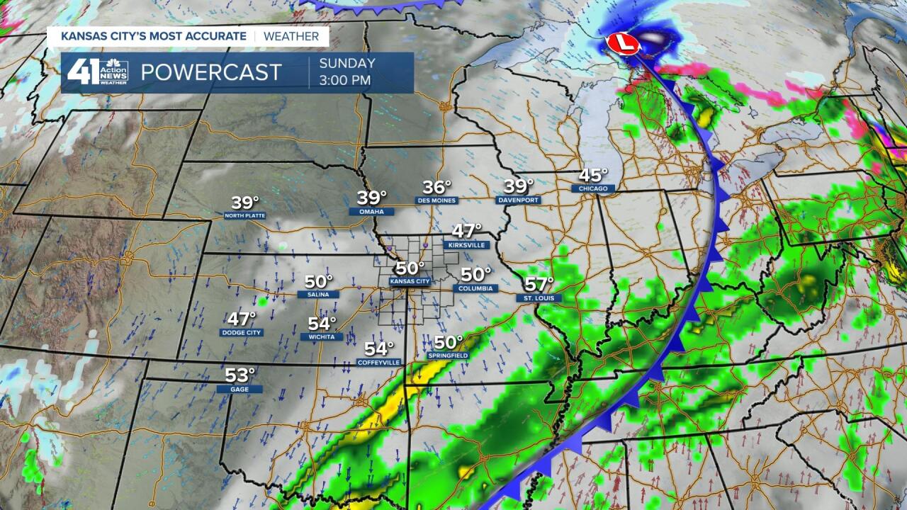
RAINFALL FORECAST TODAY-MONDAY: We will see a few drops to perhaps .01" tonight while 1" to 4" of rain occurs from Dallas and Houston, TX to NYC and Boston. Flooding may be an issue in the heavier rain zone.

MONDAY: A cold front will slip through during the day. It is somewhat interesting as Arctic air lurks about 300 miles north of the front. Temperatures may struggle to 15° across Minnesota into northern Iowa. This Arctic air will not make it any farther south as the front begins to lift north as a warm front and fall apart. We will see highs 45°-55° with abundant sunshine, a nice way to start March.

TUESDAY: The forecast is a bit tricky. The GFS model, also known as the American model, has this solution for Tuesday. Sunny with highs 55°-60° and the nearest clouds across southern Arkansas.

Here is the solution from the NAM model which is a model that goes out to 84 hours. Snow and rain with temperatures in the 30s.
These maps are both showing the weather noon Tuesday. Clearly, they both can't be right. So, which one is right?
Right now we are leaning with the GFS model as most solutions are in this direction. There is a 40% chance that the NAM has the right idea. Let's see what the data does the next 24 hours. Will there be a lean towards the NAM? Towards the GFS? Or, no change?

Have a great weekend and stay healthy.
