


TGIF Bloggers-
The National Oceanic and Atmospheric Administration published their summer outlook today, so let's talk about some climate trends.
First, we've got to understand where we are at, so let's talk the spring drought. The latest drought monitor might seem like things are trending in the right direction but you have to dig deeper. While we did see some slight improvement over the last week, it's really just a week where we saw a pause in worsening conditions.

Yesterday, the National Weather Service in Kansas City published a drought statement saying "A drier-than-normal April has persisted into the first half of May, resulting in expanding severe (D2) and extreme (D3) drought Conditions. This is typically the wettest time of the year for the area so the lack of moisture is especially problematic heading into the typical hot and drier summer months."
Over the last 30 days Kansas City is sitting below average with rainfall, at 76% of normal.

Despite a soggy few days, we need more rain! If the month of May ended today we'd be ranked as 10th driest. Spring as a whole... well it's been a dry also. We've got 16 days to go & it looks like we only have 2 more rain chances, expect to close the season below average.@KSHB41 pic.twitter.com/a216Uwj8co
— ☀️ Cassie Wilson (@CassieKSHB) May 16, 2023
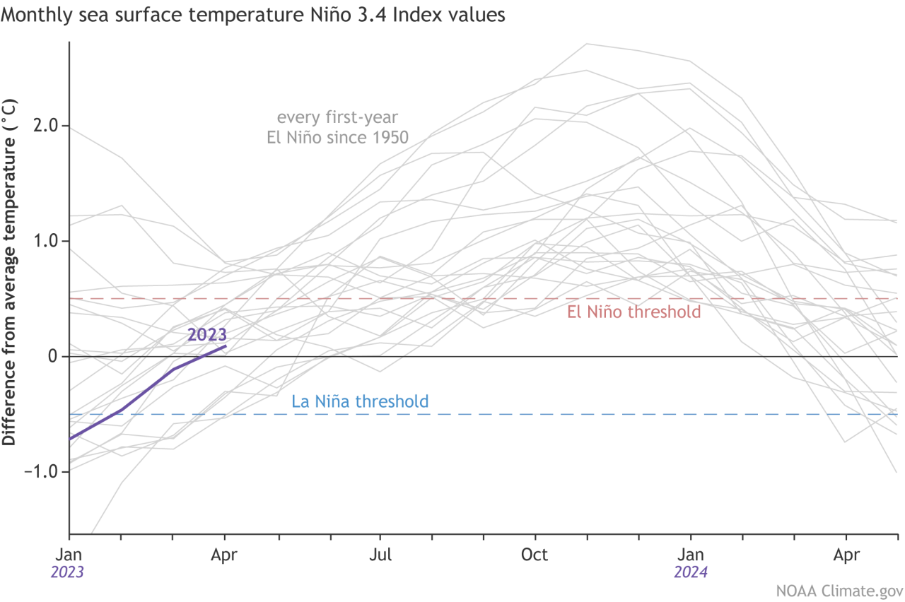
So will this trend continue into the summer? Kind of, but not necessarily. There is one unique aspect to our spring forecast: we've officially seen a three year La Niña come to an end. NOAA has been tracking the development of El Niño as we head into the summer.
Forecasters have high confidence in a summer El Niño not only because of the Pacific Ocean conditions but also because of the strong agreement from computer model predictions.
So let's look at how summer in Kansas City trends when we are transitioning out of a La Niña and into an El Niño pattern. The most recent summers we saw El Niño develop were 2009 (moderate El Niño), 2015 (strong El Niño) and 2019 (weak El Niño). What forecasters can't tell right now is the strength of the El Niño that will develop; Will it be a major El Niño summer or a bust?
Traditionally El Niño trends for Kanas are cooler and wetter, and if you really want cool and wet check out 2009. It was one of the coolest and wettest summers we've ever seen in recent recording history.

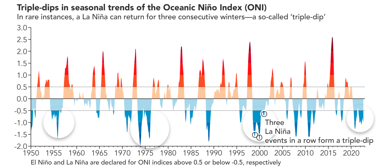
But here's where things get interesting. Remember this La Niña is unique, it's what we call a "Triple Dip." The last time we transitioned out of a Triple Dip La Niña was the summer of 2002. That summer was warm and VERY dry.
Overall, there is hope that we may escape a super hot summer, but if patterns repeat themselves, and we follow the same trend as the last time we transitioned out of a triple dip La Niña, then we could be in for a warmer and drier summer. And with climate change adding to the equation, our summer heat trend certainly hasn't been slowing down.
NOAA has released their summer outlook and it doesn't make anything more clear.
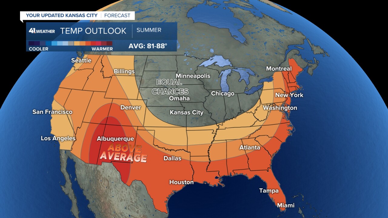
According to NOAA, we have equal chances on seeing a cool or warm summer. But honestly, I'm leaning on that "Triple Dip" La Nina trend and a slightly warmer than normal summer for KC.
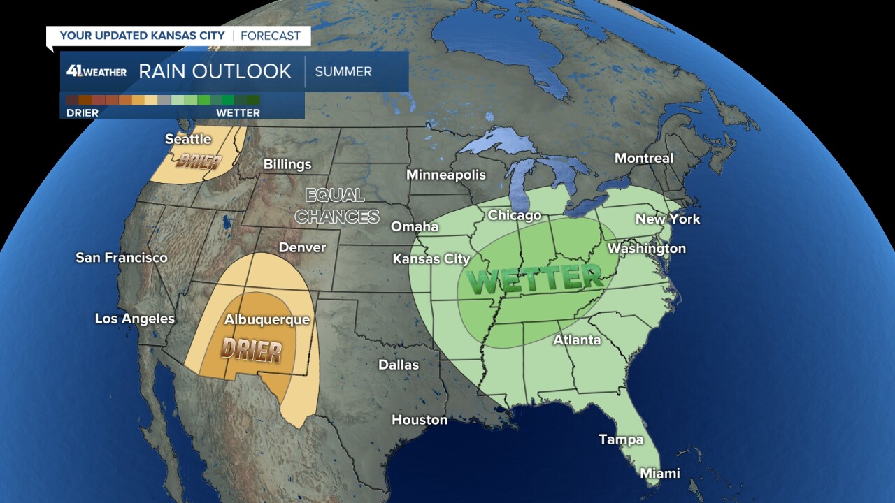
When is comes to rain, NOAA is predicting a "non-soon" monsoon for the desert southwest. This blocking pattern could push our storm track to be focused on systems that drop out of Canada or develop on the lee side of the Rockies. With this track they tend to not pick up moisture from the Gulf of Mexico until after they move through the Plains. Hence the wetter than normal trend for the Mississippi Valley.
I wouldn't bank on seeing a wet summer overall (regardless of ENSO phase) but we could be on the edge of systems, meaning our weather saga continues.
—
