


Good morning bloggers,
Weather extremes are quite impacting over the western United States. Triple digit heat with highs in the inland valley's of Los Angeles reaching 112° again today. At the same time, a hurricane is about to affect Southern California. It is extremely rare to have direct impacts from a hurricane in Los Angeles and San Diego, but it does appear some heavy rain and thunderstorms may spin around this system over the weekend.
The NFL season will kickoff in Los Angeles Thursday night on NBC, shown right here at KSHB 41 tomorrow night. It will be near 100 degrees in LA near the stadium, and it will cool off a bit during the game.
Hurricane Kay at 7 a.m. this morning:

Kay had intensified into a category 2 hurricane. It is one of three hurricanes that we can see on this satellite picture:
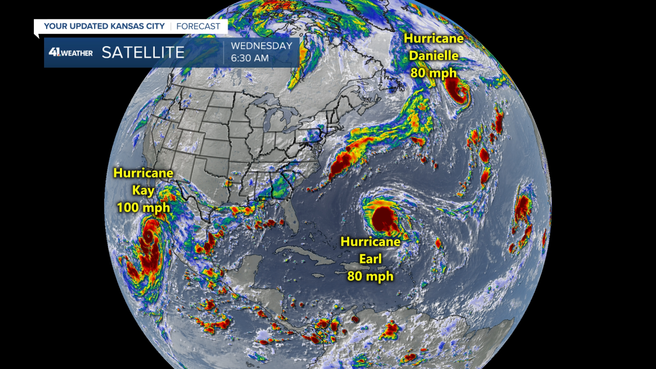
Hurricane Kay, Hurricane Earl and Hurricane Danielle are all shown on this satellite picture. Danielle and Earl are out over the open waters of the Atlantic Ocean and both of these will spin around upper level storm systems in the next three days and it will end up weakening those systems. Kay will approach Southern California.

The latest track from the National Hurricane Center shows this system getting rather close to San Diego before falling apart by early next week, and weakening into a tropical depression by Sunday night.
As this system spins by Southern California, it will bring some relief from the heat and potentially some very heavy rain.

There is an "anticyclone", which is the opposite of a cyclone. A cyclone is any low pressure center, such as a hurricane, a tornado, a strong storm system. We call these cyclones. The anticyclone is the "heat wave creating machine," and it is strong right now over the southwestern United States. This will break down and shift east as Hurricane Kay approaches.

This forecast map, above, shows the hurricane spinning rain into Southern California by Friday night and Saturday morning. This map also shows a fall cold front approaching Kansas City (the blue line). This front will move through by Sunday morning and there is a chance of rain in KC.
While the brutal heat and a hurricane affect the western United States, Kansas City continues to have rather calm weather. Expect another great summer day here with highs in the middle to upper 80s the next few days.
The NFL season will begin on NBC tomorrow night. The Kansas City Chiefs are heading out to Arizona, but by Sunday, the affects from Hurricane Kay will likely be over by then out west. The Chiefs kickoff their season at 3:25 p.m. Sunday!
Thank you for sharing in this weather experience and spending a few minutes of your day reading the weather blog. Have a great day! We will go in-depth as we track these weather changes on KSHB 41 News today and tonight.
Gary
