


Good morning bloggers,
A weak cold front is approaching Kansas City. A front like this, at this time of the year, usually produces heavy thunderstorms, but we are predicting just a slight chance of rain around midnight, and way after the wind shifts to the north.
This weak front will move through and Kansas City will see the wind shift to the north before sunset. The "Dew Point" is the temperature to which dew will form if the temperature drops to that level. So, if the dew point temperature is 75 degrees, which is extremely high, it only takes the temperature to drop to 75° for dew to form. If the dew point were 35 degrees, it would take the temperature to drop to 35 degrees before dew would form.
So, if you have a can of pop, and take it out of the refrigerator and that can is 40°, and with today's 75° dew points, dew would immediately form on that can because the humidity would be forced to go up to 100%. Now, if it was only a 35° dew point, then dew would not form on that can of pop.
Look at the dew point forecast for 1 p.m. today:

This next map shows the dew point forecast for late this afternoon:
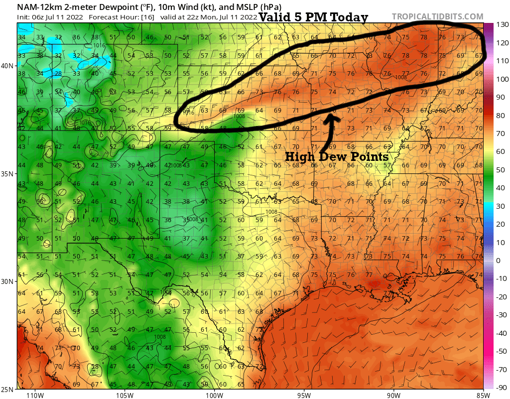
The dew points are pooling, or rather the highest humidity is pooling near the advancing cold front. Notice how the dew point is forecast to be 78° over the corn fields in Illinois, and it is close to being that high over KC with a 76° dew point.
Look at this next forecast dew point map valid Tuesday afternoon:

Our dew point is forecast to drop ton 59°, which shows a much lower humidity and it will be much more comfortable for a couple of days.
The jet stream:
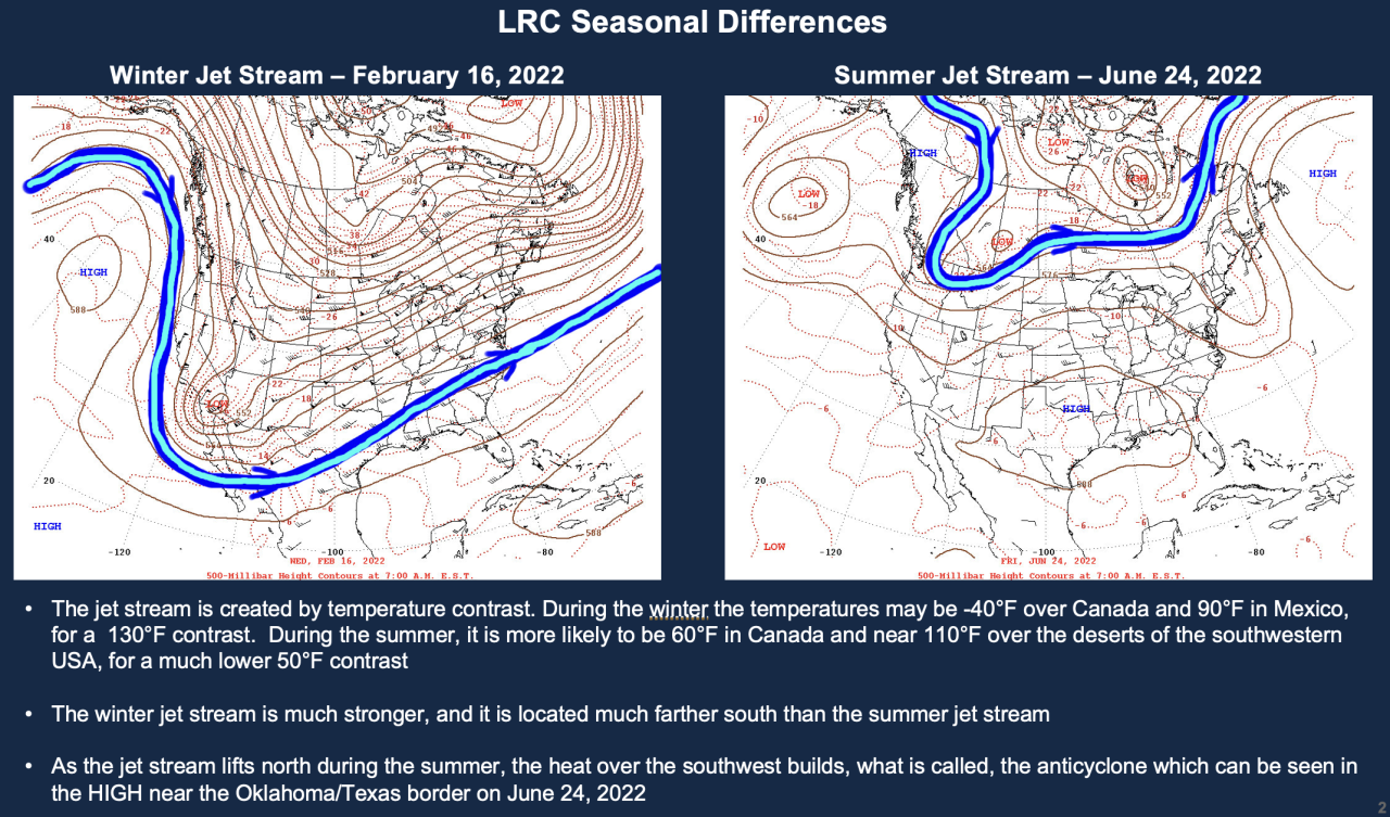
A couple of weeks ago I shared with you how the LRC is right on schedule. We looked at the LRC Cycle 2 version of the pattern in February, and then went to the LRC Cycle 5 version of the jet stream and pattern. It's the same pattern, and just much weaker and farther north.
Here is another comparison from LRC cycles 1 and 5:

The "anticyclone", or heat wave creating machine, has been located over the southwestern United States. There has been a lot of weather chatter of a major heat wave forming in the next week. It is something we are monitoring, but for now, we will be tracking the data to see how that anticyclone performs. Will it grow and strengthen right over us next week?
There has been a warm stretch in each previous LRC cycle around this part of the pattern coming up. We had warmer than average temperatures in November, January, March, and May. This is due to return in the next ten days. We will discuss this more later this week.
Kansas City Weather Timeline:
- Today: Mostly sunny, hot, and humid. The wind will be out of the south at 5-15 mph and then switch to the north later this afternoon or evening. High: 94° with a heat index of 105°
- Tonight: Partly cloudy with a 20% chance of a thunderstorm closer to midnight. Low: 68°
- Tuesday: Mostly sunny, cooler, and much lower humidity. High: 85°
Here are the weather dogs, Sunny & Rainbow, out early this morning:

Thank you for sharing in this weather experience and spending a few minutes of your day reading the weather blog.
Have a great start to your week,
Gary
