


Good morning bloggers,
A cold front moved through KC very quietly last night, and it will be around a dozen degrees cooler today. Our weather is so calm compared to what is going on in Florida:
Hurricane Ian at 7 AM:
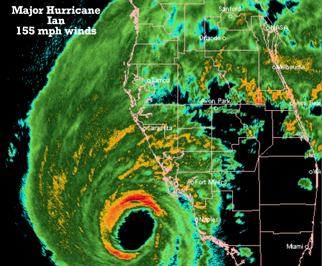
The highest and most devastating winds are near the eye wall. It will cross the coastline and make landfall later today. The winds are up to nearly 200 mph in gusts near the center.

Hurricane Ian will slowly cross Florida and move into the Atlantic Ocean as a much weaker system and make another landfall near Savannah, GA.

Major Hurricane Ian will make landfall around 6 PM this evening, 7 PM Florida time as the sun is setting. It will be interesting to see twilight from the eye, if anyone takes a picture.
Then, Ian will slowly move across Florida tracking south of Orlando and then going back out over the water tomorrow afternoon. It will likely weaken to a weak hurricane or strong tropical storm by tomorrow as it moves back out over the water, and then it will curve inland over Hilton Head, SC area.
Back here in KC; it will be cooler today and very nice. Another warm-up is on the way.
Thank you for sharing in this weather experience and spending a few minutes of your day reading the weather blog. We are thinking of our friends and family in the hurricane track today.
Gary
