


Good morning bloggers,
Today will be an incredible weather day and then changes begin as a storm approaches on St. Patrick's Day. Here is KSHB-41 Meteorologist Lindsey Anderson showing us today's incredible weather.
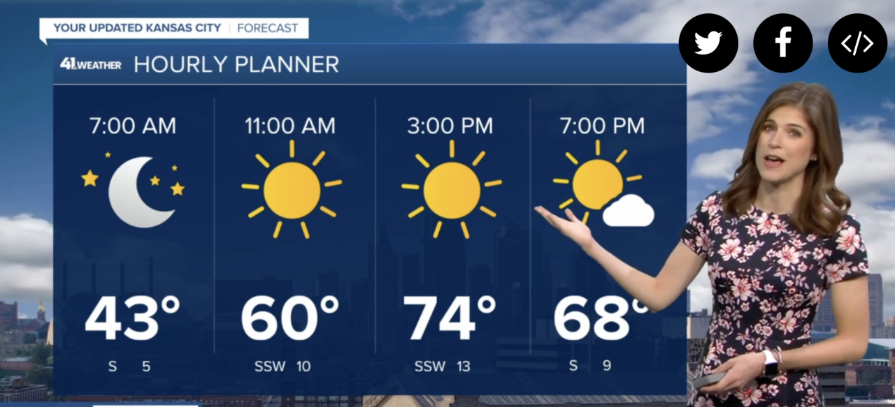
It will easily get up to 74° today and it may reach into the upper 70s in a few spots. The E.O.I. will be nearly a 10 for lunch and dinner today! The changes will then be on the way. Let's take a look at the storm approaching.

A surface cyclone will be forming over the plains by later tonight. And, by 1 PM on St. Patrick's Day you can see the center of this storm at the surface forming near Childress, Tx. Snow will already be developing over Colorado with 80s not that far away south of that surface low pressure center. Here are the temperatures forecast for 1 PM tomorrow:

This storm will then go through a couple of transitions as it approaches Kansas City. Who is ready to get the salt washed away? And, snow may again fall in KC by Friday morning, as you can see on this next forecast map from the American Model (GFS) valid at 1 AM:

The snow will likely be forming in a band northwest and west of KC early Friday morning. For any snow to accumulate the temperatures would need to drop into the lower 30s. If the precipitation is heavy enough, and the storm is just slightly stronger, then I would expect accumulations to happen on grassy surfaces in the heavier bands on Friday morning. We have experienced some strange snow and rain patterns in March before in these types of set ups. There was one storm back in the early 2000s, I believe it was 2000, where it snowed 9" in western Shawnee out near Monticello and Shawnee Mission Parkway, whereas it was just a rain/snow mix over the rest of the KC metro area. Yes, 9" of snow just a few miles from no accumulation of snow. These types of things are possible in this type of set up developing.
We will be going into a strengthening comma head of this storm system. This rain band with embedded snow forms into the classic comma shape with the head of the comma forming right over KC on Friday morning.

There is a lot we will be analyzing as the new data rolls in. I am back from vacation tonight on KSHB-41. I am refreshed and ready to go and track this storm. Our weather team will coordinate and have this forecast updated later today.
For now, expect a sunny & gorgeous day with a high near 76°. WOW! Let's enjoy the moment and we will discuss St. Patrick's Day's developing storm on KSHB-41 today and tonight.
Thank you for spending a few minutes reading the weather blog and sharing in this weather experience. We hope you have an incredible day!
Gary
