


Good morning bloggers,
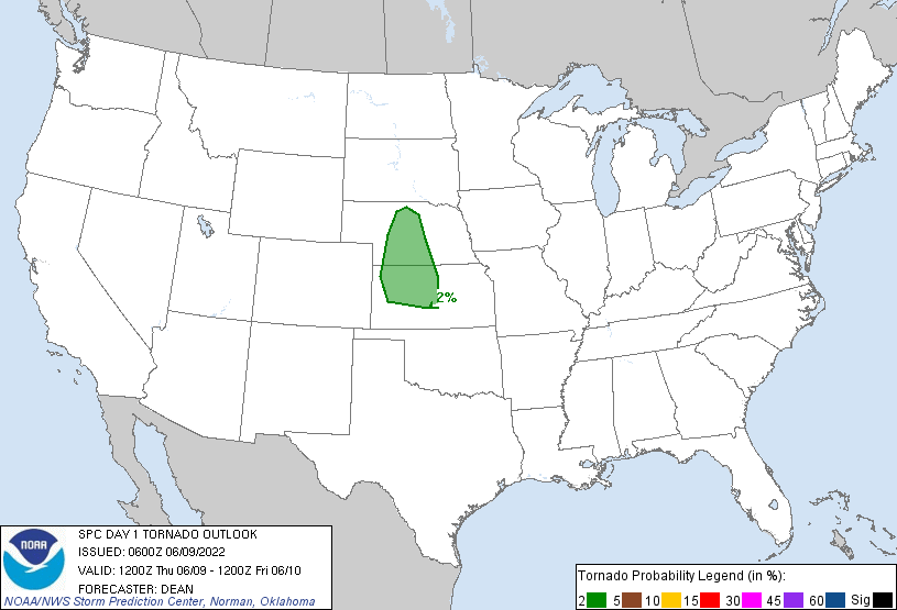
The weather pattern is calming down a bit, but there is one more severe weather risk tonight. The risk of tornadoes is over northwestern Kansas. This is the risk from the Storm Prediction Center:
The weather pattern has been dominated by a huge block that formed over northern Canada. This has not been discussed much, but it did form and it is likely the biggest reason why we have not been surging warmer in the past couple of weeks. A block like this forces the jet stream a bit farther south.
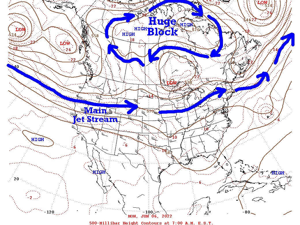
This block will be breaking down, in fact it is already almost gone. A big warm-up is in next week's forecast, but for now the great spring weather will continue.
Jeff Penner almost saw his first tornado. This is likely the developing tornado over Overland Park looking north towards Oak Park Mall:


The EF-1 Tornado tracked, or likely bounced up and down, across a 14-mile path, as you can see above. Look at the track. it first touched down near I-435 and 95th street and then tracked right near or just north of 95th street to Bannister Road (which is really still 95th street) crossing to just north of Ruskin Heights. This was an EF-1 tornado with winds estimated near 100 mph.
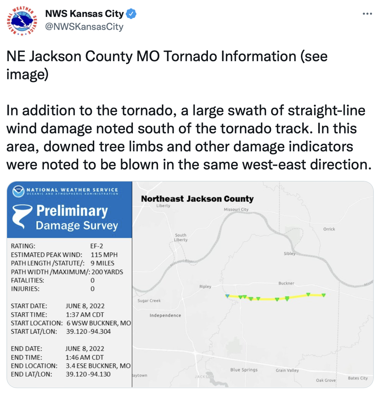
Then just a little while later we had a slightly stronger EF-2 tornado track across northeastern Jackson county near Buckner:
Today's severe weather risk is much different than that set up. I should have been more alert myself for that tornado threat two nights ago. That risk of severe weather was an LRC slam dunk prediction that I didn't analyze. This is the biggest reason for my retirement, as I need to spend 100% of my time into the LRC and Weather2020.com. This risk two nights ago is directly related to the last LRC cycle, as I showed yesterday in those reports. I just got so distracted from my retirement announcement and the emotional energy involved, that I hadn't analyzed this very important factor. The LRC will be saving lives and helping businesses in the near future when I spend more time on it next year. Of course you can keep following this technology breakthrough and I will share more later this year.
For now, here is today's risk:

We are in a level 1 out of 5 risk, or what they call "marginal". We will monitor any thunderstorms closely. I have no distractions today, so we will be all over it.
Go click on the forecast on our website for the updated forecast!
Thank you for spending a few minutes of your day sharing and reading the weather blog.
Have a great Thursday,
Gary
