

KANSAS CITY, Mo. — Good morning bloggers,
We have been tracking a part of the cycling pattern that we predicted would be an impacting storm for severe weather and winter weather for four months now. I will share more about this prediction next week as it is rather incredible watching the pattern cycle through on schedule. Kansas City has been in a spot where storm systems tend to weaken as they approach us and pass by, and then intensify east of us. This may very well happen again. We need some moisture as it has been getting dry, and this mid-week storm next week will have the potential to be one of our wetter storm systems this season.
We have a strong cold front developing north of Kansas City today and it will blast through our region Friday night.
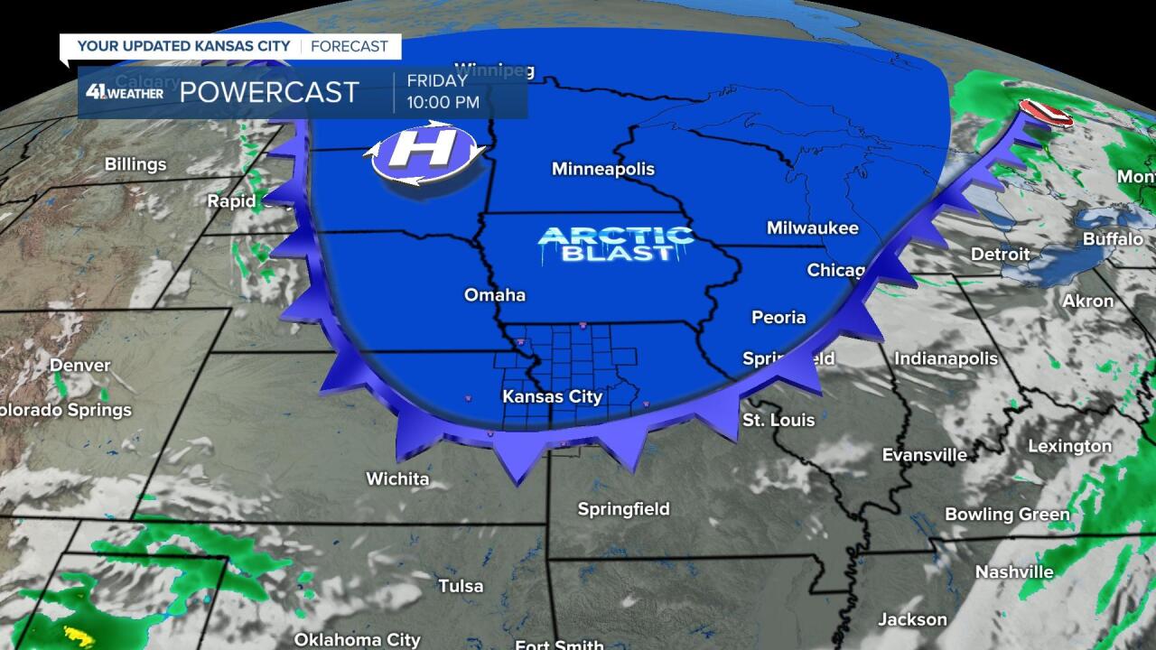
The coldest air will make it to Kansas City, but it will stay east of Western Kansas. Look at the Saturday afternoon forecast temperatures below.

The cold air will blast south. While Kansas City may stay in the 20s all day Saturday, western Kansas will be in the 40s as this cold front doesn't reach that far west.
And, then there is a huge warming trend in response to the developing mid-week storm. By Tuesday, warmer air will be surging north with higher humidity being tapped from the Gulf of Mexico.

This warm surge is actually being caused by the developing storm that we have been anticipating for this next week. This storm will draw in more than warmer air. It will also create a surge of moisture from the Gulf of Mexico which will lead to potentially our wettest storm since October.
It has been quite dry most of this winter with only a few storm systems bringing us any significant rain or snow. A solid one inch of rain would be really good as spring approaches.
Here is a look at the European and American models showing their forecast liquid-equivalent precipitation for next Wednesday and Thursday:


- The American model shows 0.97 inches
- The European model shows 1.90 inches
This storm will have a winter element to it, and at the moment, the models are tracking a band of heavy snow north of our local region. This path will likely shift north or south in the next few days.

Between now and the middle of next week we have a few ups and downs. Here is the Kansas City weather timeline:
- Today: Mostly sunny and rather nice. A few bands of clouds will zip by. The wind will be out of the west-northwest, shifting to the southwest at 10-25 miles per hour. High: 52 degrees
- Tonight: Periods of clouds and temperatures not dropping that much. There is a 30% chance of showers. Southwest winds 10-25 miles per hour. Low: 41 degrees
- Friday: Partly cloudy with a brief shower possible. The wind will shift to the northwest with gusts to 30 miles per hour by evening. High: 56 degrees
- Saturday: Partly cloudy and much colder. Northwest winds 10-25 miles per hour, decreasing later in the day. High: 28 degrees
- Sunday: Mostly sunny and rather cold. High: 41 degrees
We will be tracking all of this today and tonight on KSHB 41. Thank you for spending a few minutes of your day reading the weather blog and sharing this weather experience. Have a great Thursday.
Gary
