


Happy Easter bloggers,
Happy Easter to those that celebrate.
We had a gorgeous, cloudless, Easter sunrise. Highs today will be around 80 with a south wind 10-20 mph. The average high today is 62, and if you have lived in KC for any length of time you know temperatures can range from 20 degrees above average to 20 degrees below average in early April. The weather can range from sunny to snow and severe weather. So, we know this nice weather can't last forever.
We are tracking one main storm system this week. The 5 minute video below goes day by day through Thursday with the latest data on our next storm system.
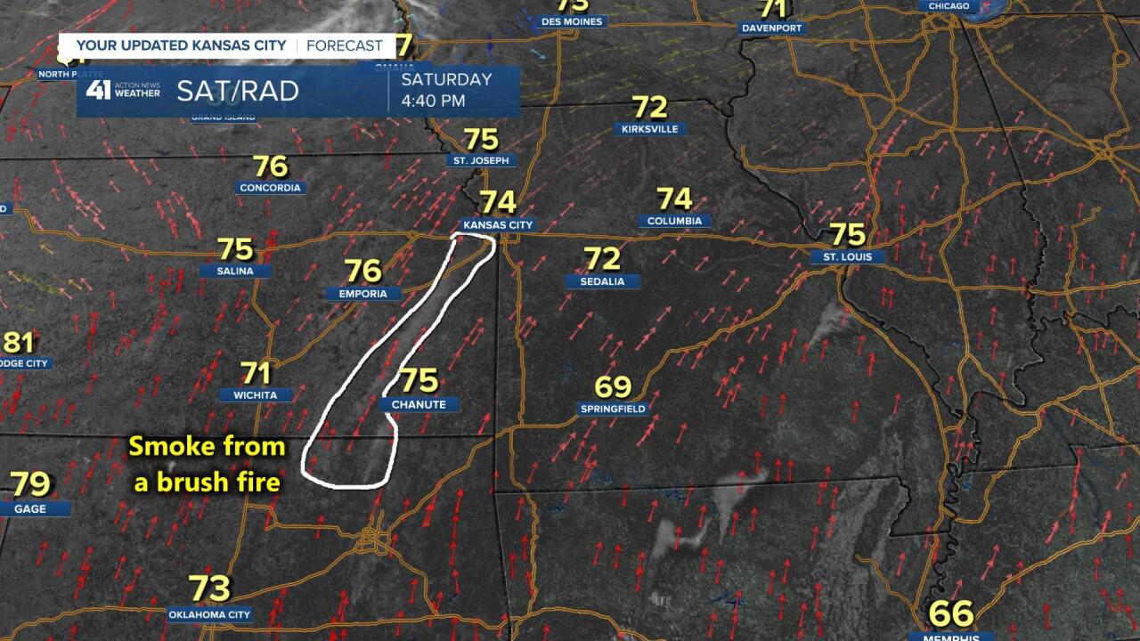
Before we talk about the week ahead let's look back to Saturday. Did you notice a thickening haze through the day? This was taken about 5 PM on Saturday. You can see the haze in the air. What was it?

It was smoke at low levels of the atmosphere from controlled burns on farmland across eastern Kansas and northern Oklahoma. The white dots from the satellite image taken at 940 AM Saturday show the smoke from those fires. The wind then transported the smoke north and northeast as we had south to southwest winds at 10-25 mph.

Around 4-5 PM Saturday we got into a thicker and bigger plume from northern Oklahoma. This may have been more of an out of control brush fire burn as there was much more smoke coming from that location than the ones in Kansas. So, we may see more haze in the air today and you can tell your friends and family what it is coming from.
Now, to the week ahead. Below is the 5 minute detailed video on the next and one main storm system we are tracking.
Have a great week and stay healthy.
